How to get to Cintex Wireless & Technology by bus?
Click on the bus route to see step by step directions with maps, line arrival times and updated time schedules.
From Holy Cross Hospital, Montgomery County
47 minFrom Clyde's of Chevy Chase, Montgomery County
50 minFrom Consulado General de El Salvador en El Dmv, Montgomery County
64 minFrom Regal Majestic Stadium 20 and IMAX, Montgomery County
41 minFrom Rockville, MD, Montgomery County
33 minFrom Embassy Suites at the Chevy Chase Pavilion, Washington
50 minFrom The Cheesecake Factory, Washington
51 minFrom Ellsworth Place, Montgomery County
40 minFrom Montgomery College-Rockville, Montgomery County
27 min
How to get to Cintex Wireless & Technology by train?
Click on the train route to see step by step directions with maps, line arrival times and updated time schedules.
How to get to Cintex Wireless & Technology by metro?
Click on the metro route to see step by step directions with maps, line arrival times and updated time schedules.
From Holy Cross Hospital, Montgomery County
63 minFrom Clyde's of Chevy Chase, Montgomery County
21 minFrom Consulado General de El Salvador en El Dmv, Montgomery County
64 minFrom Regal Majestic Stadium 20 and IMAX, Montgomery County
59 minFrom Rockville, MD, Montgomery County
19 minFrom Embassy Suites at the Chevy Chase Pavilion, Washington
20 minFrom The Cheesecake Factory, Washington
20 minFrom Ellsworth Place, Montgomery County
58 minFrom Montgomery College-Rockville, Montgomery County
40 min
Bus stops near Cintex Wireless & Technology in Montgomery County
Train station near Cintex Wireless & Technology in Montgomery County
- Garrett Park Marc Eb, 43 min walk,VIEW
Bus lines to Cintex Wireless & Technology in Montgomery County
What are the closest stations to Cintex Wireless & Technology?
The closest stations to Cintex Wireless & Technology are:
- Citadel Av+Old Georgetown Rd is 153 yards away, 2 min walk.
- Citadel Ave & Old Georgetown Rd is 164 yards away, 2 min walk.
- North Bethesda Station & Bay B is 463 yards away, 6 min walk.
- North Bethesda is 483 yards away, 6 min walk.
- North Bethesda Station & Bay D is 512 yards away, 6 min walk.
- North Bethesda Station & Marinelli Rd is 620 yards away, 8 min walk.
- Garrett Park Marc Eb is 3593 yards away, 43 min walk.
Which bus lines stop near Cintex Wireless & Technology?
These bus lines stop near Cintex Wireless & Technology: 101, 46, 5.
Which train line stops near Cintex Wireless & Technology?
MARC (Inbound - Brunswick)
Which metro line stops near Cintex Wireless & Technology?
RED (Shady Grove)
What’s the nearest bus station to Cintex Wireless & Technology in Montgomery County?
The nearest bus stations to Cintex Wireless & Technology in Montgomery County are Citadel Av+Old Georgetown Rd and Citadel Ave & Old Georgetown Rd. The closest one is a 2 min walk away.
What time is the first metro to Cintex Wireless & Technology in Montgomery County?
The RED is the first metro that goes to Cintex Wireless & Technology in Montgomery County. It stops nearby at 5:07 AM.
What time is the last metro to Cintex Wireless & Technology in Montgomery County?
The RED is the last metro that goes to Cintex Wireless & Technology in Montgomery County. It stops nearby at 12:35 AM.
What time is the first train to Cintex Wireless & Technology in Montgomery County?
The MARC is the first train that goes to Cintex Wireless & Technology in Montgomery County. It stops nearby at 6:06 AM.
What time is the last train to Cintex Wireless & Technology in Montgomery County?
The MARC is the last train that goes to Cintex Wireless & Technology in Montgomery County. It stops nearby at 7:45 PM.
What time is the first bus to Cintex Wireless & Technology in Montgomery County?
The 26 is the first bus that goes to Cintex Wireless & Technology in Montgomery County. It stops nearby at 4:37 AM.
What time is the last bus to Cintex Wireless & Technology in Montgomery County?
The 5 is the last bus that goes to Cintex Wireless & Technology in Montgomery County. It stops nearby at 1:44 AM.
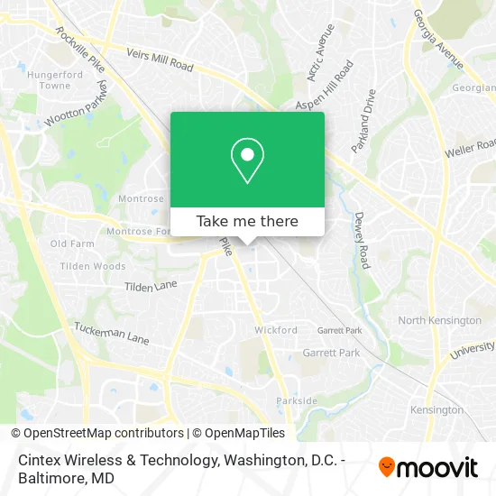
See Cintex Wireless & Technology, Montgomery County, on the map
Public Transit to Cintex Wireless & Technology in Montgomery County
Wondering how to get to Cintex Wireless & Technology in Montgomery County? Moovit helps you find the best way to get to Cintex Wireless & Technology with step-by-step directions from the nearest public transit station.
Moovit provides free maps and live directions to help you navigate through your city. View schedules, routes, timetables, and find out how long does it take to get to Cintex Wireless & Technology in real time.
Looking for the nearest stop or station to Cintex Wireless & Technology? Check out this list of stops closest to your destination: Citadel Av+Old Georgetown Rd; Citadel Ave & Old Georgetown Rd; North Bethesda Station & Bay B; North Bethesda; North Bethesda Station & Bay D; North Bethesda Station & Marinelli Rd; Garrett Park Marc Eb.
Bus: 101, 46, 5, M42, M44, 42, 26, RED, 81.Train: MARC.Metro: RED.
Want to see if there’s another route that gets you there at an earlier time? Moovit helps you find alternative routes or times. Get directions from and directions to Cintex Wireless & Technology easily from the Moovit App or Website.
We make riding to Cintex Wireless & Technology easy, which is why over 1.5 million users, including users in Montgomery County, trust Moovit as the best app for public transit. You don’t need to download an individual bus app or train app, Moovit is your all-in-one transit app that helps you find the best bus time or train time available.
For information on prices of bus, metro and train, costs and ride fares to Cintex Wireless & Technology, please check the Moovit app.
Use the app to navigate to popular places including to the airport, hospital, stadium, grocery store, mall, coffee shop, school, college, and university.
Cintex Wireless & Technology Address: 11910 Parklawn Dr street in Montgomery County
- Coinstar - Bitcoin ATM,
- STARBUCKS,
- Cfe Store,
- Ashford Kirby,
- National Institute on Drug Abuse,
- White Flint,
- Arrowwood,
- 3WFN-NRC,
- White Flint Metro Station,
- Pike District,
- RT-355,
- Ourbus Stop Bethesda,
- G Street Fabrics,
- Public Document Room,
- 3links Technologies,
- US Regulatory Commission,
- White Flint Station,
- Yardbird,
- Lularoe Stacey Deanna,
- Fda Broadcasting
Places Near Cintex Wireless & Technology (Montgomery County)
- Washington DC VA Medical Center, Washington,
- National Mall, Washington,
- Westfield Montgomery Mall, Montgomery County,
- Sibley Memorial Hospital, Washington,
- Rock Creek Tennis Center, Washington,
- Capital One Arena, Washington,
- Marriott Marquis Washington, DC, Washington,
- National Museum of African American History and Culture, Washington,
- Basilica of the National Shrine, Washington,
- Museum Of The Bible, Washington,
- PG Mall, Prince George's County,
- National Zoo, Washington,
- Georgetown, Washington,
- M&T Bank Stadium, Baltimore,
- The Anthem, Washington,
- Pennsylvania Ave NW (3rd st and pennsylvania), Washington,
- Washington National Cathedral, Washington,
- Warner Theatre, Washington,
- Amazon Hq2, Arlington County,
- Camden Yards, Baltimore
How to get to popular places in Washington, D.C. - Baltimore, MD with public transit
Get around Montgomery County by public transit!
Traveling around Montgomery County has never been so easy. See step by step directions as you travel to any attraction, street or major public transit station. View bus and train schedules, arrival times, service alerts and detailed routes on a map, so you know exactly how to get to anywhere in Montgomery County.
When traveling to any destination around Montgomery County use Moovit's Live Directions with Get Off Notifications to know exactly where and how far to walk, how long to wait for your line, and how many stops are left. Moovit will alert you when it's time to get off — no need to constantly re-check whether yours is the next stop.
Wondering how to use public transit in Montgomery County or how to pay for public transit in Montgomery County? Moovit public transit app can help you navigate your way with public transit easily, and at minimum cost. It includes public transit fees, ticket prices, and costs. Looking for a map of Montgomery County public transit lines? Moovit public transit app shows all public transit maps in Montgomery County with all Bus, Train, Metro, Light Rail and Ferry routes and stops on an interactive map.
Washington, D.C. - Baltimore, MD has 5 transit type(s), including: Bus, Train, Metro, Light Rail and Ferry, operated by several transit agencies, including WMATA, Montgomery County Ride On, Fairfax Connector, TheBus, PRTC, DASH - Alexandria, Arlington Transit (ART), RTA of Central Maryland, MDOT MTA, MDOT MTA Light RailLink, MDOT MTA Commuter Bus, MDOT MTA Local Bus, FXBGO!, Virginia Railway Express (VRE) and MARC