How to get to Circuito Orbita by bus?
Click on the bus route to see step by step directions with maps, line arrival times and updated time schedules.
From Flextronics, Aguascalientes
63 minFrom Parque Industrial El Vergel, Aguascalientes
50 minFrom Avenida Eugenio Garza Sada, Aguascalientes
63 minFrom La Soledad, Aguascalientes
56 minFrom Teleperformance Aguascalientes Hacienda, Aguascalientes
61 minFrom Fracc. Santa Imelda, Aguascalientes
55 minFrom Cantia, Aguascalientes
46 minFrom Copy Dos, Aguascalientes
39 minFrom Bosque Urbano, Aguascalientes
42 minFrom Fracc. Misión de Santa Lucía, Aguascalientes
43 min
Bus stops near Circuito Orbita in Aguascalientes
Bus lines to Circuito Orbita in Aguascalientes
What are the closest stations to Circuito Orbita?
The closest stations to Circuito Orbita are:
- Circuito Mercurio, 328 is 117 meters away, 2 min walk.
- Calle Serengueti, 350 is 668 meters away, 9 min walk.
- Avenida Vallarta, 326 is 722 meters away, 10 min walk.
Which bus lines stop near Circuito Orbita?
These bus lines stop near Circuito Orbita: RUTA 19, RUTA 24, RUTA 48.
What’s the nearest bus station to Circuito Orbita in Aguascalientes?
The nearest bus station to Circuito Orbita in Aguascalientes is Circuito Mercurio, 328. It’s a 2 min walk away.
What time is the first bus to Circuito Orbita in Aguascalientes?
The RUTA 24 is the first bus that goes to Circuito Orbita in Aguascalientes. It stops nearby at 5:50 AM.
What time is the last bus to Circuito Orbita in Aguascalientes?
The RUTA 39 is the last bus that goes to Circuito Orbita in Aguascalientes. It stops nearby at 10:24 PM.
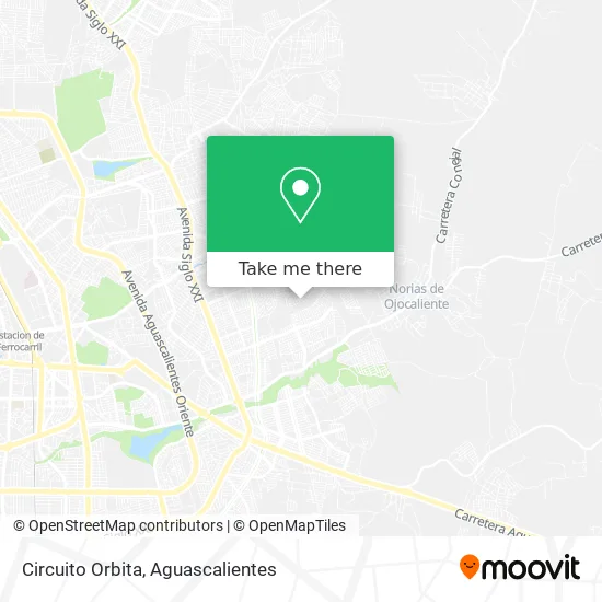
See Circuito Orbita, Aguascalientes, on the map
Public Transit to Circuito Orbita in Aguascalientes
Wondering how to get to Circuito Orbita in Aguascalientes? Moovit helps you find the best way to get to Circuito Orbita with step-by-step directions from the nearest public transit station.
Moovit provides free maps and live directions to help you navigate through your city. View schedules, routes, timetables, and find out how long does it take to get to Circuito Orbita in real time.
Looking for the nearest stop or station to Circuito Orbita? Check out this list of stops closest to your destination: Circuito Mercurio; Calle Serengueti; Avenida Vallarta.
Bus: RUTA 19, RUTA 24, RUTA 48, RUTA 39.
Want to see if there’s another route that gets you there at an earlier time? Moovit helps you find alternative routes or times. Get directions from and directions to Circuito Orbita easily from the Moovit App or Website.
We make riding to Circuito Orbita easy, which is why over 1.5 million users, including users in Aguascalientes, trust Moovit as the best app for public transit. You don’t need to download an individual bus app or train app, Moovit is your all-in-one transit app that helps you find the best bus time or train time available.
For information on prices of bus, costs and ride fares to Circuito Orbita, please check the Moovit app.
Use the app to navigate to popular places including to the airport, hospital, stadium, grocery store, mall, coffee shop, school, college, and university.
Circuito Orbita Address: Circuito Orbita, Aguascalientes, México street in Aguascalientes
- Abarrotes Ely,
- El Soly Menudo y Tacos de Barbacoa,
- Modelorama Real del Sol,
- Paletería y Dulceria Faldangos,
- Vistas De Oriente,
- Fraccionamiento Real del Sol,
- Papeleria Martínez,
- Balcones de oriente,
- Cereales y Semillas del Sol,
- Clases de Spinning Kika,
- Papeleria Real del Sol,
- Secundaria Tecnica Num. 43 Saturnino Herrán,
- Escuela Secundaria Técnica Num. 43,
- Cbtis 195 Extensión,
- Cbtis No 283,
- Vinculacion Cbtis 283,
- Tienda de Abarrotes El Morro,
- Cbtis 283,
- San Francisco de Los Viveros,
- Tienda de Abarrotes Arabes 2
Places Near Circuito Orbita (Aguascalientes)
- Centro, Aguascalientes,
- Isla San Marcos, Aguascalientes,
- Villasuncion, Aguascalientes,
- Central De Autobuses, Aguascalientes,
- Villas de Nuestra Señora de la Asunción, Aguascalientes,
- Nuevo Hospital Hidalgo, Aguascalientes,
- Hospital Imss No. 3, Aguascalientes,
- clinica 3 uaa, Aguascalientes,
- ESPACIOS, Aguascalientes,
- Aeropuerto de Aguascalientes S.A. de C.V., Aguascalientes,
- Parque Las Tres Centurias, Aguascalientes,
- La Isla San Marcos, Aguascalientes,
- Terminal De Combis, Aguascalientes,
- Blvd. Luis Donaldo Colosio, Aguascalientes,
- Jesús María, Aguascalientes,
- Ciudad industrial, Aguascalientes,
- Imss Clinica 1, Aguascalientes,
- Agropecuario, Aguascalientes,
- Universidad Autónoma de Aguascalientes, Aguascalientes,
- Centro Comercial Altaria, Aguascalientes
How to get to popular places in Aguascalientes with public transit
Get around Aguascalientes by public transit!
Traveling around Aguascalientes has never been so easy. See step by step directions as you travel to any attraction, street or major public transit station. View bus and train schedules, arrival times, service alerts and detailed routes on a map, so you know exactly how to get to anywhere in Aguascalientes.
When traveling to any destination around Aguascalientes use Moovit's Live Directions with Get Off Notifications to know exactly where and how far to walk, how long to wait for your line, and how many stops are left. Moovit will alert you when it's time to get off — no need to constantly re-check whether yours is the next stop.
Wondering how to use public transit in Aguascalientes or how to pay for public transit in Aguascalientes? Moovit public transit app can help you navigate your way with public transit easily, and at minimum cost. It includes public transit fees, ticket prices, and costs. Looking for a map of Aguascalientes public transit lines? Moovit public transit app shows all public transit maps in Aguascalientes with all bus routes and stops on an interactive map.
Aguascalientes has 1 transit type(s), including: bus, operated by several transit agencies, including Coordinación General de Movilidad