Cirene stop - Sunday schedule
| Line | Direction | Time |
|---|---|---|
| 62 | Mirafiori South Caio Mario Square | 5:19 AM |
| 62 | Mirafiori South Caio Mario Square | 5:45 AM |
| 62 | Mirafiori South Caio Mario Square | 6:12 AM |
| VE1 | Pozzo Strada Martini Hospital | 6:21 AM |
| 32 | Martinetto Corso Tassoni | 6:23 AM |
| 62 | Mirafiori South Caio Mario Square | 6:39 AM |
| VE1 | Pozzo Strada Martini Hospital | 6:56 AM |
| 62 | Mirafiori South Caio Mario Square | 7:06 AM |
| VE1 | Pozzo Strada Martini Hospital | 7:32 AM |
| 62 | Mirafiori South Caio Mario Square | 7:33 AM |
| 32 | Martinetto Corso Tassoni | 7:38 AM |
| 62 | Mirafiori South Caio Mario Square | 8:01 AM |
| VE1 | Pozzo Strada Martini Hospital | 8:07 AM |
| 62 | Mirafiori South Caio Mario Square | 8:30 AM |
| VE1 | Pozzo Strada Martini Hospital | 8:44 AM |
| 32 | Martinetto Corso Tassoni | 8:55 AM |
| 62 | Mirafiori South Caio Mario Square | 8:59 AM |
| VE1 | Pozzo Strada Martini Hospital | 9:21 AM |
| 62 | Mirafiori South Caio Mario Square | 9:27 AM |
| 32 | Martinetto Corso Tassoni | 9:37 AM |
| 62 | Mirafiori South Caio Mario Square | 9:55 AM |
| VE1 | Pozzo Strada Martini Hospital | 9:59 AM |
| 32 | Martinetto Corso Tassoni | 10:17 AM |
| 62 | Mirafiori South Caio Mario Square | 10:21 AM |
| VE1 | Pozzo Strada Martini Hospital | 10:36 AM |
Directions to Cirene stop (Torino) with public transit
The following transit lines have routes that pass near Cirene
 Bus: 59, 62, VE1, 32, 90.
- Metro: M1.
How to get to Cirene stop by bus?
Click on the bus route to see step by step directions with maps, line arrival times and updated time schedules.
How to get to Cirene stop by metro?
Click on the metro route to see step by step directions with maps, line arrival times and updated time schedules.
Bus stops near Cirene stop in Torino
- Cirene, 7 min walk,
- Terraneo, 9 min walk,
- East Molise, 10 min walk,
Light Rail stations near Cirene station in Torino
- Sansovino, 18 min walk,
Bus lines to Cirene stop in Torino
- VE1, Pozzo Strada Martini Hospital,
- 32, Martinetto Corso Tassoni,
- 62, Guido Reni,
- 90, Falchera Via Delle Querce,
- 59, Center Solferino Square,
- 59 /, Vallette Via Delle Primule,
- 29, Vallette,
What are the closest stations to Cirene?
The closest stations to Cirene are:
- Cirene stop is 522 meters away, 7 min walk.
- Terraneo stop is 686 meters away, 9 min walk.
- East Molise stop is 734 meters away, 10 min walk.
- Sansovino station is 1335 meters away, 18 min walk.
Which bus lines stop near Cirene?
These bus lines stop near Cirene: 59, 62, VE1.
Which metro line stops near Cirene?
M1 (Fermi)
What’s the nearest light rail station to Cirene in Torino?
The nearest light rail station to Cirene in Torino is Sansovino. It’s a 18 min walk away.
What’s the nearest bus station to Cirene in Torino?
The nearest bus station to Cirene in Torino is Cirene. It’s a 7 min walk away.
What time is the first light rail to Cirene in Torino?
The 3 is the first light rail that goes to Cirene in Torino. It stops nearby at 5:01 AM.
What time is the last light rail to Cirene in Torino?
The 3 is the last light rail that goes to Cirene in Torino. It stops nearby at 1:40 AM.
What time is the first bus to Cirene in Torino?
The 62 is the first bus that goes to Cirene in Torino. It stops nearby at 4:52 AM.
What time is the last bus to Cirene in Torino?
The 62 is the last bus that goes to Cirene in Torino. It stops nearby at 1:24 AM.
Cirene station
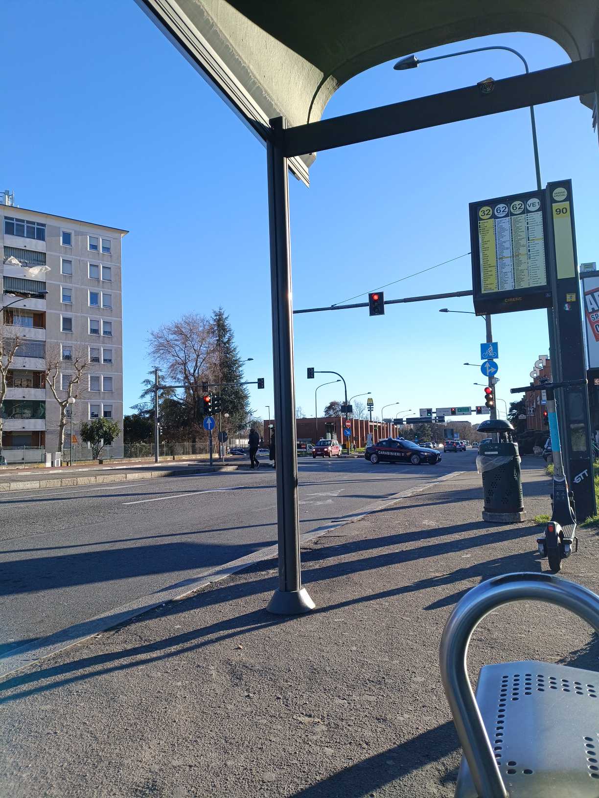 Taken by Anonymous
See Cirene stop, Torino, on the map
Public transit to Cirene stop (ID: 1842) in Torino
Looking for directions to Cirene in Torino, Italy?
Download the Moovit App to find the current schedule and step-by-step directions for Bus, Light Rail or Metro routes that pass through Cirene.
Looking for the nearest stops closest to Cirene ? Check out this list of closest stops to your destination: Cirene; Terraneo; East Molise; Sansovino.
Bus: 59, 62, VE1, 32, 90, 59 /, 29.Metro: M1.
We make riding on public transit to Cirene easy, which is why over 1.7 billion users, including users in Torino trust Moovit as the best app for public transit.
Use the app to navigate to popular places including to the airport, hospital, stadium, grocery store, mall, coffee shop, school, college, and university.
Cirene stop’s code is 1842
The first line to this stop is 62, at 5:19 AM, and the last line is 62 at 12:55 AM.
This stop serves GTT Urban Service’s lines
Popular routes from Cirene stop, Torino
- Cirene,
- Terraneo,
- East Molise
Bus stops near Cirene stop
- Sansovino
Light Rail station near Cirene station
- Motovelodromo,
- Barolo (Vergne Junction),
- Saluzzo - Pagno Street - Terre Rosse Street,
- Valdellatorre,
- Lusiglie,
- Pinerolo - Santa Croce Square,
- Graglia - Sanctuary,
- Castagnito (Baraccone),
- Albiano (Via Cigliano/Cascina Camadio),
- Rivalta (Fiat Rivalta-Gate 11),
- Sanremo,
- Montgenevre,
- Casale Monferrato - Corso Indipendenza,
- Fraisse,
- C.T.O.,
- Casale Di Mazze (Rondissone Street),
- Asti - Revignano Area,
- Villanova - Dierre Factory,
- Turin No.74,
- Collegno
Popular public transit stations in Torino
Get around Torino by public transit!
Traveling around Torino has never been so easy. See step by step directions as you travel to any attraction, street or major public transit station. View bus and train schedules, arrival times, service alerts and detailed routes on a map, so you know exactly how to get to anywhere in Torino.
When traveling to any destination around Torino use Moovit's Live Directions with Get Off Notifications to know exactly where and how far to walk, how long to wait for your line, and how many stops are left. Moovit will alert you when it's time to get off — no need to constantly re-check whether yours is the next stop.
Wondering how to use public transit in Torino or how to pay for public transit in Torino? Moovit public transit app can help you navigate your way with public transit easily, and at minimum cost. It includes public transit fees, ticket prices, and costs. Looking for a map of Torino public transit lines? Moovit public transit app shows all public transit maps in Torino with all Bus, Train, Metro, Light Rail, Funicular and Gondola routes and stops on an interactive map.
Turin has 6 transit type(s), including: Bus, Train, Metro, Light Rail, Funicular and Gondola, operated by several transit agencies, including GTT Urban Service, GTT Suburban Service, GTT Tourist Services, Trenitalia, Arenaways, Sadem, Cavourese, Grandabus Consortium, Bus Company - GrandaBus, Bus Company, Gelosobus, Nuova S.a.a.r., SAC, Giors Bus Lines and Allasia Bus Lines