How to get to Citco Fuel Terminal by bus?
Click on the bus route to see step by step directions with maps, line arrival times and updated time schedules.
Bus stops near Citco Fuel Terminal in South Portland
- Broadway + Elm St, 12 min walk,VIEW
Ferry station near Citco Fuel Terminal in South Portland
- Casco Bay Lines Terminal, 17 min walk,VIEW
Bus lines to Citco Fuel Terminal in South Portland
What are the closest stations to Citco Fuel Terminal?
The closest stations to Citco Fuel Terminal are:
- Broadway + Elm St is 908 yards away, 12 min walk.
- Casco Bay Lines Terminal is 1400 yards away, 17 min walk.
Which bus lines stop near Citco Fuel Terminal?
These bus lines stop near Citco Fuel Terminal: 24A, 24B.
What’s the nearest bus station to Citco Fuel Terminal in South Portland?
The nearest bus station to Citco Fuel Terminal in South Portland is Broadway + Elm St. It’s a 12 min walk away.
What’s the nearest ferry station to Citco Fuel Terminal in South Portland?
The nearest ferry station to Citco Fuel Terminal in South Portland is Casco Bay Lines Terminal. It’s a 17 min walk away.
What time is the first bus to Citco Fuel Terminal in South Portland?
The 24A is the first bus that goes to Citco Fuel Terminal in South Portland. It stops nearby at 5:30 AM.
What time is the last bus to Citco Fuel Terminal in South Portland?
The 24A is the last bus that goes to Citco Fuel Terminal in South Portland. It stops nearby at 10:48 PM.
What time is the first ferry to Citco Fuel Terminal in South Portland?
The DB is the first ferry that goes to Citco Fuel Terminal in South Portland. It stops nearby at 5:00 AM.
What time is the last ferry to Citco Fuel Terminal in South Portland?
The PK is the last ferry that goes to Citco Fuel Terminal in South Portland. It stops nearby at 11:10 PM.
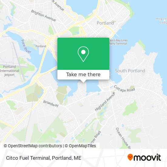
See Citco Fuel Terminal, South Portland, on the map
Public Transit to Citco Fuel Terminal in South Portland
Wondering how to get to Citco Fuel Terminal in South Portland? Moovit helps you find the best way to get to Citco Fuel Terminal with step-by-step directions from the nearest public transit station.
Moovit provides free maps and live directions to help you navigate through your city. View schedules, routes, timetables, and find out how long does it take to get to Citco Fuel Terminal in real time.
Looking for the nearest stop or station to Citco Fuel Terminal? Check out this list of stops closest to your destination: Broadway + Elm St; Casco Bay Lines Terminal.
Bus: 24A, 24B.Ferry: DB, IB, PK.
Want to see if there’s another route that gets you there at an earlier time? Moovit helps you find alternative routes or times. Get directions from and directions to Citco Fuel Terminal easily from the Moovit App or Website.
We make riding to Citco Fuel Terminal easy, which is why over 1.5 million users, including users in South Portland, trust Moovit as the best app for public transit. You don’t need to download an individual bus app or train app, Moovit is your all-in-one transit app that helps you find the best bus time or train time available.
For information on prices of bus, costs and ride fares to Citco Fuel Terminal, please check the Moovit app.
Use the app to navigate to popular places including to the airport, hospital, stadium, grocery store, mall, coffee shop, school, college, and university.
Location: South Portland, Portland, ME
- Greenbelt Trail,
- Rick Bouchard LCSW,
- Northeast Popshop,
- Boost Mobile,
- Creative Change Counseling,
- Amazon Locker-Complicity,
- Tres Leches Cakes Flor,
- SMB Resource Group,
- David Young Hair Salon,
- Stephen Trombley Ins Agcy Inc.,
- Landing Real Estate,
- Theatra-Dance Studio,
- Williams Accounting & Tax,
- Broadway,
- Body Rev Fitness,
- The Drapery Trading Company,
- JWS Consulting,
- Lee Katherine Nicoloff PHD Psychologist,
- Jillian Smith Mass,
- Kimberly Coville
Places Near Citco Fuel Terminal (South Portland)
- Cross Insurance Arena,
- Mercy Hospital - Fore River Campus,
- Jewell Island,
- Cape Elizabeth, ME, Cape Elizabeth,
- Casco Bay Ferry Terminal,
- Fort Williams Park, Cape Elizabeth,
- ZzZzZzZzZzZ, Westbrook,
- Walmart,
- Portland Transportation Center,
- Walmart Scarborough Supercenter,
- The Old Port,
- On a bus to Kennebunkport,
- Southern Maine Community College, South Portland,
- Maine Medical Center,
- L. L. Bean Outlet,
- House Island,
- Clarion Hotel Portland,
- Portland International Jetport (PWM) (Portland International Jetport),
- Fort Gorges,
- Exit 45 Park And Ride, South Portland
How to get to popular places in Portland, ME with public transit
Get around South Portland by public transit!
Traveling around South Portland has never been so easy. See step by step directions as you travel to any attraction, street or major public transit station. View bus and train schedules, arrival times, service alerts and detailed routes on a map, so you know exactly how to get to anywhere in South Portland.
When traveling to any destination around South Portland use Moovit's Live Directions with Get Off Notifications to know exactly where and how far to walk, how long to wait for your line, and how many stops are left. Moovit will alert you when it's time to get off — no need to constantly re-check whether yours is the next stop.
Wondering how to use public transit in South Portland or how to pay for public transit in South Portland? Moovit public transit app can help you navigate your way with public transit easily, and at minimum cost. It includes public transit fees, ticket prices, and costs. Looking for a map of South Portland public transit lines? Moovit public transit app shows all public transit maps in South Portland with all Bus, Train and Ferry routes and stops on an interactive map.
Portland, ME has 3 transit type(s), including: Bus, Train and Ferry, operated by several transit agencies, including Greater Portland Metro, City of South Portland, Biddeford Saco Old Orchard Beach Transit, Casco Bay Lines, Amtrak, Greyhound-us and FlixBus-us