Directions to Citibank (Boston) with public transportation
The following transit lines have routes that pass near Citibank
 Bus: 22, 39, 66, 85, 35.
- Train: FRANKLIN/FOXBORO, PROVIDENCE/STOUGHTON.
- Subway: GREEN LINE E.
How to get to Citibank by bus?
Click on the bus route to see step by step directions with maps, line arrival times and updated time schedules.
From Chevalier Theatre (Chevalier Theater Show Line), Medford
93 minFrom Chevalier Theater, Medford
93 minFrom McLean Hospital, Belmont
90 minFrom Curry College, Milton
67 minFrom Renaissance Boston Waterfront Hotel (Renaissance Waterfront Conference Center), Boston
49 minFrom Kimpton Marlowe Hotel, Cambridge
60 minFrom Terrace Room, Paige Hall, Medford
82 minFrom Marina Bay, Quincy
110 minFrom Yankee Lobster, Boston
55 min
How to get to Citibank by train?
Click on the train route to see step by step directions with maps, line arrival times and updated time schedules.
How to get to Citibank by subway?
Click on the subway route to see step by step directions with maps, line arrival times and updated time schedules.
From Chevalier Theatre (Chevalier Theater Show Line), Medford
84 minFrom Chevalier Theater, Medford
84 minFrom Renaissance Boston Waterfront Hotel (Renaissance Waterfront Conference Center), Boston
65 minFrom Kimpton Marlowe Hotel, Cambridge
59 minFrom Terrace Room, Paige Hall, Medford
65 minFrom Yankee Lobster, Boston
70 min
Subway station near Citibank in Boston
- Back Of the Hill, 3 min walk,VIEW
Bus stops near Citibank in Boston
Bus lines to Citibank in Boston
What are the closest stations to Citibank?
The closest stations to Citibank are:
- Back Of the Hill is 233 yards away, 3 min walk.
- 105 S Huntington Ave is 297 yards away, 4 min walk.
- 835 Huntington Ave Opp Parker Hill Ave is 354 yards away, 5 min walk.
- Heath St @ S Huntington Ave is 395 yards away, 5 min walk.
Which bus lines stop near Citibank?
These bus lines stop near Citibank: 22, 39, 66, 85.
Which train lines stop near Citibank?
These train lines stop near Citibank: FRANKLIN/FOXBORO, PROVIDENCE/STOUGHTON.
Which subway line stops near Citibank?
GREEN LINE E (Heath Street)
What’s the nearest subway station to Citibank in Boston?
The nearest subway station to Citibank in Boston is Back Of the Hill. It’s a 3 min walk away.
What’s the nearest bus station to Citibank in Boston?
The nearest bus station to Citibank in Boston is 105 S Huntington Ave. It’s a 4 min walk away.
What time is the first subway to Citibank in Boston?
The GREEN LINE E is the first subway that goes to Citibank in Boston. It stops nearby at 5:28 AM.
What time is the last subway to Citibank in Boston?
The GREEN LINE E is the last subway that goes to Citibank in Boston. It stops nearby at 1:03 AM.
What time is the first bus to Citibank in Boston?
The 39 is the first bus that goes to Citibank in Boston. It stops nearby at 4:45 AM.
What time is the last bus to Citibank in Boston?
The 66 is the last bus that goes to Citibank in Boston. It stops nearby at 1:25 AM.
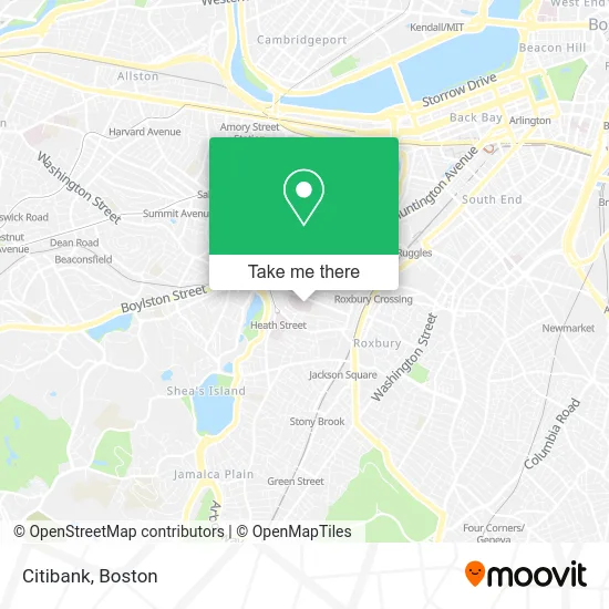
See Citibank, Boston, on the map
Public Transit to Citibank in Boston
Wondering how to get to Citibank in Boston? Moovit helps you find the best way to get to Citibank with step-by-step directions from the nearest public transit station.
Moovit provides free maps and live directions to help you navigate through your city. View schedules, routes, timetables, and find out how long does it take to get to Citibank in real time.
Looking for the nearest stop or station to Citibank? Check out this list of stops closest to your destination: Back Of the Hill; 105 S Huntington Ave; 835 Huntington Ave Opp Parker Hill Ave; Heath St @ S Huntington Ave.
Bus: 22, 39, 66, 85, 35, GREEN LINE E SHUTTLE, GREEN LINE E SHUTTLE, 14.Train: FRANKLIN/FOXBORO, PROVIDENCE/STOUGHTON.Subway: GREEN LINE E.
Want to see if there’s another route that gets you there at an earlier time? Moovit helps you find alternative routes or times. Get directions from and directions to Citibank easily from the Moovit App or Website.
We make riding to Citibank easy, which is why over 1.5 million users, including users in Boston, trust Moovit as the best app for public transit. You don’t need to download an individual bus app or train app, Moovit is your all-in-one transit app that helps you find the best bus time or train time available.
For information on prices of bus, subway, train and ferry, costs and ride fares to Citibank, please check the Moovit app.
Use the app to navigate to popular places including to the airport, hospital, stadium, grocery store, mall, coffee shop, school, college, and university.
Citibank Address: 125 Parker Hill Ave Roxbury Crossing, MA 02120 street in Boston
- Carl T Talmo MD,
- Baptist Hospital,
- Gordon Tree & Landscaping,
- Medical Center of Boston,
- Eric J Woodard MD (Robert J Banco MD),
- New England Baptist Hospital,
- FedEx,
- Hayden Box, MD,
- Insurance Covered Chiropractic Care,
- Mission Hill Link,
- Gas Leak Detection Plumbing,
- N E Baptist Hos,
- Edgar P. Benjamin Healthcare Center,
- Roxbury Prep Charter School ,
- Roxbury Preparatory Charter School,
- 21 Iroquois St Parking,
- Backbaydrumming,
- Edward H. Haskell Home for Nurses,
- Parker Hill Ave & Sunset St,
- Gail H Kaufman MD
Places Near Citibank (Boston)
- Leader Bank Pavilion (Leader Bank Pavillion), Boston,
- Prudential Center, Boston,
- Boston Convention & Exhibition Center, Boston,
- Quincy Market, Boston,
- North End, Boston,
- Boston Common, Boston,
- Wang Theater, Boston,
- Castle Island, Boston,
- Boston Children's Hospital, Boston,
- Boston Medical Center, Boston,
- Wilbur Theatre, Boston,
- House Of Blues, Boston,
- City Hall Plaza, Boston,
- Museum Of Science, Boston,
- Cheers, Boston,
- Massachusetts General Hospital, Boston,
- Mgm Music Hall, Boston,
- Faneuil Hall, Boston,
- Seaport District, Boston,
- Td Garden, Boston
How to get to popular places in Boston with public transit
Get around Boston by public transit!
Traveling around Boston has never been so easy. See step by step directions as you travel to any attraction, street or major public transit station. View bus and train schedules, arrival times, service alerts and detailed routes on a map, so you know exactly how to get to anywhere in Boston.
When traveling to any destination around Boston use Moovit's Live Directions with Get Off Notifications to know exactly where and how far to walk, how long to wait for your line, and how many stops are left. Moovit will alert you when it's time to get off — no need to constantly re-check whether yours is the next stop.
Wondering how to use public transit in Boston or how to pay for public transit in Boston? Moovit public transit app can help you navigate your way with public transit easily, and at minimum cost. It includes public transit fees, ticket prices, and costs. Looking for a map of Boston public transit lines? Moovit public transit app shows all public transit maps in Boston with all Bus, Train, Subway and Ferry routes and stops on an interactive map.
Boston has 4 transit type(s), including: Bus, Train, Subway and Ferry, operated by several transit agencies, including MBTA, Southeastern Regional Transit Authority, MetroWest Regional Transit Authority, Rhode Island Public Transit Authority, WRTA, Lowell Regional Transit Authority, Merrimack Valley Transit, Montachusett Regional Transit Authority, Cape Cod Regional Transit Authority, Brockton Area Transit Authority, Martha's Vineyard Transit Authority, the WAVE - Nantucket Regional Transit Authority, GATRA, Cape Ann Transportation Authority and Massport