How to get to Clarks by bus?
Click on the bus route to see step by step directions with maps, line arrival times and updated time schedules.
From Sunny's World, Paud
42 minFrom Passport Office, Pune & Velhe
74 minFrom Pandit Jawaharlal Nehru Udyog Kendra, Pune & Velhe
54 minFrom Dr. D. Y. Patil Dental College and Hospital, Pune & Velhe
78 minFrom 16 no. thergaon, Paud
37 minFrom Pimple Gurav Dinosaur Park, Pune & Velhe
37 minFrom Vadgaon Sheri, Pune & Velhe
67 minFrom D Y Patil Medical College, Pune & Velhe
74 minFrom Abhiruchi City Pride, Pune & Velhe
46 minFrom Sinhgad Dental College & Hospital, Pune & Velhe
43 min
How to get to Clarks by metro?
Click on the metro route to see step by step directions with maps, line arrival times and updated time schedules.
Bus stops near Clarks in Pune & Velhe
Metro stations near Clarks in Pune & Velhe
Train station near Clarks in Pune & Velhe
- Shivaji Nagar, 38 min walk,VIEW
Bus lines to Clarks in Pune & Velhe
- 41, Sangvi Gaon,VIEW
- 276, Ganpati Matha,VIEW
- 277, Bhosari Terminal,VIEW
- 216A, Khadki Railway Station Via Nal Stop,VIEW
- 276A, NDA Gate No.10,VIEW
- 50K, Sinhgad Paytha,VIEW
- 90, Katraj - Gokhale Nagar,VIEW
- 146, Pune Station - Gokhale Nagar,VIEW
- 58, Shanipar Bus Stand,VIEW
- 59, Niljyoti Society,VIEW
- 21, Swargate - Sangvi Gaon,VIEW
- 30, Marketyard - Ghotawade Phata,VIEW
- 35, Ma.Na.Pa Bhavan - Mukai Chowk Terminal Kiwale,VIEW
- 87, Sutarwadi Depot - Deccan Gymkhana Via Bhagvati Nagar,VIEW
- 93, Wakad Pul - Deccan Gymkhana,VIEW
- 100, Ma.Na.Pa Bhavan - Hinjawadi Maan Phase 3,VIEW
- 105, Deccan Gymkhana - Medi Point Hospital,VIEW
- 109, Ma.Na.Pa Bhavan ⟲ Ma.Na.Pa Bhavan Via Pashan, Kothrud (Circular),VIEW
- 113, Vasant Talkies - Sangvi Gaon,VIEW
- 114, Bajirao Padale Chowk Mhalunge - Ma.Na.Pa Bhavan,VIEW
What are the closest stations to Clarks?
The closest stations to Clarks are:
- Shivaji Housing Society (S.B Road) is 17 meters away, 1 min walk.
- Garware College is 162 meters away, 3 min walk.
- Vetalbaba Chowk is 493 meters away, 7 min walk.
- Kusalkar Putla Chowk is 630 meters away, 9 min walk.
- Rangehills Corner is 1008 meters away, 14 min walk.
- Shivaji Nagar is 2636 meters away, 34 min walk.
Which bus lines stop near Clarks?
These bus lines stop near Clarks: 276, 276A, 277.
Which metro lines stop near Clarks?
These metro lines stop near Clarks: AQUA, PURPLE.
What’s the nearest metro station to Clarks in Pune & Velhe?
The nearest metro station to Clarks in Pune & Velhe is Garware College. It’s a 3 min walk away.
What’s the nearest bus station to Clarks in Pune & Velhe?
The nearest bus station to Clarks in Pune & Velhe is Shivaji Housing Society (S.B Road). It’s a 1 min walk away.
What time is the first metro to Clarks in Pune & Velhe?
The AQUA is the first metro that goes to Clarks in Pune & Velhe. It stops nearby at 6:09 AM.
What time is the last metro to Clarks in Pune & Velhe?
The AQUA is the last metro that goes to Clarks in Pune & Velhe. It stops nearby at 11:27 PM.
What time is the first train to Clarks in Pune & Velhe?
The 99804 is the first train that goes to Clarks in Pune & Velhe. It stops nearby at 4:50 AM.
What time is the last train to Clarks in Pune & Velhe?
The 99901 is the last train that goes to Clarks in Pune & Velhe. It stops nearby at 1:14 AM.
What time is the first bus to Clarks in Pune & Velhe?
The 333 is the first bus that goes to Clarks in Pune & Velhe. It stops nearby at 4:50 AM.
What time is the last bus to Clarks in Pune & Velhe?
The 204 is the last bus that goes to Clarks in Pune & Velhe. It stops nearby at 1:01 AM.
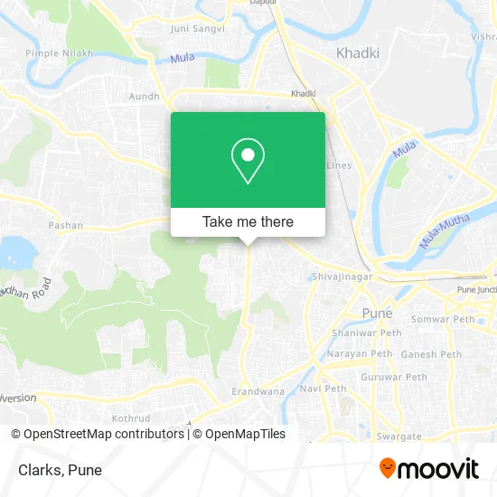
See Clarks, Pune & Velhe, on the map
Public Transit to Clarks in Pune & Velhe
Wondering how to get to Clarks in Pune & Velhe? Moovit helps you find the best way to get to Clarks with step-by-step directions from the nearest public transit station.
Moovit provides free maps and live directions to help you navigate through your city. View schedules, routes, timetables, and find out how long does it take to get to Clarks in real time.
Looking for the nearest stop or station to Clarks? Check out this list of stops closest to your destination: Shivaji Housing Society (S.B Road); Garware College; Vetalbaba Chowk; Kusalkar Putla Chowk; Rangehills Corner; Shivaji Nagar.
Bus: 276, 276A, 277, 41, 216A, 90, 146, 58, 59.Train: 99801, 99802, 99803, 99804, 99805.Metro: AQUA, PURPLE.
Want to see if there’s another route that gets you there at an earlier time? Moovit helps you find alternative routes or times. Get directions from and directions to Clarks easily from the Moovit App or Website.
We make riding to Clarks easy, which is why over 1.7 million users, including users in Pune & Velhe, trust Moovit as the best app for public transit. You don’t need to download an individual bus app or train app, Moovit is your all-in-one transit app that helps you find the best bus time or train time available.
For information on prices of bus and metro, costs and ride fares to Clarks, please check the Moovit app.
Use the app to navigate to popular places including to the airport, hospital, stadium, grocery store, mall, coffee shop, school, college, and university.
Clarks Address: Senapati Bapat Path पुणे 411016 MH street in Pune & Velhe
- Peora,
- Kiko Milano,
- Parcos,
- Dorabjees,
- Chumbak,
- Poona Guest House,
- House of Candy,
- Iconic,
- VERO MODA,
- GO COLORS!,
- Gas,
- Aurelia,
- Nautica,
- Arrow,
- Ecco Shoes,
- Speedo,
- Hunkemoller,
- And,
- Wadeshwar,
- Marks & Spencer
Places Near Clarks (Pune & Velhe)
- Sarasbaug, Pune & Velhe,
- Raviwar Peth, Pune & Velhe,
- Dagdusheth Halwai Ganpati Mandir, Pune & Velhe,
- Vishwakarma Institute Of Technology (Vit), Pune & Velhe,
- Dagadusheth Halwai Ganapati Temple, Pune & Velhe,
- Laxmi Road, Pune & Velhe,
- M G Road, Pune & Velhe,
- ISKCON Nvcc Temple, Pune & Velhe,
- Pune Okayama Friendship Garden, Pune & Velhe,
- Westend Mall, Pune & Velhe,
- Cognizant Deccan Campus (CDC), Paud,
- Ion Digital Zone, Pune & Velhe,
- Fc Road, Pune & Velhe,
- Tulshibaug, Pune & Velhe,
- Symbiosis Lavale Bus Stop, Pune & Velhe,
- Swaminarayan Mandir, Pune & Velhe,
- Chaturshringi Temple, Pune & Velhe,
- Senapati Bapat Road, Pune & Velhe,
- Pvr Icon - Pavilion Mall, Pune & Velhe,
- ISKCON Pune, Pune & Velhe
How to get to popular places in Pune with public transit
Get around Pune & Velhe by public transit!
Traveling around Pune & Velhe has never been so easy. See step by step directions as you travel to any attraction, street or major public transit station. View bus and train schedules, arrival times, service alerts and detailed routes on a map, so you know exactly how to get to anywhere in Pune & Velhe.
When traveling to any destination around Pune & Velhe use Moovit's Live Directions with Get Off Notifications to know exactly where and how far to walk, how long to wait for your line, and how many stops are left. Moovit will alert you when it's time to get off — no need to constantly re-check whether yours is the next stop.
Wondering how to use public transit in Pune & Velhe or how to pay for public transit in Pune & Velhe? Moovit public transit app can help you navigate your way with public transit easily, and at minimum cost. It includes public transit fees, ticket prices, and costs. Looking for a map of Pune & Velhe public transit lines? Moovit public transit app shows all public transit maps in Pune & Velhe with all Bus, Train and Metro routes and stops on an interactive map.
Pune has 3 transit type(s), including: Bus, Train and Metro, operated by several transit agencies, including Pune Metro (Maha Metro), PMPML, PMPML Night Bus Service (Ratrani) and Central Railways (Indian Railways)