How to get to ClassWatch by bus?
Click on the bus route to see step by step directions with maps, line arrival times and updated time schedules.
From Navy Yard, Washington
37 minFrom Navy Lodge, Washington
96 minFrom Pentagon North Parking Lot, Arlington County
60 minFrom Thomas Jefferson Community Center & Theatre, Arlington County
75 minFrom I-295 Exit 1 - Naval Research Lab, Washington
75 minFrom Naval Research Lab, Washington
92 minFrom Costco, Arlington County
48 minFrom Del Ray, Alexandria
68 minFrom Quarterdeck, Arlington County
63 minFrom U.S. Naval Research Laboratory - NRL, Washington
93 min
How to get to ClassWatch by train?
Click on the train route to see step by step directions with maps, line arrival times and updated time schedules.
How to get to ClassWatch by metro?
Click on the metro route to see step by step directions with maps, line arrival times and updated time schedules.
Bus stops near ClassWatch in Washington
Metro stations near ClassWatch in Washington
Bus lines to ClassWatch in Washington
What are the closest stations to ClassWatch?
The closest stations to ClassWatch are:
- Vermont Av Nw+U St NW is 35 yards away, 1 min walk.
- U St Nw+Vermont Av NW is 60 yards away, 1 min walk.
- U Street/African-Amer Civil War Memorial/ Cardozo is 133 yards away, 2 min walk.
- 7 St Nw+T St NW is 357 yards away, 5 min walk.
- Dupont Circle Metro Station is 2580 yards away, 31 min walk.
Which bus lines stop near ClassWatch?
These bus lines stop near ClassWatch: C51, C91, D44.
Which train line stops near ClassWatch?
NORTHEAST REGIONAL (Boston)
Which metro lines stop near ClassWatch?
These metro lines stop near ClassWatch: GREEN, YELLOW.
What’s the nearest metro station to ClassWatch in Washington?
The nearest metro station to ClassWatch in Washington is U Street/African-Amer Civil War Memorial/ Cardozo. It’s a 2 min walk away.
What’s the nearest bus station to ClassWatch in Washington?
The nearest bus stations to ClassWatch in Washington are Vermont Av Nw+U St NW and U St Nw+Vermont Av NW. The closest one is a 1 min walk away.
What time is the first metro to ClassWatch in Washington?
The GREEN is the first metro that goes to ClassWatch in Washington. It stops nearby at 5:16 AM.
What time is the last metro to ClassWatch in Washington?
The GREEN is the last metro that goes to ClassWatch in Washington. It stops nearby at 12:25 AM.
What time is the first bus to ClassWatch in Washington?
The C53 is the first bus that goes to ClassWatch in Washington. It stops nearby at 3:00 AM.
What time is the last bus to ClassWatch in Washington?
The C53 is the last bus that goes to ClassWatch in Washington. It stops nearby at 3:17 AM.
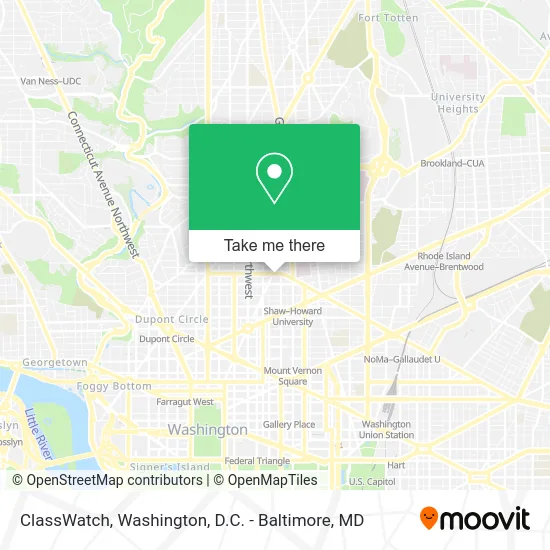
See ClassWatch, Washington, on the map
Public Transit to ClassWatch in Washington
Wondering how to get to ClassWatch in Washington? Moovit helps you find the best way to get to ClassWatch with step-by-step directions from the nearest public transit station.
Moovit provides free maps and live directions to help you navigate through your city. View schedules, routes, timetables, and find out how long does it take to get to ClassWatch in real time.
Looking for the nearest stop or station to ClassWatch? Check out this list of stops closest to your destination: Vermont Av Nw+U St NW; U St Nw+Vermont Av NW; U Street/African-Amer Civil War Memorial/ Cardozo; 7 St Nw+T St NW; Dupont Circle Metro Station.
Bus: C51, C91, D44, C53, C57, D4X, D40.Train: NORTHEAST REGIONAL.Metro: GREEN, YELLOW, RED.
Want to see if there’s another route that gets you there at an earlier time? Moovit helps you find alternative routes or times. Get directions from and directions to ClassWatch easily from the Moovit App or Website.
We make riding to ClassWatch easy, which is why over 1.5 million users, including users in Washington, trust Moovit as the best app for public transit. You don’t need to download an individual bus app or train app, Moovit is your all-in-one transit app that helps you find the best bus time or train time available.
For information on prices of bus, metro and train, costs and ride fares to ClassWatch, please check the Moovit app.
Use the app to navigate to popular places including to the airport, hospital, stadium, grocery store, mall, coffee shop, school, college, and university.
ClassWatch Address: 920 U St NW street in Washington
- El Rey DC Taqueria & Mexican Beer Garden,
- El Rey,
- U NW and 9 1/2 St NW,
- Kiki,
- DC9 Nightclub,
- Expo Restaurant & Club (Expo DC Bar and Lounge),
- XX+ Crostino,
- Al Crostino (xx+ Crostino),
- The Brixton,
- DC 9,
- Kabob Restaurant,
- Ethiopian Yellow Pages (Bawza Ethiopian Newspaper),
- Mr Nice Guys DC,
- MK Lounge dc,
- A Alemu Investment,
- Ghion Ethiopian Restaurant (Ghion Restaurant & Lounge),
- Andy's Pizza,
- Tiny Tiki Bar (Euphoria Bar and Lounge),
- U Street Corridor,
- Erim Eye Care
Places Near ClassWatch (Washington)
- Capital One Arena, Washington,
- National Mall, Washington,
- Georgetown, Washington,
- Rock Creek Tennis Center, Washington,
- Marriott Marquis Washington, DC, Washington,
- Sibley Memorial Hospital, Washington,
- Camden Yards, Baltimore,
- Amazon Hq2, Arlington County,
- Washington National Cathedral, Washington,
- Washington DC VA Medical Center, Washington,
- National Zoo, Washington,
- The Anthem, Washington,
- National Museum of African American History and Culture, Washington,
- M&T Bank Stadium, Baltimore,
- Pennsylvania Ave NW (3rd st and pennsylvania), Washington,
- Museum Of The Bible, Washington,
- Warner Theatre, Washington,
- Westfield Montgomery Mall, Montgomery County,
- PG Mall, Prince George's County,
- Basilica of the National Shrine, Washington
How to get to popular places in Washington, D.C. - Baltimore, MD with public transit
Get around Washington by public transit!
Traveling around Washington has never been so easy. See step by step directions as you travel to any attraction, street or major public transit station. View bus and train schedules, arrival times, service alerts and detailed routes on a map, so you know exactly how to get to anywhere in Washington.
When traveling to any destination around Washington use Moovit's Live Directions with Get Off Notifications to know exactly where and how far to walk, how long to wait for your line, and how many stops are left. Moovit will alert you when it's time to get off — no need to constantly re-check whether yours is the next stop.
Wondering how to use public transit in Washington or how to pay for public transit in Washington? Moovit public transit app can help you navigate your way with public transit easily, and at minimum cost. It includes public transit fees, ticket prices, and costs. Looking for a map of Washington public transit lines? Moovit public transit app shows all public transit maps in Washington with all Bus, Train, Metro, Light Rail and Ferry routes and stops on an interactive map.
Washington, D.C. - Baltimore, MD has 5 transit type(s), including: Bus, Train, Metro, Light Rail and Ferry, operated by several transit agencies, including WMATA, Montgomery County Ride On, Fairfax Connector, TheBus, PRTC, DASH - Alexandria, Arlington Transit (ART), RTA of Central Maryland, MDOT MTA, MDOT MTA Light RailLink, MDOT MTA Commuter Bus, MDOT MTA Local Bus, FXBGO!, Virginia Railway Express (VRE) and MARC