Directions to Clau Modas (São José Dos Pinhais) with public transportation
The following transit lines have routes that pass near Clau Modas
How to get to Clau Modas by bus?
Click on the bus route to see step by step directions with maps, line arrival times and updated time schedules.
From Rua Anne Frank, Boqueirão
63 minFrom Terminal Boqueirão, Boqueirão
56 minFrom Rua Carlos de Laet, Boqueirão
71 minFrom Rua Bartolomeu Lourenço de Gusmão, Boqueirão
64 minFrom terminal do hauer, Boqueirão
70 minFrom Centro, São José Dos Pinhais
35 minFrom UPA 24h - Unidade de Pronto Atendimento Cajuru, Cajuru
59 minFrom Boate Garotas Anonimas de Plantão, São José Dos Pinhais
31 minFrom Unidade De Saúde Boqueirão, Boqueirão
71 minFrom Cajuru, Cajuru
56 min
Bus stops near Clau Modas in São José Dos Pinhais
Bus lines to Clau Modas in São José Dos Pinhais
What are the closest stations to Clau Modas?
The closest stations to Clau Modas are:
- Av. Benjamin Possebon, 144 is 335 meters away, 5 min walk.
- Av. Benjamin Possebon, 64 is 377 meters away, 5 min walk.
Which bus lines stop near Clau Modas?
These bus lines stop near Clau Modas: 530 BAIRRO A BAIRRO - 2, 531 BAIRRO A BAIRRO - 1, 568 T. CENTRAL / TRABALHADOR, E68 QUISSISSANA / GUADALUPE.
What’s the nearest bus station to Clau Modas in São José Dos Pinhais?
The nearest bus stations to Clau Modas in São José Dos Pinhais are Av. Benjamin Possebon, 144 and Av. Benjamin Possebon, 64. The closest one is a 5 min walk away.
What time is the first bus to Clau Modas in São José Dos Pinhais?
The 530 BAIRRO A BAIRRO - 2 is the first bus that goes to Clau Modas in São José Dos Pinhais. It stops nearby at 4:20 AM.
What time is the last bus to Clau Modas in São José Dos Pinhais?
The 530 BAIRRO A BAIRRO - 2 is the last bus that goes to Clau Modas in São José Dos Pinhais. It stops nearby at 1:36 AM.
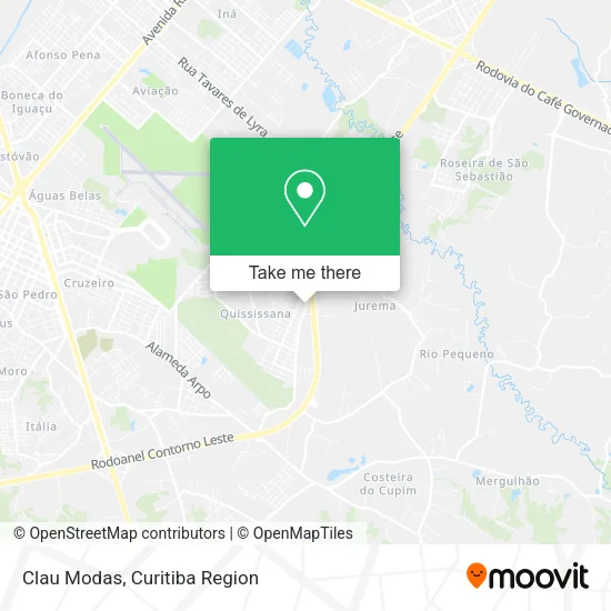
See Clau Modas, São José Dos Pinhais, on the map
Public Transit to Clau Modas in São José Dos Pinhais
Wondering how to get to Clau Modas in São José Dos Pinhais? Moovit helps you find the best way to get to Clau Modas with step-by-step directions from the nearest public transit station.
Moovit provides free maps and live directions to help you navigate through your city. View schedules, routes, timetables, and find out how long does it take to get to Clau Modas in real time.
Looking for the nearest stop or station to Clau Modas? Check out this list of stops closest to your destination: Av. Benjamin Possebon; Av. Benjamin Possebon.
Bus: 530 BAIRRO A BAIRRO - 2, 531 BAIRRO A BAIRRO - 1, 568 T. CENTRAL / TRABALHADOR, E68 QUISSISSANA / GUADALUPE.
Want to see if there’s another route that gets you there at an earlier time? Moovit helps you find alternative routes or times. Get directions from and directions to Clau Modas easily from the Moovit App or Website.
We make riding to Clau Modas easy, which is why over 1.5 million users, including users in São José Dos Pinhais, trust Moovit as the best app for public transit. You don’t need to download an individual bus app or train app, Moovit is your all-in-one transit app that helps you find the best bus time or train time available.
For information on prices of bus, costs and ride fares to Clau Modas, please check the Moovit app.
Use the app to navigate to popular places including to the airport, hospital, stadium, grocery store, mall, coffee shop, school, college, and university.
Clau Modas Address: Rua Miguel Jareck, 350 Quissisana São José dos Pinhais-PR 83085-020 street in São José Dos Pinhais
- Residencial Dona Bella II,
- Rua Silvio Pinto Ribeiro 707,
- Posto de Saude Quississana,
- Supimpa Assados,
- Avenida Benjamin Possebon 230,
- Natfarma Medicamentos Ltda,
- Comercio De Argila Sete Cores,
- Roan. Contorno Leste,
- Rua Elisa Simeon Meretka 326,
- Rua Silvio Pinto Ribeiro 777,
- Gracie Barra São José dos Pinhais,
- Come Come Lanches - Quississana,
- Linck Volvo,
- Transgires Transportes Ltda.,
- Quississana,
- O Alvorecer,
- Rua da Jaca,
- Rua Alifranci Celestino da Silva 15,
- Quissisana,
- Escola Municipal Aníbal Ribeiro
Places Near Clau Modas (São José Dos Pinhais)
- Pontifícia Universidade Católica do Paraná (PUCPR), Prado Velho,
- Hospital Universitário Evangélico de Curitiba, Bigorrilho,
- Rua Martim Afonso 558, Mercês,
- Hospital de Clínicas (HC - UFPR), Centro,
- Arena Da Baixada - Curitiba,
- Hospital Madalena Sofia, Bairro Alto,
- Park Shopping Barigüi, Mossunguê,
- Hhhhh, Fazendinha,
- Jockey Plaza Shopping Center, Tarumã,
- Shopping Palladium, Portão,
- Hospital Angelina Caron, Campina Grande Do Sul,
- Hospital Da Cruz Vermelha, Batel,
- Parque Barigui, Mercês,
- Campo Largo, Campo,
- Hospital Erasto Gaertner, Jardim Das Américas,
- Hospital do Rocio, Campo,
- Shopping Estação, Rebouças,
- Hospital Nossa Senhora Das Graças, Mercês,
- Rua General Mário Tourinho, Campina Do Siqueira,
- Jardim Botânico de Curitiba PR, Centro
How to get to popular places in Curitiba Region with public transit
Get around São José Dos Pinhais by public transit!
Traveling around São José Dos Pinhais has never been so easy. See step by step directions as you travel to any attraction, street or major public transit station. View bus and train schedules, arrival times, service alerts and detailed routes on a map, so you know exactly how to get to anywhere in São José Dos Pinhais.
When traveling to any destination around São José Dos Pinhais use Moovit's Live Directions with Get Off Notifications to know exactly where and how far to walk, how long to wait for your line, and how many stops are left. Moovit will alert you when it's time to get off — no need to constantly re-check whether yours is the next stop.
Wondering how to use public transit in São José Dos Pinhais or how to pay for public transit in São José Dos Pinhais? Moovit public transit app can help you navigate your way with public transit easily, and at minimum cost. It includes public transit fees, ticket prices, and costs. Looking for a map of São José Dos Pinhais public transit lines? Moovit public transit app shows all public transit maps in São José Dos Pinhais with all Bus and Cable Car routes and stops on an interactive map.
Curitiba Region has 2 transit type(s), including: Bus and Cable Car, operated by several transit agencies, including Sistema Integrado de Mobilidade (URBS), Sistema Integrado de Mobilidade (AMEP), URBS (Cartões bancários e Dinheiro), URBS (Cartões bancários / Cartão URBS), AMEP (Cartões bancários / Cartão MetroCard), AMEP (Cartões bancários / Cartão MetroCard / Dinheiro), Viação Colombo (Dinheiro), TRIAR (Cartão TRIAR / Dinheiro), Empresa Curitiba Cerro Azul (Dinheiro), Expresso Nossa Senhora da Penha (Dinheiro), Empresa Campo Alto Tijucas (Dinheiro), Auto Viação São José (Cartão VEM / Dinheiro), BRT S/A (Cartão VEM / Dinheiro), TransPiedade (Cartão Cidadão / Dinheiro) and Oceânica Sul (Cartão Transporte / Dinheiro)