How to get to Clearwater Processing by bus?
Click on the bus route to see step by step directions with maps, line arrival times and updated time schedules.
From Keiser University-West Palm Beach, Royal Palm Beach-West Jupiter
54 minFrom Amazon Fulfillment Center-DMI7, West Palm Beach
65 minFrom 1661B South Congress Avenue, Lake Worth
43 minFrom Lake Worth Tri Rail Station, Lake Worth
78 minFrom Walmart West Palm Beach Supercenter, West Palm Beach
51 minFrom Lake Worth, FL, Lake Worth
60 minFrom John I. Leonard High School, Lake Worth
86 minFrom Palm Beach State College, Lake Worth
65 minFrom The Ballpark of the Palm Beaches, West Palm Beach
58 minFrom Whispers All Girl Staff, West Palm Beach
54 min
How to get to Clearwater Processing by train?
Click on the train route to see step by step directions with maps, line arrival times and updated time schedules.
Bus stop near Clearwater Processing in West Palm Beach
- DIXIE HWY at N LAKESIDE CT, 4 min walk,VIEW
Train stations near Clearwater Processing in West Palm Beach
Bus lines to Clearwater Processing in West Palm Beach
- 1, Rt 1 Southbound To Wpb Trirail,VIEW
What are the closest stations to Clearwater Processing?
The closest stations to Clearwater Processing are:
- DIXIE HWY at N LAKESIDE CT is 283 yards away, 4 min walk.
- West Palm Beach is 2227 yards away, 27 min walk.
- West Palm Beach Station is 2867 yards away, 34 min walk.
- West Palm Beach Amtrak Station is 2930 yards away, 35 min walk.
Which bus lines stop near Clearwater Processing?
These bus lines stop near Clearwater Processing: 1, 31.
Which train line stops near Clearwater Processing?
TRIRAIL (Northbound To Mangonia Park)
What’s the nearest train station to Clearwater Processing in West Palm Beach?
The nearest train station to Clearwater Processing in West Palm Beach is West Palm Beach. It’s a 27 min walk away.
What’s the nearest bus station to Clearwater Processing in West Palm Beach?
The nearest bus station to Clearwater Processing in West Palm Beach is DIXIE HWY at N LAKESIDE CT. It’s a 4 min walk away.
What time is the first train to Clearwater Processing in West Palm Beach?
The TRIRAIL is the first train that goes to Clearwater Processing in West Palm Beach. It stops nearby at 3:56 AM.
What time is the last train to Clearwater Processing in West Palm Beach?
The FLORIDIAN is the last train that goes to Clearwater Processing in West Palm Beach. It stops nearby at 4:16 PM.
What time is the first bus to Clearwater Processing in West Palm Beach?
The 1 is the first bus that goes to Clearwater Processing in West Palm Beach. It stops nearby at 5:33 AM.
What time is the last bus to Clearwater Processing in West Palm Beach?
The 1 is the last bus that goes to Clearwater Processing in West Palm Beach. It stops nearby at 9:58 PM.
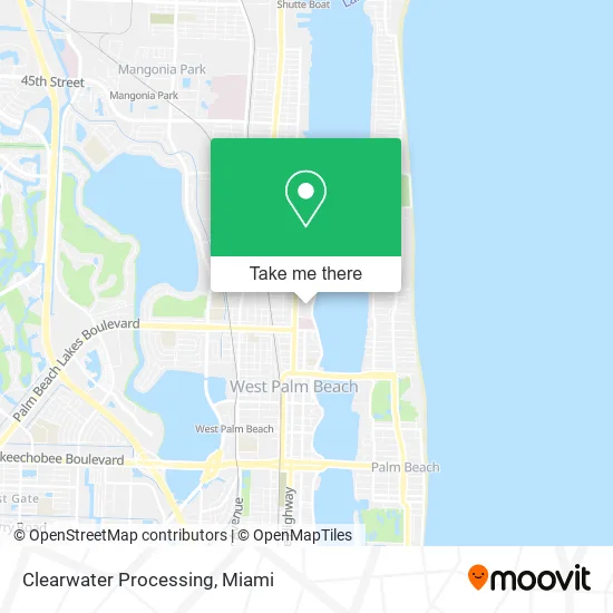
See Clearwater Processing, West Palm Beach, on the map
Public Transit to Clearwater Processing in West Palm Beach
Wondering how to get to Clearwater Processing in West Palm Beach? Moovit helps you find the best way to get to Clearwater Processing with step-by-step directions from the nearest public transit station.
Moovit provides free maps and live directions to help you navigate through your city. View schedules, routes, timetables, and find out how long does it take to get to Clearwater Processing in real time.
Looking for the nearest stop or station to Clearwater Processing? Check out this list of stops closest to your destination: DIXIE HWY at N LAKESIDE CT; West Palm Beach; West Palm Beach Station; West Palm Beach Amtrak Station.
Bus: 1, 31.Train: TRIRAIL, BLFM, FLORIDIAN, SILVER METEOR.
Want to see if there’s another route that gets you there at an earlier time? Moovit helps you find alternative routes or times. Get directions from and directions to Clearwater Processing easily from the Moovit App or Website.
We make riding to Clearwater Processing easy, which is why over 1.5 million users, including users in West Palm Beach, trust Moovit as the best app for public transit. You don’t need to download an individual bus app or train app, Moovit is your all-in-one transit app that helps you find the best bus time or train time available.
For information on prices of bus and train, costs and ride fares to Clearwater Processing, please check the Moovit app.
Use the app to navigate to popular places including to the airport, hospital, stadium, grocery store, mall, coffee shop, school, college, and university.
Clearwater Processing Address: 1617 N Flagler Dr West Palm Beach, FL 33407 street in West Palm Beach
- Apex Porta Potty Rentals,
- Oscar Giraldo Designer,
- Kravis Performing Arts Center,
- The Executive Office of the President,
- Osiyemi Olayemi MD,
- Palm Beach Diabetes,
- Jones, Debra A,
- Palm Beach Ear Nose & Throat Association Pa,
- Lakeside Medical,
- FedEx,
- Jeffrey Ganelas DMD,
- A D T,
- Bunny's Eatery,
- Ahf Healthcare Center - West Palm,
- Interventional Pain Physicians of South Florida,
- Palm Beach Obstetrics & Gynecology (Palm Beach ob-Gyn),
- David Amrose, MD,
- Alberto Ortiz,
- Medneph Pa,
- Makkah Transport
Places Near Clearwater Processing (West Palm Beach)
- Brickell City Centre, Miami,
- Zoo Miami, Miami,
- Miami VA Hospital, Miami,
- Sawgrass mall ( FL ), Miami Beach,
- Dolphin Mall Bus, Miami,
- Port of Miami Cruise Terminal, Miami,
- Miami Freedom Park, Miami,
- Miami Design District, Miami,
- Aventura Mall, Miami Beach,
- Hard Rock Stadium, Miami Gardens,
- Sawgrass Mall, Miami,
- Dolphin Mall, Miami,
- Keiser University Flagship Campus, West Palm Beach,
- Aventura Mall, Miami,
- Little Havana, Miami,
- Richard E. Gerstein Justice Building, Miami,
- Marlins Park, Miami,
- Miami-Dade County Courthouse, Miami,
- Wynwood, Miami,
- Bayside Marketplace, Miami
How to get to popular places in Miami with public transit
Get around West Palm Beach by public transit!
Traveling around West Palm Beach has never been so easy. See step by step directions as you travel to any attraction, street or major public transit station. View bus and train schedules, arrival times, service alerts and detailed routes on a map, so you know exactly how to get to anywhere in West Palm Beach.
When traveling to any destination around West Palm Beach use Moovit's Live Directions with Get Off Notifications to know exactly where and how far to walk, how long to wait for your line, and how many stops are left. Moovit will alert you when it's time to get off — no need to constantly re-check whether yours is the next stop.
Wondering how to use public transit in West Palm Beach or how to pay for public transit in West Palm Beach? Moovit public transit app can help you navigate your way with public transit easily, and at minimum cost. It includes public transit fees, ticket prices, and costs. Looking for a map of West Palm Beach public transit lines? Moovit public transit app shows all public transit maps in West Palm Beach with all Bus, Train, Light Rail and Ferry routes and stops on an interactive map.
Miami has 4 transit type(s), including: Bus, Train, Light Rail and Ferry, operated by several transit agencies, including Broward County Transit, Miami-Dade Transit, Metrorail, Palm Tran, Tri-Rail, Brightline, MARTY, City of Homestead Trolley, Key West Transit, Treasure Coast Connector, GoLine IRT, Amtrak, Greyhound-us, FlixBus-us and Aventura Express Shuttle Bus