How to get to Clever Fit by bus?
Click on the bus route to see step by step directions with maps, line arrival times and updated time schedules.
From Krankenhaus Freudenstadt, Vereinbarte Verwaltungsgemeinschaft Freudenstadt
221 minFrom Epplesee, Rheinstetten
180 minFrom Hopfenschlingel, Vereinbarte Verwaltungsgemeinschaft Rastatt
83 minFrom Mercedes-Benz Werk Rastatt, Vereinbarte Verwaltungsgemeinschaft Rastatt
101 minFrom Parkplatz Bauhaus, Verwaltungsgemeinschaft Offenburg
114 minFrom Panorama-Bad Freudenstadt, Vereinbarte Verwaltungsgemeinschaft Freudenstadt
211 minFrom Lotto-Annahmestelle, Vereinbarte Verwaltungsgemeinschaft Sinzheim
55 minFrom Baden-Baden, Karlsruhe/Baden-Baden Airport, Rheinmünster
51 minFrom Grinde-Hütte, Seebach
90 min
How to get to Clever Fit by train?
Click on the train route to see step by step directions with maps, line arrival times and updated time schedules.
From Krankenhaus Freudenstadt, Vereinbarte Verwaltungsgemeinschaft Freudenstadt
137 minFrom Epplesee, Rheinstetten
60 minFrom Hopfenschlingel, Vereinbarte Verwaltungsgemeinschaft Rastatt
43 minFrom Parkplatz Bauhaus, Verwaltungsgemeinschaft Offenburg
51 minFrom Panorama-Bad Freudenstadt, Vereinbarte Verwaltungsgemeinschaft Freudenstadt
130 minFrom Lotto-Annahmestelle, Vereinbarte Verwaltungsgemeinschaft Sinzheim
33 minFrom Höhenhotel Pfeifle, Baiersbronn
91 min
Bus stops near Clever Fit in Vereinbarte Verwaltungsgemeinschaft Bühl
Train stations near Clever Fit in Vereinbarte Verwaltungsgemeinschaft Bühl
- Bühl (Baden), 19 min walk,VIEW
Bus lines to Clever Fit in Vereinbarte Verwaltungsgemeinschaft Bühl
- 274, Bühl Zob/Bahnhof,VIEW
- 274, Eisental Abzw. Affental,VIEW
- 274, Bühl (Baden),VIEW
- 271, Bühl (Baden) Bstg 2 - Bühl Bühlertalstr/Hauptstr,VIEW
- 271, Bühl (Baden) Bstg 2 - Bühl (Baden) Bstg 1,VIEW
- 272, Bühl (Baden) Bstg 3 - Bühl (Baden) Bstg 1,VIEW
- 271, Bühl Zob/Bahnhof,VIEW
- 272, Weitenung Wiesenweg,VIEW
- 267, Weitenung Alte Post,VIEW
- 268, Schwarzach (Bd) Bahnhof,VIEW
- 268S, Bühl (Baden),VIEW
- 267, Bühl Gymnasium - Söllingen Schule,VIEW
- 268, Bühl Rheintalschule - Freistett Busbahnhof,VIEW
- 268S, Bühl Gymnasium - Freistett Busbahnhof,VIEW
- 262, Bühl (Baden) Bstg 7 - Sinzheim Goethestraße,VIEW
- X44, Bad Herrenalb - Bühl (Baden) Bstg 1,VIEW
What are the closest stations to Clever Fit?
The closest stations to Clever Fit are:
- Bühl Im Grün is 337 meters away, 5 min walk.
- Bühl Erlenstraße is 376 meters away, 6 min walk.
- Bühl Rheinstraße is 504 meters away, 7 min walk.
- Bühl Klostergarten is 515 meters away, 7 min walk.
- Bühl (Baden) is 1454 meters away, 19 min walk.
Which train lines stop near Clever Fit?
These train lines stop near Clever Fit: RE 2, RE2, S7.
Which bus lines stop near Clever Fit?
These bus lines stop near Clever Fit: 264, 268, 272, 7135, X34, X44.
What’s the nearest train station to Clever Fit in Vereinbarte Verwaltungsgemeinschaft Bühl?
The nearest train station to Clever Fit in Vereinbarte Verwaltungsgemeinschaft Bühl is Bühl (Baden). It’s a 19 min walk away.
What’s the nearest bus station to Clever Fit in Vereinbarte Verwaltungsgemeinschaft Bühl?
The nearest bus station to Clever Fit in Vereinbarte Verwaltungsgemeinschaft Bühl is Bühl Im Grün. It’s a 5 min walk away.
What time is the first train to Clever Fit in Vereinbarte Verwaltungsgemeinschaft Bühl?
The RE2 is the first train that goes to Clever Fit in Vereinbarte Verwaltungsgemeinschaft Bühl. It stops nearby at 5:08 AM.
What time is the last train to Clever Fit in Vereinbarte Verwaltungsgemeinschaft Bühl?
The RB44 is the last train that goes to Clever Fit in Vereinbarte Verwaltungsgemeinschaft Bühl. It stops nearby at 1:26 AM.
What time is the first bus to Clever Fit in Vereinbarte Verwaltungsgemeinschaft Bühl?
The X44 is the first bus that goes to Clever Fit in Vereinbarte Verwaltungsgemeinschaft Bühl. It stops nearby at 5:09 AM.
What time is the last bus to Clever Fit in Vereinbarte Verwaltungsgemeinschaft Bühl?
The 271 is the last bus that goes to Clever Fit in Vereinbarte Verwaltungsgemeinschaft Bühl. It stops nearby at 12:34 AM.
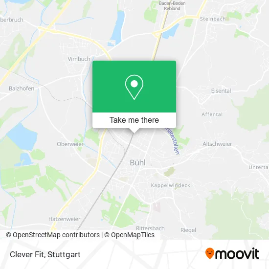
See Clever Fit, Vereinbarte Verwaltungsgemeinschaft Bühl, on the map
Public Transit to Clever Fit in Vereinbarte Verwaltungsgemeinschaft Bühl
Wondering how to get to Clever Fit in Vereinbarte Verwaltungsgemeinschaft Bühl? Moovit helps you find the best way to get to Clever Fit with step-by-step directions from the nearest public transit station.
Moovit provides free maps and live directions to help you navigate through your city. View schedules, routes, timetables, and find out how long does it take to get to Clever Fit in real time.
Looking for the nearest stop or station to Clever Fit? Check out this list of stops closest to your destination: Bühl Im Grün; Bühl Erlenstraße; Bühl Rheinstraße; Bühl Klostergarten; Bühl (Baden).
Train: RE 2, RE2, S7, S71, RE7, RB44, S71.Bus: 264, 268, 272, 7135, X34, X44, 274, 274, 274, 271, 271, 271.
Want to see if there’s another route that gets you there at an earlier time? Moovit helps you find alternative routes or times. Get directions from and directions to Clever Fit easily from the Moovit App or Website.
We make riding to Clever Fit easy, which is why over 1.5 million users, including users in Vereinbarte Verwaltungsgemeinschaft Bühl, trust Moovit as the best app for public transit. You don’t need to download an individual bus app or train app, Moovit is your all-in-one transit app that helps you find the best bus time or train time available.
For information on prices of bus and train, costs and ride fares to Clever Fit, please check the Moovit app.
Use the app to navigate to popular places including to the airport, hospital, stadium, grocery store, mall, coffee shop, school, college, and university.
Clever Fit Address: Meister-Erwin-Straße 29 77815 Bühl street in Vereinbarte Verwaltungsgemeinschaft Bühl
- Cf Fitness Bühl GmbH & Co,
- Vk Bodyfit,
- Volker Hess,
- Telekom Vermittlungsstelle Bühl (Vorwahlbereich: 07223),
- Samaxx GmbH Land-und Baumaschinenvertrieb,
- Björn Pröhl Fitline Berater-Ihr Ansprechpartner-Pm International Deutschland,
- Adam Schütz Natursteinbetrieb,
- Psychologische Privatpraxis Elke Schulmeister,
- Hatz-Humanmanagement,
- Palettenabnahme,
- Hegemann Steuerberatung,
- Musikschule Bühl - Haus Der Musik,
- Meier Campingservice,
- Großsporthalle TV Bühl,
- Furnierwerk Bühler Spankorbfabrik Gmbh,
- Heinz Schindler,
- Fiex,
- AWD Ihr Unabhängiger Finanzoptimierer,
- Beate Walter-Wieland Hessen Express,
- G. Wyrwoll
Places Near Clever Fit (Vereinbarte Verwaltungsgemeinschaft Bühl)
- Porsche-Arena, Bad Cannstatt,
- SI-Centrum, Möhringen,
- Marmorsaal Im Weissenburgpark, Stuttgart-Süd,
- Mercedes-Benz Museum, Bad Cannstatt,
- Waldfriedhof, Degerloch,
- Im Wizemann (Halle), Bad Cannstatt,
- Gasometer Pforzheim, Pforzheim,
- Mettingen Eros-Center Puff Laufhaus, Esslingen Am Neckar,
- Porsche Museum, Zuffenhausen,
- Schleyerhalle, Bad Cannstatt,
- Geilhaus Haus 33a, Reutlingen-Betzingen,
- Klinikum Stuttgart - Katharinenhospital, Stuttgart-Mitte,
- Hanns-Martin-Schleyer-Halle, Bad Cannstatt,
- FlixBus Haltestelle, Stuttgart,
- Gleis 101/102 (tief), Stuttgart-Mitte,
- Hanns-Martin-Schleyer-Halle (Stuttgart Hans-Martin-Schleyerhalle), Bad Cannstatt,
- Hauptbahnhof Stuttgart, Stuttgart-Mitte,
- Wilhelma (U-Bahn Wilhelma), Bad Cannstatt,
- Pariser Platz Stuttgart, Stuttgart-Mitte,
- Mercedes-Benz Museum (Mercedes Museum Stuttgart), Bad Cannstatt
How to get to popular places in Stuttgart with public transit
Get around Vereinbarte Verwaltungsgemeinschaft Bühl by public transit!
Traveling around Vereinbarte Verwaltungsgemeinschaft Bühl has never been so easy. See step by step directions as you travel to any attraction, street or major public transit station. View bus and train schedules, arrival times, service alerts and detailed routes on a map, so you know exactly how to get to anywhere in Vereinbarte Verwaltungsgemeinschaft Bühl.
When traveling to any destination around Vereinbarte Verwaltungsgemeinschaft Bühl use Moovit's Live Directions with Get Off Notifications to know exactly where and how far to walk, how long to wait for your line, and how many stops are left. Moovit will alert you when it's time to get off — no need to constantly re-check whether yours is the next stop.
Wondering how to use public transit in Vereinbarte Verwaltungsgemeinschaft Bühl or how to pay for public transit in Vereinbarte Verwaltungsgemeinschaft Bühl? Moovit public transit app can help you navigate your way with public transit easily, and at minimum cost. It includes public transit fees, ticket prices, and costs. Looking for a map of Vereinbarte Verwaltungsgemeinschaft Bühl public transit lines? Moovit public transit app shows all public transit maps in Vereinbarte Verwaltungsgemeinschaft Bühl with all Bus, Train, Subway, Light Rail, Ferry, S-Bahn and Funicular routes and stops on an interactive map.
Stuttgart has 7 transit type(s), including: Bus, Train, Subway, Light Rail, Ferry, S-Bahn and Funicular, operated by several transit agencies, including SSB - Stadtbahn, SSB, SSB - Seilbahn / Zacke, S-Bahn Stuttgart, Rhein-Neckar-Verkehr GmbH (rnv), Karlsruher Verkehrsverbund, DB AG, DB Regiobus BW, Arverio Baden-Württemberg GmbH, DB RegioNetz Verkehrs GmbH Westfrankenbahn, DB Regio AG Baden-Württemberg, Südwestdeutsche Verkehrs-AG, DB Regio AG Mitte Region Hessen, DB and Bodensee-Oberschwaben-Bahn