How to get to Cleverspace by bus?
Click on the bus route to see step by step directions with maps, line arrival times and updated time schedules.
From Fogo de Chao, Washington
44 minFrom Penn Quarter, Washington DC, Washington
53 minFrom Lyndon Baines Johnson Department of Education Building, Washington
47 minFrom The World Bank, Washington
43 minFrom Quarterdeck, Arlington County
71 minFrom Thomas Jefferson Memorial, Washington
59 minFrom Capital Hilton, Washington
31 minFrom Eastern Market, Washington
54 minFrom Quarterdeck Restaurant, Arlington County
71 minFrom White House Visitor Center, Washington
46 min
How to get to Cleverspace by train?
Click on the train route to see step by step directions with maps, line arrival times and updated time schedules.
From Fogo de Chao, Washington
183 minFrom Penn Quarter, Washington DC, Washington
166 minFrom Lyndon Baines Johnson Department of Education Building, Washington
170 minFrom Thomas Jefferson Memorial, Washington
188 minFrom Eastern Market, Washington
166 minFrom White House Visitor Center, Washington
189 min
How to get to Cleverspace by metro?
Click on the metro route to see step by step directions with maps, line arrival times and updated time schedules.
From Fogo de Chao, Washington
45 minFrom Penn Quarter, Washington DC, Washington
56 minFrom Lyndon Baines Johnson Department of Education Building, Washington
53 minFrom The World Bank, Washington
50 minFrom Quarterdeck, Arlington County
67 minFrom Thomas Jefferson Memorial, Washington
66 minFrom Capital Hilton, Washington
47 minFrom Eastern Market, Washington
56 minFrom Quarterdeck Restaurant, Arlington County
67 minFrom White House Visitor Center, Washington
49 min
Bus stops near Cleverspace in Washington
Train station near Cleverspace in Washington
- Silver Spring Marc Wb, 43 min walk,VIEW
Bus lines to Cleverspace in Washington
What are the closest stations to Cleverspace?
The closest stations to Cleverspace are:
- 14 St Nw+Aspen St NW is 49 yards away, 1 min walk.
- 16 St Nw+Underwood St NW is 322 yards away, 4 min walk.
- 16 St Nw+Aspen St NW is 342 yards away, 5 min walk.
- 16th St & Aspen St NW Nb is 386 yards away, 5 min walk.
- Takoma is 1474 yards away, 18 min walk.
- Fort Totten is 2341 yards away, 28 min walk.
- Silver Spring Marc Wb is 3612 yards away, 43 min walk.
Which bus lines stop near Cleverspace?
These bus lines stop near Cleverspace: D5X, D60, D6X.
Which train line stops near Cleverspace?
MARC (Inbound - Brunswick)
Which metro line stops near Cleverspace?
RED (Glenmont)
What’s the nearest metro station to Cleverspace in Washington?
The nearest metro station to Cleverspace in Washington is Takoma. It’s a 18 min walk away.
What’s the nearest bus station to Cleverspace in Washington?
The nearest bus station to Cleverspace in Washington is 14 St Nw+Aspen St NW. It’s a 1 min walk away.
What time is the first metro to Cleverspace in Washington?
The RED is the first metro that goes to Cleverspace in Washington. It stops nearby at 5:10 AM.
What time is the last metro to Cleverspace in Washington?
The GREEN is the last metro that goes to Cleverspace in Washington. It stops nearby at 12:30 AM.
What time is the first train to Cleverspace in Washington?
The MARC is the first train that goes to Cleverspace in Washington. It stops nearby at 5:51 AM.
What time is the last train to Cleverspace in Washington?
The MARC is the last train that goes to Cleverspace in Washington. It stops nearby at 7:37 PM.
What time is the first bus to Cleverspace in Washington?
The D60 is the first bus that goes to Cleverspace in Washington. It stops nearby at 3:08 AM.
What time is the last bus to Cleverspace in Washington?
The D50 is the last bus that goes to Cleverspace in Washington. It stops nearby at 3:31 AM.
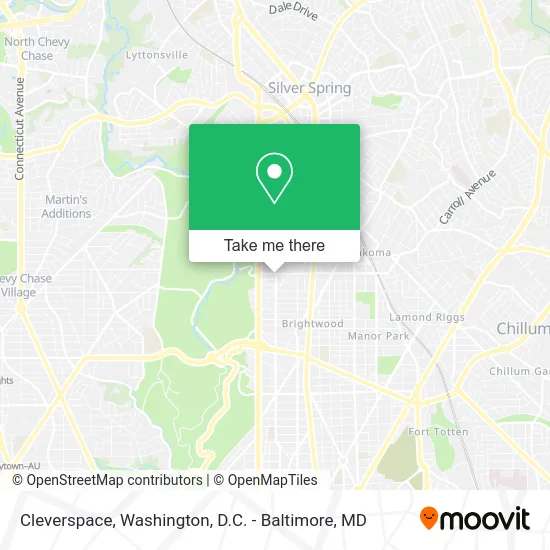
See Cleverspace, Washington, on the map
Public Transit to Cleverspace in Washington
Wondering how to get to Cleverspace in Washington? Moovit helps you find the best way to get to Cleverspace with step-by-step directions from the nearest public transit station.
Moovit provides free maps and live directions to help you navigate through your city. View schedules, routes, timetables, and find out how long does it take to get to Cleverspace in real time.
Looking for the nearest stop or station to Cleverspace? Check out this list of stops closest to your destination: 14 St Nw+Aspen St NW; 16 St Nw+Underwood St NW; 16 St Nw+Aspen St NW; 16th St & Aspen St NW Nb; Takoma; Fort Totten; Silver Spring Marc Wb.
Bus: D5X, D60, D6X, D50, C87.Train: MARC.Metro: RED, GREEN, YELLOW.
Want to see if there’s another route that gets you there at an earlier time? Moovit helps you find alternative routes or times. Get directions from and directions to Cleverspace easily from the Moovit App or Website.
We make riding to Cleverspace easy, which is why over 1.5 million users, including users in Washington, trust Moovit as the best app for public transit. You don’t need to download an individual bus app or train app, Moovit is your all-in-one transit app that helps you find the best bus time or train time available.
For information on prices of bus, metro and train, costs and ride fares to Cleverspace, please check the Moovit app.
Use the app to navigate to popular places including to the airport, hospital, stadium, grocery store, mall, coffee shop, school, college, and university.
Cleverspace Address: 14th St NW Washington, DC 20012 street in Washington
- Aldon,
- Water Softeners,
- Abrams Hall Senior Apartments,
- Housing Up,
- Dc International School,
- Fort Stevens Recreation Center ,
- 16th St & Aspen St,
- BRS Associates,
- The Planning Process Services & Fees,
- Abrams Assisted Living,
- Juneberry Garage,
- Yancey G R Rev,
- Tuckerman St NW & 14th St,
- Children's National Research and Innovation Campus,
- Livewell Animal Hospital at the Parks,
- Whole Foods,
- District Dogs Walter Reed,
- The Parks Historic Walter Reed,
- Accelerated Heating & Cooling Repair,
- Children's National Shepherd Park
Places Near Cleverspace (Washington)
- PG Mall, Prince George's County,
- National Zoo, Washington,
- Marriott Marquis Washington, DC, Washington,
- Washington National Cathedral, Washington,
- National Theatre, Washington,
- Rock Creek Tennis Center, Washington,
- The Anthem, Washington,
- Pennsylvania Ave NW (3rd st and pennsylvania), Washington,
- Capital One Arena, Washington,
- Museum Of The Bible, Washington,
- Westfield Montgomery Mall, Montgomery County,
- National Museum of African American History and Culture, Washington,
- Georgetown, Washington,
- Camden Yards, Baltimore,
- M&T Bank Stadium, Baltimore,
- Sibley Memorial Hospital, Washington,
- Washington DC VA Medical Center, Washington,
- Basilica of the National Shrine, Washington,
- Warner Theatre, Washington,
- Amazon Hq2, Arlington County
How to get to popular places in Washington, D.C. - Baltimore, MD with public transit
Get around Washington by public transit!
Traveling around Washington has never been so easy. See step by step directions as you travel to any attraction, street or major public transit station. View bus and train schedules, arrival times, service alerts and detailed routes on a map, so you know exactly how to get to anywhere in Washington.
When traveling to any destination around Washington use Moovit's Live Directions with Get Off Notifications to know exactly where and how far to walk, how long to wait for your line, and how many stops are left. Moovit will alert you when it's time to get off — no need to constantly re-check whether yours is the next stop.
Wondering how to use public transit in Washington or how to pay for public transit in Washington? Moovit public transit app can help you navigate your way with public transit easily, and at minimum cost. It includes public transit fees, ticket prices, and costs. Looking for a map of Washington public transit lines? Moovit public transit app shows all public transit maps in Washington with all Bus, Train, Metro, Light Rail and Ferry routes and stops on an interactive map.
Washington, D.C. - Baltimore, MD has 5 transit type(s), including: Bus, Train, Metro, Light Rail and Ferry, operated by several transit agencies, including WMATA, Montgomery County Ride On, Fairfax Connector, TheBus, PRTC, DASH - Alexandria, Arlington Transit (ART), RTA of Central Maryland, MDOT MTA, MDOT MTA Light RailLink, MDOT MTA Commuter Bus, MDOT MTA Local Bus, FXBGO!, Virginia Railway Express (VRE) and MARC