How to get to Click3xdev by bus?
Click on the bus route to see step by step directions with maps, line arrival times and updated time schedules.
From 45th & Broadway, Manhattan
65 minFrom 31st St (astoria blvd & 31st street), Queens
75 minFrom Lincoln Hospital, Bronx
73 minFrom Costco Wholesale, Queens
69 minFrom Woodside, Queens
61 minFrom Queens Center Mall, Queens
36 minFrom Central Park - Conservatory Garden, Manhattan
44 minFrom 51, Jersey City
69 minFrom American Dream, East Rutherford
66 min
How to get to Click3xdev by train?
Click on the train route to see step by step directions with maps, line arrival times and updated time schedules.
How to get to Click3xdev by subway?
Click on the subway route to see step by step directions with maps, line arrival times and updated time schedules.
Bus stops near Click3xdev in Manhattan
Subway stations near Click3xdev in Manhattan
Train station near Click3xdev in Manhattan
- 23rd Street, 2 min walk,VIEW
Bus lines to Click3xdev in Manhattan
- GREENWICH, Midtown / W 39th Street - Midtown / W 39th Street,VIEW
- M1, Harlem - East Village,VIEW
- M2, Washington Heights - East Village,VIEW
- M3, Fort George - East Village,VIEW
- M55, W 44 St - South Ferry,VIEW
- DOWNTOWN LOCAL, W Houston & Mercer St,VIEW
- M7, Harlem 147 St Via 6 Av Via Amsterdam,VIEW
- SHORTLINE HUDSON, New York,VIEW
- X27, Bay Ridge - Manhattan Express,VIEW
- X28, Sea Gate / Bensonhurst - Manhattan Express,VIEW
- M23-SBS, Select Bus East Side Avenue C Crosstown,VIEW
- 28, 23rd St @ 5th Ave,VIEW
- X37, Bay Ridge Shore Rd Via 23 St Via Fdr Dr,VIEW
- X38, Bensonhurst Cropsey Av Via 23 St Via Fdr,VIEW
- SIM4C, Midtown Via Church St Via Madison Av,VIEW
- SIM10, Eltingville Trans Ctr Via Hylan Via Rich,VIEW
- SIM31, Eltingville Trans Ctr Via Forest Hill Rd,VIEW
- SIM33C, Midtown Via Church Via Madison Av,VIEW
What are the closest stations to Click3xdev?
The closest stations to Click3xdev are:
- 5th Ave & W 20th St is 80 yards away, 2 min walk.
- 23 St is 106 yards away, 2 min walk.
- 23rd Street is 126 yards away, 2 min walk.
- 6th Ave & W 20th St is 159 yards away, 2 min walk.
- 6 Av/W 20 St is 185 yards away, 3 min walk.
- 5th Ave & W 23rd St is 200 yards away, 3 min walk.
- W 23 St/6 Av is 225 yards away, 3 min walk.
- 23rd St @ 5th Ave is 384 yards away, 5 min walk.
- E 23 St/Broadway is 400 yards away, 5 min walk.
- 23 St-Baruch College is 589 yards away, 8 min walk.
Which bus lines stop near Click3xdev?
These bus lines stop near Click3xdev: 28, BM4, M1, M2.
Which train lines stop near Click3xdev?
These train lines stop near Click3xdev: 1, YEL.
Which subway lines stop near Click3xdev?
These subway lines stop near Click3xdev: 5, F, R, W.
What’s the nearest subway station to Click3xdev in Manhattan?
The nearest subway station to Click3xdev in Manhattan is 23 St. It’s a 2 min walk away.
What’s the nearest train station to Click3xdev in Manhattan?
The nearest train station to Click3xdev in Manhattan is 23rd Street. It’s a 2 min walk away.
What’s the nearest bus station to Click3xdev in Manhattan?
The nearest bus stations to Click3xdev in Manhattan are 5th Ave & W 20th St and 6th Ave & W 20th St. The closest one is a 2 min walk away.
What time is the first subway to Click3xdev in Manhattan?
The Q is the first subway that goes to Click3xdev in Manhattan. It stops nearby at 3:00 AM.
What time is the last subway to Click3xdev in Manhattan?
The 2 is the last subway that goes to Click3xdev in Manhattan. It stops nearby at 3:58 AM.
What time is the first train to Click3xdev in Manhattan?
The ATW is the first train that goes to Click3xdev in Manhattan. It stops nearby at 3:18 AM.
What time is the last train to Click3xdev in Manhattan?
The ATW is the last train that goes to Click3xdev in Manhattan. It stops nearby at 3:18 AM.
What time is the first bus to Click3xdev in Manhattan?
The M23-SBS is the first bus that goes to Click3xdev in Manhattan. It stops nearby at 3:09 AM.
What time is the last bus to Click3xdev in Manhattan?
The M2 is the last bus that goes to Click3xdev in Manhattan. It stops nearby at 2:55 AM.
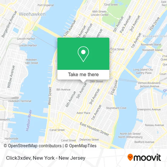
See Click3xdev, Manhattan, on the map
Public Transit to Click3xdev in Manhattan
Wondering how to get to Click3xdev in Manhattan? Moovit helps you find the best way to get to Click3xdev with step-by-step directions from the nearest public transit station.
Moovit provides free maps and live directions to help you navigate through your city. View schedules, routes, timetables, and find out how long does it take to get to Click3xdev in real time.
Looking for the nearest stop or station to Click3xdev? Check out this list of stops closest to your destination: 5th Ave & W 20th St; 23 St; 23rd Street; 6th Ave & W 20th St; 6 Av/W 20 St; 5th Ave & W 23rd St; W 23 St/6 Av; 23rd St @ 5th Ave; E 23 St/Broadway; 23 St-Baruch College.
Bus: 28, BM4, M1, M2, GREENWICH, M3, M55.Train: 1, YEL, ATW, BLU.Subway: 5, F, R, W, D, FX, M, 1, 2, N, Q, 4, 6, 6X.
Want to see if there’s another route that gets you there at an earlier time? Moovit helps you find alternative routes or times. Get directions from and directions to Click3xdev easily from the Moovit App or Website.
We make riding to Click3xdev easy, which is why over 1.5 million users, including users in Manhattan, trust Moovit as the best app for public transit. You don’t need to download an individual bus app or train app, Moovit is your all-in-one transit app that helps you find the best bus time or train time available.
For information on prices of subway, bus and train, costs and ride fares to Click3xdev, please check the Moovit app.
Use the app to navigate to popular places including to the airport, hospital, stadium, grocery store, mall, coffee shop, school, college, and university.
Click3xdev Address: 16 W 22nd St street in Manhattan
- Mimeo,
- The Teak Fellowship,
- Websterhall Nyc,
- Sen Nyc,
- Reason To Be,
- Tipton & Maglione,
- Gmc Parking,
- Zero Otto Nove Manhattan,
- M&C Saatchi Group,
- Zero Otto Nove,
- Get Creative 6,
- Quintessential Therapy,
- Thekey by Mavencare - Senior Home Care,
- Mihoko's 21 Grams,
- Ronin Labs Hq,
- Tri-State Area,
- Consolidated Flooring,
- Blonde & Co.,
- Four Star General Cleaning Service,
- Cosplay Contacts
Places Near Click3xdev (Manhattan)
- 911 Memorial, Manhattan,
- 111 Centre New York City Supreme Court, Manhattan,
- Times Square, Manhattan,
- 3 Stone St, Manhattan,
- 1 Police Plaza, Manhattan,
- Mountainside Hospital, Glen Ridge,
- 26 Federal Plaza, Manhattan,
- Chinatown, Manhattan,
- San Gennaro Feast, Manhattan,
- SoHo, Manhattan,
- Queens Center Mall, Queens,
- 376 Hudson Street, Manhattan,
- Bellevue Hospital, Manhattan,
- 66 John Street, Manhattan,
- Hudson Yards, Manhattan,
- Wall Street, Manhattan,
- Rockefeller Center, Manhattan,
- qqqq, Manhattan,
- Katz's Deli, Manhattan,
- Pier 83, Manhattan
How to get to popular places in New York - New Jersey with public transit
Get around Manhattan by public transit!
Traveling around Manhattan has never been so easy. See step by step directions as you travel to any attraction, street or major public transit station. View bus and train schedules, arrival times, service alerts and detailed routes on a map, so you know exactly how to get to anywhere in Manhattan.
When traveling to any destination around Manhattan use Moovit's Live Directions with Get Off Notifications to know exactly where and how far to walk, how long to wait for your line, and how many stops are left. Moovit will alert you when it's time to get off — no need to constantly re-check whether yours is the next stop.
Wondering how to use public transit in Manhattan or how to pay for public transit in Manhattan? Moovit public transit app can help you navigate your way with public transit easily, and at minimum cost. It includes public transit fees, ticket prices, and costs. Looking for a map of Manhattan public transit lines? Moovit public transit app shows all public transit maps in Manhattan with all Bus, Train, Subway, Light Rail, Ferry and Cable Car routes and stops on an interactive map.
New York - New Jersey has 6 transit type(s), including: Bus, Train, Subway, Light Rail, Ferry and Cable Car, operated by several transit agencies, including MTA Subway, Metro-North Railroad, LIRR, PATH, MTA New York City Transit - Express routes, MTA Bus, NJ Transit, NYC Ferry, NICE bus, Bee-Line Bus, NJ Transit Rail, Norwalk Transit District, Hartford Line, River Valley Transit and HART