Directions to Cobalchini (Santa Cândida) with public transportation
The following transit lines have routes that pass near Cobalchini
How to get to Cobalchini by bus?
Click on the bus route to see step by step directions with maps, line arrival times and updated time schedules.
From Terminal Campina do Siqueira - 020 - Interbairros II (Horário), Campina Do Siqueira
50 minFrom Expotrade, Pinhais
73 minFrom UFPR - Universidade Federal do Paraná, Centro
38 minFrom Rua Treze de Maio, Centro
31 minFrom Terminal Campina do Siqueira - 304 - Pinhais / Campo Comprido, Campina Do Siqueira
49 minFrom Expotrade Convention Center, Pinhais
73 minFrom Avenida Marechal Floriano Peixoto 2509, Parolin
53 minFrom Universidade Tuiuti do Paraná (UTP), Santo Inácio
74 minFrom Rua Barão do Rio Branco 122, Centro
33 minFrom Detran/Pr - Unidade Tarumã, Capão Da Imbúia
50 min
Bus stops near Cobalchini in Santa Cândida
Bus lines to Cobalchini in Santa Cândida
What are the closest stations to Cobalchini?
The closest stations to Cobalchini are:
- R. Lourenço Volpi, 200 is 135 meters away, 2 min walk.
- Rua Theodoro Makiolka 1461 is 297 meters away, 4 min walk.
- Rua José Antônio Leprevost, 1182-1306 is 305 meters away, 4 min walk.
Which bus lines stop near Cobalchini?
These bus lines stop near Cobalchini: 280 NOSSA SENHORA DE NAZARÉ, 924 SANTA FELICIDADE / SANTA CÂNDIDA.
What’s the nearest bus station to Cobalchini in Santa Cândida?
The nearest bus station to Cobalchini in Santa Cândida is R. Lourenço Volpi, 200. It’s a 2 min walk away.
What time is the first bus to Cobalchini in Santa Cândida?
The 226 ABAETÉ is the first bus that goes to Cobalchini in Santa Cândida. It stops nearby at 5:03 AM.
What time is the last bus to Cobalchini in Santa Cândida?
The 924 SANTA FELICIDADE / SANTA CÂNDIDA is the last bus that goes to Cobalchini in Santa Cândida. It stops nearby at 12:56 AM.
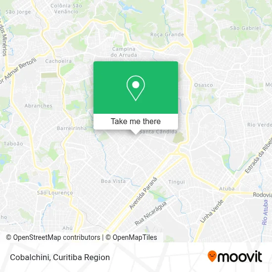
See Cobalchini, Santa Cândida, on the map
Public Transit to Cobalchini in Santa Cândida
Wondering how to get to Cobalchini in Santa Cândida? Moovit helps you find the best way to get to Cobalchini with step-by-step directions from the nearest public transit station.
Moovit provides free maps and live directions to help you navigate through your city. View schedules, routes, timetables, and find out how long does it take to get to Cobalchini in real time.
Looking for the nearest stop or station to Cobalchini? Check out this list of stops closest to your destination: R. Lourenço Volpi; Rua Theodoro Makiolka 1461; Rua José Antônio Leprevost.
Bus: 280 NOSSA SENHORA DE NAZARÉ, 924 SANTA FELICIDADE / SANTA CÂNDIDA, 226 ABAETÉ.
Want to see if there’s another route that gets you there at an earlier time? Moovit helps you find alternative routes or times. Get directions from and directions to Cobalchini easily from the Moovit App or Website.
We make riding to Cobalchini easy, which is why over 1.5 million users, including users in Santa Cândida, trust Moovit as the best app for public transit. You don’t need to download an individual bus app or train app, Moovit is your all-in-one transit app that helps you find the best bus time or train time available.
For information on prices of bus, costs and ride fares to Cobalchini, please check the Moovit app.
Use the app to navigate to popular places including to the airport, hospital, stadium, grocery store, mall, coffee shop, school, college, and university.
Cobalchini Address: Rua Doutor Álvaro Teixeira Pinto, 404 Santa Cândida Curitiba-PR 82640-580 street in Santa Cândida
- Quero Bim Bar,
- Bitencourt Ambientes Moveis Sob Medida e Decoracao,
- Jh Carvalho Pisos e Produtos Para Decoracao,
- Hrn Mundi,
- Conjunto Residencial Bella Vista,
- Rua Pedro Spisla Filho, 336- Santa Candida,
- L&R Fly,
- Curitiba Entregas,
- Mr Fibras Projetos e Construcoes,
- 551 Imoveis,
- Pc Comercio Veiculos,
- Ancora Locadora de Veiculos,
- Locarauto,
- Sforza Assessoria e Consultoria,
- Paloma Distribuidora de Bebidas,
- Atelier Angelita Russo,
- Studio Susan Cajigal,
- Dvb Administradora de Imoveis,
- Bela Bia Cosmeticos Maquiagens Perfumaria e Vestuario,
- Meri Romero
Places Near Cobalchini (Santa Cândida)
- Shopping Palladium, Portão,
- Hhhhh, Fazendinha,
- Jardim Botânico de Curitiba PR, Centro,
- Hospital Madalena Sofia, Bairro Alto,
- Jockey Plaza Shopping Center, Tarumã,
- Pontifícia Universidade Católica do Paraná (PUCPR), Prado Velho,
- Rua Martim Afonso 558, Mercês,
- Hospital Universitário Evangélico de Curitiba, Bigorrilho,
- Hospital de Clínicas (HC - UFPR), Centro,
- Shopping Estação, Rebouças,
- Park Shopping Barigüi, Mossunguê,
- Hospital Da Cruz Vermelha, Batel,
- Hospital Nossa Senhora Das Graças, Mercês,
- Rua General Mário Tourinho, Campina Do Siqueira,
- Hospital do Rocio, Campo,
- Hospital Erasto Gaertner, Jardim Das Américas,
- Parque Barigui, Mercês,
- Arena Da Baixada - Curitiba,
- Campo Largo, Campo,
- Hospital Angelina Caron, Campina Grande Do Sul
How to get to popular places in Curitiba Region with public transit
Get around Santa Cândida by public transit!
Traveling around Santa Cândida has never been so easy. See step by step directions as you travel to any attraction, street or major public transit station. View bus and train schedules, arrival times, service alerts and detailed routes on a map, so you know exactly how to get to anywhere in Santa Cândida.
When traveling to any destination around Santa Cândida use Moovit's Live Directions with Get Off Notifications to know exactly where and how far to walk, how long to wait for your line, and how many stops are left. Moovit will alert you when it's time to get off — no need to constantly re-check whether yours is the next stop.
Wondering how to use public transit in Santa Cândida or how to pay for public transit in Santa Cândida? Moovit public transit app can help you navigate your way with public transit easily, and at minimum cost. It includes public transit fees, ticket prices, and costs. Looking for a map of Santa Cândida public transit lines? Moovit public transit app shows all public transit maps in Santa Cândida with all Bus and Cable Car routes and stops on an interactive map.
Curitiba Region has 2 transit type(s), including: Bus and Cable Car, operated by several transit agencies, including Sistema Integrado de Mobilidade (URBS), Sistema Integrado de Mobilidade (AMEP), URBS (Cartões bancários e Dinheiro), URBS (Cartões bancários / Cartão URBS), AMEP (Cartões bancários / Cartão MetroCard), AMEP (Cartões bancários / Cartão MetroCard / Dinheiro), Viação Colombo (Dinheiro), TRIAR (Cartão TRIAR / Dinheiro), Empresa Curitiba Cerro Azul (Dinheiro), Expresso Nossa Senhora da Penha (Dinheiro), Empresa Campo Alto Tijucas (Dinheiro), Auto Viação São José (Cartão VEM / Dinheiro), BRT S/A (Cartão VEM / Dinheiro), TransPiedade (Cartão Cidadão / Dinheiro) and Oceânica Sul (Cartão Transporte / Dinheiro)