Directions to Coca-Cola Coliseum (Toronto) with public transportation
The following transit lines have routes that pass near Coca-Cola Coliseum
 Bus: 63, 929, 329, 307S, 363.
- Train: LW.
- Subway: 1, 2.
- Streetcar: 509, 511.
How to get to Coca-Cola Coliseum by bus?
Click on the bus route to see step by step directions with maps, line arrival times and updated time schedules.
How to get to Coca-Cola Coliseum by train?
Click on the train route to see step by step directions with maps, line arrival times and updated time schedules.
How to get to Coca-Cola Coliseum by subway?
Click on the subway route to see step by step directions with maps, line arrival times and updated time schedules.
Streetcar stations near Coca-Cola Coliseum in Toronto
- King St West at Shaw St, 4 min walk,
- Manitoba Dr at Strachan Ave West Side, 7 min walk,
- King St West at Sudbury St, 8 min walk,
Bus stops near Coca-Cola Coliseum in Toronto
- East Liberty St at Pirandello St, 6 min walk,
- Fleet St at Strachan Ave, 7 min walk,
- Strachan Ave at Fleet St, 8 min walk,
- Strachan Ave at Fleet St North Side, 8 min walk,
- Strachan Ave at East Liberty St, 9 min walk,
Train station near Coca-Cola Coliseum in Toronto
- Exhibition Go, 7 min walk,
Bus lines to Coca-Cola Coliseum in Toronto
- 329, North - 329 Dufferin Towards Steeles Via Liberty Village,
- 307S, North - 307s Bathurst Short Turn Towards Wilson,
- 363, North - 363 Ossington Towards Cedarvale Station,
- 329S, North - 329s Dufferin Short Turn Towards Wilson Station Via Liberty Village,
- 63, South - 63 Ossington Towards Liberty Village,
- 363S, South - 363s Ossington Short Turn Towards Liberty Village,
What are the closest stations to Coca-Cola Coliseum?
The closest stations to Coca-Cola Coliseum are:
- King St West at Shaw St station is 233 meters away, 4 min walk.
- East Liberty St at Pirandello St stop is 423 meters away, 6 min walk.
- Manitoba Dr at Strachan Ave West Side station is 441 meters away, 7 min walk.
- Fleet St at Strachan Ave stop is 465 meters away, 7 min walk.
- Exhibition Go station is 514 meters away, 7 min walk.
- Strachan Ave at Fleet St stop is 517 meters away, 8 min walk.
- Strachan Ave at Fleet St North Side stop is 543 meters away, 8 min walk.
- King St West at Sudbury St station is 616 meters away, 8 min walk.
- Strachan Ave at East Liberty St stop is 686 meters away, 9 min walk.
Which bus lines stop near Coca-Cola Coliseum?
These bus lines stop near Coca-Cola Coliseum: 63, 929.
Which train line stops near Coca-Cola Coliseum?
LW (Northbound)
Which subway lines stop near Coca-Cola Coliseum?
These subway lines stop near Coca-Cola Coliseum: 1, 2.
Which Streetcar lines stop near Coca-Cola Coliseum?
These Streetcar lines stop near Coca-Cola Coliseum: 509, 511.
What’s the nearest Streetcar station to Coca-Cola Coliseum in Toronto?
The nearest Streetcar station to Coca-Cola Coliseum in Toronto is King St West at Shaw St. It’s a 4 min walk away.
What’s the nearest train station to Coca-Cola Coliseum in Toronto?
The nearest train station to Coca-Cola Coliseum in Toronto is Exhibition Go. It’s a 7 min walk away.
What’s the nearest bus station to Coca-Cola Coliseum in Toronto?
The nearest bus station to Coca-Cola Coliseum in Toronto is East Liberty St at Pirandello St. It’s a 6 min walk away.
What time is the first Streetcar to Coca-Cola Coliseum in Toronto?
The 304 is the first Streetcar that goes to Coca-Cola Coliseum in Toronto. It stops nearby at 3:00 AM.
What time is the last Streetcar to Coca-Cola Coliseum in Toronto?
The 304 is the last Streetcar that goes to Coca-Cola Coliseum in Toronto. It stops nearby at 3:35 AM.
What time is the first train to Coca-Cola Coliseum in Toronto?
The LW is the first train that goes to Coca-Cola Coliseum in Toronto. It stops nearby at 5:51 AM.
What time is the last train to Coca-Cola Coliseum in Toronto?
The LW is the last train that goes to Coca-Cola Coliseum in Toronto. It stops nearby at 12:06 AM.
What time is the first bus to Coca-Cola Coliseum in Toronto?
The 311 is the first bus that goes to Coca-Cola Coliseum in Toronto. It stops nearby at 3:00 AM.
What time is the last bus to Coca-Cola Coliseum in Toronto?
The 329 is the last bus that goes to Coca-Cola Coliseum in Toronto. It stops nearby at 3:29 AM.
See Coca-Cola Coliseum, Toronto, on the map
Public Transit to Coca-Cola Coliseum in Toronto
Wondering how to get to Coca-Cola Coliseum in Toronto? Moovit helps you find the best way to get to Coca-Cola Coliseum with step-by-step directions from the nearest public transit station.
Moovit provides free maps and live directions to help you navigate through your city. View schedules, routes, timetables, and find out how long does it take to get to Coca-Cola Coliseum in real time.
Looking for the nearest stop or station to Coca-Cola Coliseum? Check out this list of stops closest to your destination: King St West at Shaw St; East Liberty St at Pirandello St; Manitoba Dr at Strachan Ave West Side; Fleet St at Strachan Ave; Exhibition Go; Strachan Ave at Fleet St; Strachan Ave at Fleet St North Side; King St West at Sudbury St; Strachan Ave at East Liberty St.
Bus: 63, 929, 329, 307S, 363, 329S, 363S.Train: LW.Subway: 1, 2.Streetcar: 509, 511.
Want to see if there’s another route that gets you there at an earlier time? Moovit helps you find alternative routes or times. Get directions from and directions to Coca-Cola Coliseum easily from the Moovit App or Website.
We make riding to Coca-Cola Coliseum easy, which is why over 1.7 billion users, including users in Toronto, trust Moovit as the best app for public transit. You don’t need to download an individual bus app or train app, Moovit is your all-in-one transit app that helps you find the best bus time or train time available.
For information on prices of bus, subway, Streetcar and train, costs and ride fares to Coca-Cola Coliseum, please check the Moovit app.
Use the app to navigate to popular places including to the airport, hospital, stadium, grocery store, mall, coffee shop, school, college, and university.
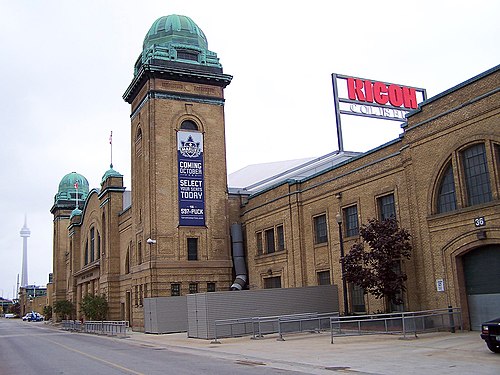
Coca-Cola Coliseum Address: Manitoba Drive street in Toronto
Popular routes to Coca-Cola Coliseum, Toronto
- 45 Manitoba Drive,
- Ricoh Coliseum at Exhibition Place,
- 19 Nunavut Road,
- Enercare Centre,
- Canadian National Exhibition,
- Hotel X - Maxx's Restaruant - 2nd Floor,
- Exhibition Place,
- Honda Indy Toronto,
- One Of A Kind Show,
- Taxi Stand,
- Exhibition Place / Enercare Centre - Lot 850,
- Exhibition GO Station,
- Polar Express,
- Hotel X Toronto - Skid,
- Hotel X Toronto by Library Hotel Collection,
- Toronto Caribbean Carnival,
- Manitoba Dr at Nova Scotia Ave,
- Enercare Centre-Gate 4,
- Hotel X,
- Stanley Barracks
Places Near Coca-Cola Coliseum (Toronto)
- BMO Field, Toronto,
- Brandy Melville, Toronto,
- St Michael s Hospital, Toronto,
- Rogers Centre, Toronto,
- Ripley's Aquarium Of Canada, Toronto,
- Medieval Times, Toronto,
- Vaughan Mills Shopping Centre, Vaughan,
- St Lawrence Market, Toronto,
- Great Canadian Casino Resort, Toronto,
- St. Joseph's Health Centre, Toronto,
- 777 Bay Street, Toronto,
- Toronto Western Hospital, Toronto,
- Toronto General Hospital, Toronto,
- Scarborough Town Centre, Toronto,
- St. Michael's Hospital, Toronto,
- Enercare Centre, Toronto,
- Toronto Eaton Centre, Toronto,
- Sunnybrook Hospital, Toronto,
- Exhibition Place, Toronto,
- Toronto Courthouse, Toronto
How to get to popular places in Toronto with public transit
Get around Toronto by public transit!
Traveling around Toronto has never been so easy. See step by step directions as you travel to any attraction, street or major public transit station. View bus and train schedules, arrival times, service alerts and detailed routes on a map, so you know exactly how to get to anywhere in Toronto.
When traveling to any destination around Toronto use Moovit's Live Directions with Get Off Notifications to know exactly where and how far to walk, how long to wait for your line, and how many stops are left. Moovit will alert you when it's time to get off — no need to constantly re-check whether yours is the next stop.
Wondering how to use public transit in Toronto or how to pay for public transit in Toronto? Moovit public transit app can help you navigate your way with public transit easily, and at minimum cost. It includes public transit fees, ticket prices, and costs. Looking for a map of Toronto public transit lines? Moovit public transit app shows all public transit maps in Toronto with all Bus, Train, Subway, Streetcar and Ferry routes and stops on an interactive map.
Toronto has 5 transit type(s), including: Bus, Train, Subway, Streetcar and Ferry, operated by several transit agencies, including TTC, Toronto Subway, Brampton Transit, MiWay, York Region Transit, GO Transit Bus, GO Transit, Durham Region Transit, UP Express, Grand River Transit, Guelph Transit, Hamilton Street Railway, Burlington Transit, Oakville Transit and pererborough