Directions to Cockrell Butterfly Center (Houston) with public transportation
The following transit lines have routes that pass near Cockrell Butterfly Center
 Bus: 298, 5, 56, 65, 292.
- Light Rail: 700.
How to get to Cockrell Butterfly Center by bus?
Click on the bus route to see step by step directions with maps, line arrival times and updated time schedules.
Bus stops near Cockrell Butterfly Center in Houston
- Main St @ Remington Ln, 5 min walk,
- Main St @ Sunset Blvd, 7 min walk,
- Binz St @ Fannin St, 7 min walk,
- Bissonnet St @ Montrose Blvd, 8 min walk,
Light Rail stations near Cockrell Butterfly Center in Houston
- Hermann Park/Rice U, 39 min walk,
Bus lines to Cockrell Butterfly Center in Houston
- 56, Greenspoint Tc - Northbound,
- 292, Southwest Freeway / TMC P&R,
- 298, Katy Freeway / TMC P&R,
- 5, Wheeler Tc - Westbound,
- 65, Wheeler Tc - Eastbound,
What are the closest stations to Cockrell Butterfly Center?
The closest stations to Cockrell Butterfly Center are:
- Main St @ Remington Ln stop is 349 yards away, 5 min walk.
- Main St @ Sunset Blvd stop is 527 yards away, 7 min walk.
- Binz St @ Fannin St stop is 576 yards away, 7 min walk.
- Bissonnet St @ Montrose Blvd stop is 630 yards away, 8 min walk.
- Hermann Park/Rice U station is 3325 yards away, 39 min walk.
Which bus lines stop near Cockrell Butterfly Center?
These bus lines stop near Cockrell Butterfly Center: 298, 5, 56, 65.
Which light rail line stops near Cockrell Butterfly Center?
700 (Metrorail - Fannin South - Southbound)
What’s the nearest bus station to Cockrell Butterfly Center in Houston?
The nearest bus station to Cockrell Butterfly Center in Houston is Main St @ Remington Ln. It’s a 5 min walk away.
What time is the first light rail to Cockrell Butterfly Center in Houston?
The 700 is the first light rail that goes to Cockrell Butterfly Center in Houston. It stops nearby at 3:40 AM.
What time is the last light rail to Cockrell Butterfly Center in Houston?
The 700 is the last light rail that goes to Cockrell Butterfly Center in Houston. It stops nearby at 1:03 AM.
What time is the first bus to Cockrell Butterfly Center in Houston?
The 56 is the first bus that goes to Cockrell Butterfly Center in Houston. It stops nearby at 4:48 AM.
What time is the last bus to Cockrell Butterfly Center in Houston?
The 56 is the last bus that goes to Cockrell Butterfly Center in Houston. It stops nearby at 1:09 AM.
See Cockrell Butterfly Center, Houston, on the map
Public Transit to Cockrell Butterfly Center in Houston
Wondering how to get to Cockrell Butterfly Center in Houston? Moovit helps you find the best way to get to Cockrell Butterfly Center with step-by-step directions from the nearest public transit station.
Moovit provides free maps and live directions to help you navigate through your city. View schedules, routes, timetables, and find out how long does it take to get to Cockrell Butterfly Center in real time.
Looking for the nearest stop or station to Cockrell Butterfly Center? Check out this list of stops closest to your destination: Main St @ Remington Ln; Main St @ Sunset Blvd; Binz St @ Fannin St; Bissonnet St @ Montrose Blvd; Hermann Park/Rice U.
Bus: 298, 5, 56, 65, 292.Light Rail: 700.
Want to see if there’s another route that gets you there at an earlier time? Moovit helps you find alternative routes or times. Get directions from and directions to Cockrell Butterfly Center easily from the Moovit App or Website.
We make riding to Cockrell Butterfly Center easy, which is why over 1.7 billion users, including users in Houston, trust Moovit as the best app for public transit. You don’t need to download an individual bus app or train app, Moovit is your all-in-one transit app that helps you find the best bus time or train time available.
For information on prices of bus and light rail, costs and ride fares to Cockrell Butterfly Center, please check the Moovit app.
Use the app to navigate to popular places including to the airport, hospital, stadium, grocery store, mall, coffee shop, school, college, and university.
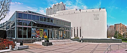
Cockrell Butterfly Center Address: Houston Museum of Natural Science street in Houston
- Butterfly Museum,
- Hmns Cockrell Butterfly Museum In Houston,
- Houston Museum Of Natural Science,
- Houston Natrual Science Museum,
- Natural History Museum Houston,
- Hmns Cafe,
- Weiss Hall Of Energy,
- Scout Programs at the Houston Museum Of Natural Science,
- Parque Hermann,
- I-10,
- Hca Houston Brain & Spine - Med Center,
- Vital Heart & Vein,
- Health Street,
- Davita Binz Home Training at Home,
- Museum District Endodontics,
- Metropolis,
- Maxa Male Enhancement,
- Houston Skin,
- Elijah Medical Clinic,
- Mark A. Price
Places Near Cockrell Butterfly Center (Houston)
- The Woodlands, Houston,
- galveston, Houston,
- Tornado Bus, Houston,
- Pasadena, TX, Pasadena,
- Harris Health Smith Clinic, Houston,
- Medical Center, Houston,
- University of Houston, Houston,
- Ben Taub General Hospital, Houston,
- Tdecu Stadium, Houston,
- Ben Taub Hospital, Houston,
- Katy, TX, Houston,
- Space Center Houston, Houston,
- I-45 Freeway & Tx 249 Tomball Parkway, Houston,
- Space Center Houston, Houston,
- Aeropuerto Intercontinental George Bush (Iah), Houston,
- The Galleria, Houston,
- Houston, TX, Houston,
- George R. Brown Convention Center, Houston,
- Nrg Stadium, Houston,
- Northwest TRANSIT Center, Houston
How to get to popular places in Houston with public transit
Get around Houston by public transit!
Traveling around Houston has never been so easy. See step by step directions as you travel to any attraction, street or major public transit station. View bus and train schedules, arrival times, service alerts and detailed routes on a map, so you know exactly how to get to anywhere in Houston.
When traveling to any destination around Houston use Moovit's Live Directions with Get Off Notifications to know exactly where and how far to walk, how long to wait for your line, and how many stops are left. Moovit will alert you when it's time to get off — no need to constantly re-check whether yours is the next stop.
Wondering how to use public transit in Houston or how to pay for public transit in Houston? Moovit public transit app can help you navigate your way with public transit easily, and at minimum cost. It includes public transit fees, ticket prices, and costs. Looking for a map of Houston public transit lines? Moovit public transit app shows all public transit maps in Houston with all Bus and Light Rail routes and stops on an interactive map.
Houston has 2 transit type(s), including: Bus and Light Rail, operated by several transit agencies, including METRO, Greyhound-us and FlixBus-us