How to get to Coco by bus?
Click on the bus route to see step by step directions with maps, line arrival times and updated time schedules.
From Changsha Meixi Lake Jinmao Luxury Collection Hotel, Yuelu District
60 minFrom Tesla Charging Station (Changsha High-Speed Railway South Station), Yuhua District
40 minFrom Changsha City Public Security Bureau Yuhua Branch Jingwanzi Police Station Red Star Village Community Police Station, Tianxin District
44 minFrom Changsha Government Service Center - Parking Lot, Yuelu District
51 minFrom Changsha New Gas South Garden Road Business Hall, Yuelu District
42 minFrom Changsha-Zhuzhou-Xiangtan Intercity Railway Kaifusi Station South Entrance, Kaifu District
37 minFrom New Environment Housing (Xingsha Pedestrian Street Branch), Changsha County
53 minFrom Wangchengpo Metro Station - Exit 1B, Yuelu District
54 minFrom Yanghu Wetland Park, Wangcheng District
65 minFrom Yangzhou Foot Massage Shop, Yuelu District
44 min
How to get to Coco by metro?
Click on the metro route to see step by step directions with maps, line arrival times and updated time schedules.
From Changsha Meixi Lake Jinmao Luxury Collection Hotel, Yuelu District
55 minFrom Tesla Charging Station (Changsha High-Speed Railway South Station), Yuhua District
47 minFrom Changsha Government Service Center - Parking Lot, Yuelu District
71 minFrom Changsha New Gas South Garden Road Business Hall, Yuelu District
46 minFrom Changsha-Zhuzhou-Xiangtan Intercity Railway Kaifusi Station South Entrance, Kaifu District
37 minFrom New Environment Housing (Xingsha Pedestrian Street Branch), Changsha County
41 minFrom Wangchengpo Metro Station - Exit 1B, Yuelu District
41 minFrom Yangzhou Foot Massage Shop, Yuelu District
45 min
Bus stops near Coco in Furong District
Metro stations near Coco in Furong District
Bus lines to Coco in Furong District
- Temporary Route 131, West Fuyuan Road Bridge,VIEW
- Temporary Route 317, Changhua Residential Area,VIEW
- Route 122, South Suburb Park,VIEW
- Route 130, Labor Square,VIEW
- Route 168, West Auto Station,VIEW
- Route 702, Changsha University of Science and Technology Yuntang Campus,VIEW
- Route 707, Huaxia,VIEW
- Route 809, Xinkaipo Sewage Treatment Plant,VIEW
- Route 912, Changsha Tiandi Terminal,VIEW
- Route 915, Sea World,VIEW
- Route 917, Jiulong Lingshihui,VIEW
- Route 121, Taiyu Garden,VIEW
- Bus Route 148, Yazipo Community,VIEW
- Route 348, Changsha South Railway,VIEW
- Route 308 Express, Dezheng Garden,VIEW
- 308, Changhua Residential Area,VIEW
- Route 906, Tang Mill Lane,VIEW
- Route 114, Changsha Railway,VIEW
- Temporary Route 406, Huaxia,VIEW
- Route 101, Dehui Road Intersection - Changsha No.9 Middle School,VIEW
What are the closest stations to Coco?
The closest stations to Coco are:
- Gaojian Market (West Yangjiashan) is 102 meters away, 2 min walk.
- People's Road Interchange is 545 meters away, 8 min walk.
- People's Road Overpass North is 555 meters away, 8 min walk.
- Chaoyang Village is 586 meters away, 8 min walk.
- Jintai Plaza is 1126 meters away, 15 min walk.
Which bus lines stop near Coco?
These bus lines stop near Coco: Route 121, Route 168, 308, Route 368, Route 915, Route 917, Temporary Route 317.
Which metro line stops near Coco?
Line 3 (Shantang)
What’s the nearest metro station to Coco in Furong District?
The nearest metro station to Coco in Furong District is Chaoyang Village. It’s a 8 min walk away.
What’s the nearest bus station to Coco in Furong District?
The nearest bus station to Coco in Furong District is Gaojian Market (West Yangjiashan). It’s a 2 min walk away.
What time is the first metro to Coco in Furong District?
The Line 3 is the first metro that goes to Coco in Furong District. It stops nearby at 6:30 AM.
What time is the last metro to Coco in Furong District?
The Line 2 is the last metro that goes to Coco in Furong District. It stops nearby at 11:30 PM.
What time is the first bus to Coco in Furong District?
The 308 is the first bus that goes to Coco in Furong District. It stops nearby at 6:01 AM.
What time is the last bus to Coco in Furong District?
The Temp Route 135 is the last bus that goes to Coco in Furong District. It stops nearby at 11:32 PM.
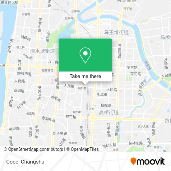
See Coco, Furong District, on the map
Public Transit to Coco in Furong District
Wondering how to get to Coco in Furong District? Moovit helps you find the best way to get to Coco with step-by-step directions from the nearest public transit station.
Moovit provides free maps and live directions to help you navigate through your city. View schedules, routes, timetables, and find out how long does it take to get to Coco in real time.
Looking for the nearest stop or station to Coco? Check out this list of stops closest to your destination: Gaojian Market (West Yangjiashan); People's Road Interchange; People's Road Overpass North; Chaoyang Village; Jintai Plaza.
Bus: Route 121, Route 168, 308, Route 368, Route 915, Route 917, Temporary Route 317, Temporary Route 131, Temporary Route 317, Route 122, Route 130, Route 168, Route 121, Bus Route 148, Route 348, Route 308 Express, 308, Route 906, Route 114.Metro: Line 3, Line 3, Line 2.
Want to see if there’s another route that gets you there at an earlier time? Moovit helps you find alternative routes or times. Get directions from and directions to Coco easily from the Moovit App or Website.
We make riding to Coco easy, which is why over 1.5 million users, including users in Furong District, trust Moovit as the best app for public transit. You don’t need to download an individual bus app or train app, Moovit is your all-in-one transit app that helps you find the best bus time or train time available.
For information on prices of bus and metro, costs and ride fares to Coco, please check the Moovit app.
Use the app to navigate to popular places including to the airport, hospital, stadium, grocery store, mall, coffee shop, school, college, and university.
Coco Address: 长沙市芙蓉区南正街 street in Furong District
- Heyi Computer City (Chaoyang Road),
- Miao Yan Western Bakery (Chaoyang Store),
- Changsha Furong District Rural Cooperative Bank 24-Hour Self-Service Bank (Chaoyang Branch),
- South Zheng Street Shoes and Clothing Market,
- Leqi Computer Printer Specialty Store,
- WlifeS Wonderful Life,
- Han City Strategy (Changsha Railway Station Branch),
- Smile Angel (South Zheng Street Branch),
- Ac or Male Lead,
- Golden Apple Clothing Mall,
- South Zheng Street Hall,
- GH,
- Shen Mei Plastic Surgery,
- Chaoyang First Village - Building 42,
- Tianxin Computer City,
- Kejia Chaoyang Digital Street,
- Kaitong International City Building 2 - 2A Building,
- Chaoyang Liyuan - Building 3,
- Chaoshan Qunjie Beef Hotpot,
- YY Shoe Store
Places Near Coco (Furong District)
- Changsha South Station Square, Yuelu District,
- Hunan Province Tumor Hospital, Yuelu District,
- National University of Defense Technology (North Gate), Kaifu District,
- Central South University Xiangya Second Hospital, Furong District,
- Changsha Bank (Sifang Branch), Kaifu District,
- Zhongnan University Xiangya Hospital, Kaifu District,
- First Club, Kaifu District,
- Changsha South Station, Yuhua District,
- First Affiliated Hospital of Hunan University of Traditional Chinese Medicine - Outpatient Department, Yuhua District,
- Yuelu Mountain Juzizhou Tourist Area, Yuelu District,
- Xingsha Police Station Songya Community Police Room, Changsha County,
- Hunan University of Traditional Chinese Medicine First Affiliated Hospital, Yuhua District,
- Desiqin City Square, Yuhua District,
- Hunan Provincial Maternal and Child Health Hospital - Outpatient Department, Kaifu District,
- Wanjiali International Mall, Furong District,
- Changsha Bank ATM (Sifang Branch), Kaifu District,
- Hunan Provincial Museum - Multipurpose Hall, Kaifu District,
- Changsha Yangming Mountain Funeral Home, Yuhua District,
- Du Fu River Pavilion, Tianxin District,
- Apple Authorized Dealer (Sam Changsha Store), Yuhua District
How to get to popular places in Changsha with public transit
Get around Furong District by public transit!
Traveling around Furong District has never been so easy. See step by step directions as you travel to any attraction, street or major public transit station. View bus and train schedules, arrival times, service alerts and detailed routes on a map, so you know exactly how to get to anywhere in Furong District.
When traveling to any destination around Furong District use Moovit's Live Directions with Get Off Notifications to know exactly where and how far to walk, how long to wait for your line, and how many stops are left. Moovit will alert you when it's time to get off — no need to constantly re-check whether yours is the next stop.
Wondering how to use public transit in Furong District or how to pay for public transit in Furong District? Moovit public transit app can help you navigate your way with public transit easily, and at minimum cost. It includes public transit fees, ticket prices, and costs. Looking for a map of Furong District public transit lines? Moovit public transit app shows all public transit maps in Furong District with all Bus and Metro routes and stops on an interactive map.
Changsha has 2 transit type(s), including: Bus and Metro, operated by several transit agencies, including Changsha Metro and Changsha Bus Group