How to get to Cocom by bus?
Click on the bus route to see step by step directions with maps, line arrival times and updated time schedules.
From Edmonton Valley Zoo, Edmonton
45 minFrom W.P. Wagner High School, Edmonton
77 minFrom 8440 112 Street Northwest, Edmonton
24 minFrom Tammys Plastic Canvas Crafting, Edmonton
69 minFrom Londonderry Mall, Edmonton
50 minFrom Webber Greens, Edmonton
82 minFrom Pigeon Lake, Edmonton
91 minFrom Real Canadian Superstore, Edmonton
65 minFrom Asebp, Edmonton
63 minFrom W. P. Wagner School, Edmonton
97 min
Bus stops near Cocom in Edmonton
Light Rail stations near Cocom in Edmonton
- Macewan Station, 8 min walk,VIEW
Bus lines to Cocom in Edmonton
What are the closest stations to Cocom?
The closest stations to Cocom are:
- 127 Street & 119 Avenue is 179 meters away, 3 min walk.
- 127 Street & 118 Avenue is 326 meters away, 5 min walk.
- 124 Street & 118 Avenue is 415 meters away, 6 min walk.
- 127 Street & 122 Avenue is 614 meters away, 9 min walk.
- Macewan Station is 623 meters away, 8 min walk.
Which bus lines stop near Cocom?
These bus lines stop near Cocom: 051, 052, 201, 903.
What’s the nearest light rail station to Cocom in Edmonton?
The nearest light rail station to Cocom in Edmonton is Macewan Station. It’s a 8 min walk away.
What’s the nearest bus station to Cocom in Edmonton?
The nearest bus station to Cocom in Edmonton is 127 Street & 119 Avenue. It’s a 3 min walk away.
What time is the first light rail to Cocom in Edmonton?
The METRO is the first light rail that goes to Cocom in Edmonton. It stops nearby at 6:05 AM.
What time is the last light rail to Cocom in Edmonton?
The METRO is the last light rail that goes to Cocom in Edmonton. It stops nearby at 12:41 AM.
What time is the first bus to Cocom in Edmonton?
The 201 is the first bus that goes to Cocom in Edmonton. It stops nearby at 5:54 AM.
What time is the last bus to Cocom in Edmonton?
The 903 is the last bus that goes to Cocom in Edmonton. It stops nearby at 12:13 AM.
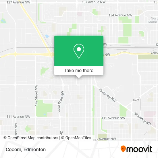
See Cocom, Edmonton, on the map
Public Transit to Cocom in Edmonton
Wondering how to get to Cocom in Edmonton? Moovit helps you find the best way to get to Cocom with step-by-step directions from the nearest public transit station.
Moovit provides free maps and live directions to help you navigate through your city. View schedules, routes, timetables, and find out how long does it take to get to Cocom in real time.
Looking for the nearest stop or station to Cocom? Check out this list of stops closest to your destination: 127 Street & 119 Avenue; 127 Street & 118 Avenue; 124 Street & 118 Avenue; 127 Street & 122 Avenue; Macewan Station.
Bus: 051, 052, 201, 903, 140X, 124.
Want to see if there’s another route that gets you there at an earlier time? Moovit helps you find alternative routes or times. Get directions from and directions to Cocom easily from the Moovit App or Website.
We make riding to Cocom easy, which is why over 1.5 million users, including users in Edmonton, trust Moovit as the best app for public transit. You don’t need to download an individual bus app or train app, Moovit is your all-in-one transit app that helps you find the best bus time or train time available.
For information on prices of bus and light rail, costs and ride fares to Cocom, please check the Moovit app.
Use the app to navigate to popular places including to the airport, hospital, stadium, grocery store, mall, coffee shop, school, college, and university.
Cocom Address: 126 St NW Edmonton, AB T5L 0W2 street in Edmonton
- Garage,
- Han'Snails,
- A & A Auto Detailing,
- Krave Liquor,
- City & Soul Wellness Collective,
- Harhare Cafe,
- Techos Technician on Site,
- Emma's Ethiopian Restaurant & Grocery,
- First Choice Daycare,
- International Bible Baptist Church Edmonton,
- Videogamerepairs.Ca,
- WESTERN UNION,
- Ancestral Therapeutics,
- JML Best Creative Landscaping LTD,
- Alberta Cash Loan Ctr,
- Prince George Park,
- Bar Impero,
- En Tile Construction,
- The Tantalizers,
- The Tantalizers Cuisine
Places Near Cocom (Edmonton)
- Kaye Edmonton Clinic, Edmonton,
- Londonderry Mall, Edmonton,
- Borden Park, Edmonton,
- Alberta Legislature Building, Edmonton,
- Edmonton Valley Zoo, Edmonton,
- Royal Alexandra Hospital, Edmonton,
- Kingsway Mall, Edmonton,
- Northgate Centre, Edmonton,
- University of Alberta, Edmonton,
- Rogers Place, Edmonton,
- Fort Edmonton Park, Edmonton,
- Whyte Avenue, Edmonton,
- West Edmonton Mall, Edmonton,
- Edmonton EXPO Centre, Edmonton,
- Edmonton Commonwealth Stadium, Edmonton,
- Edmonton VIA Rail Station, Edmonton,
- Canada Place Service Canada Centre, Edmonton,
- MacEwan University, Edmonton,
- Grey Nuns Community Hospital, Edmonton,
- Cross Cancer Institute, Edmonton
How to get to popular places in Edmonton with public transit
Get around Edmonton by public transit!
Traveling around Edmonton has never been so easy. See step by step directions as you travel to any attraction, street or major public transit station. View bus and train schedules, arrival times, service alerts and detailed routes on a map, so you know exactly how to get to anywhere in Edmonton.
When traveling to any destination around Edmonton use Moovit's Live Directions with Get Off Notifications to know exactly where and how far to walk, how long to wait for your line, and how many stops are left. Moovit will alert you when it's time to get off — no need to constantly re-check whether yours is the next stop.
Wondering how to use public transit in Edmonton or how to pay for public transit in Edmonton? Moovit public transit app can help you navigate your way with public transit easily, and at minimum cost. It includes public transit fees, ticket prices, and costs. Looking for a map of Edmonton public transit lines? Moovit public transit app shows all public transit maps in Edmonton with all Bus and Light Rail routes and stops on an interactive map.
Edmonton has 2 transit type(s), including: Bus and Light Rail, operated by several transit agencies, including ETS LRT, ETS, Strathcona County Transit, St. Albert Transit, Spruce Grove Transit, Fort Saskatchewan Transit, Beaumont Transit and Leduc Transit