How to get to Cocotá by bus?
Click on the bus route to see step by step directions with maps, line arrival times and updated time schedules.
From Museu Do Amanhã, Centro
62 minFrom Rua 24 de Fevereiro, Bonsucesso
45 minFrom olaria, Olaria
48 minFrom Avenida Rodrigues Alves 10, Saúde
57 minFrom BRT - Estação Galeão - Tom Jobim 2, Galeão
39 minFrom Hospital Geral De Bonsucesso/Rj, Bonsucesso
45 minFrom Hospital De Bonsucesso, Bonsucesso
46 minFrom Hospital Balbino, Olaria
51 minFrom TRE-RJ - 11ª Zona Eleitoral, Olaria
49 min
How to get to Cocotá by ferry?
Click on the ferry route to see step by step directions with maps, line arrival times and updated time schedules.
Bus stops near Cocotá in Rio de Janeiro Region
Ferry stations near Cocotá in Rio de Janeiro Region
Bus lines to Cocotá in Rio de Janeiro Region
- SV 921, Bancários,VIEW
- 739L, Cocotá (Expresso),VIEW
- 323, Bananal - Castelo (Brs 4 - via Linha Vermelha),VIEW
- 328, Bananal - Candelária (Brs 4 - via Av. Brasil),VIEW
- SN 328, Bananal - Candelária (Brs 4 - via Aeroporto / Av. Brasil),VIEW
- SP 328, Bananal - BRT Fundão (via Cocotá / Cacuia),VIEW
- SR 328, Bananal - Candelária (Brs 4 - Expresso),VIEW
- 634, Bananal - Saens Peña (Brs 6 - via Bonsucesso),VIEW
- 635, Bananal - Saens Peña (Brs 6 - via Linha Vermelha / São Cristóvão),VIEW
- 696, Praia do Dendê - Méier (Via Av. Brasil),VIEW
- SN 696, Praia do Dendê - Meier (Via Praia do Rosa / Bancários),VIEW
- 901, Bananal - Bonsucesso (via Ribeira / Jardim Guanabara),VIEW
- SVB 901, Bananal - Bonsucesso (via Praia do Barão / Estrada do Galeão - Direto),VIEW
- 910, Bananal - Irajá (via Olaria / Penha / Largo do Bicão),VIEW
- SE 913, Bananal - Del Castilho (Integração Com Metrô),VIEW
- 921, Ribeira - Bancários (via Cocotá),VIEW
- 925, Bancários - Aeroporto ✈ (Via Área de Apoio - Circular),VIEW
- 2342, Bananal - Castelo (Brs 4),VIEW
- 913, Del Castilho (Saídas do Bananal),VIEW
- 327, Castelo,VIEW
What are the closest stations to Cocotá?
The closest stations to Cocotá are:
- Estação Das Barcas Cocotá is 159 meters away, 3 min walk.
- Ponto Final - Cocotá / Barcas is 210 meters away, 3 min walk.
- Praça Poeta Manuel Bandeira (Estação De Barcas) is 425 meters away, 6 min walk.
- Rua Capitão Barbosa, 321-375 is 730 meters away, 10 min walk.
- Terminal De Barcas - Cocotá ⛴ is 1555 meters away, 20 min walk.
- Praia Da Bica - Ilha Do Governador is 1751 meters away, 23 min walk.
Which bus lines stop near Cocotá?
These bus lines stop near Cocotá: 323, 328, 739L, 910, 925.
Which ferry line stops near Cocotá?
COCOTÁ - PRAÇA XV (Cocotá)
What’s the nearest bus station to Cocotá in Rio de Janeiro Region?
The nearest bus stations to Cocotá in Rio de Janeiro Region are Estação Das Barcas Cocotá and Ponto Final - Cocotá / Barcas. The closest one is a 3 min walk away.
What’s the nearest ferry station to Cocotá in Rio de Janeiro Region?
The nearest ferry station to Cocotá in Rio de Janeiro Region is Terminal De Barcas - Cocotá ⛴. It’s a 20 min walk away.
What time is the first bus to Cocotá in Rio de Janeiro Region?
The SN 696 is the first bus that goes to Cocotá in Rio de Janeiro Region. It stops nearby at 3:01 AM.
What time is the last bus to Cocotá in Rio de Janeiro Region?
The SN 328 is the last bus that goes to Cocotá in Rio de Janeiro Region. It stops nearby at 3:44 AM.
What time is the first ferry to Cocotá in Rio de Janeiro Region?
The COCOTÁ - PRAÇA XV is the first ferry that goes to Cocotá in Rio de Janeiro Region. It stops nearby at 7:00 AM.
What time is the last ferry to Cocotá in Rio de Janeiro Region?
The COCOTÁ - PRAÇA XV is the last ferry that goes to Cocotá in Rio de Janeiro Region. It stops nearby at 8:45 PM.
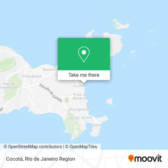
See Cocotá, Rio de Janeiro Region, on the map
Public Transit to Cocotá in Rio de Janeiro Region
Wondering how to get to Cocotá in Rio de Janeiro Region? Moovit helps you find the best way to get to Cocotá with step-by-step directions from the nearest public transit station.
Moovit provides free maps and live directions to help you navigate through your city. View schedules, routes, timetables, and find out how long does it take to get to Cocotá in real time.
Looking for the nearest stop or station to Cocotá? Check out this list of stops closest to your destination: Estação Das Barcas Cocotá; Ponto Final - Cocotá / Barcas; Praça Poeta Manuel Bandeira (Estação De Barcas); Rua Capitão Barbosa; Terminal De Barcas - Cocotá ⛴; Praia Da Bica - Ilha Do Governador.
Bus: 323, 328, 739L, 910, 925, SV 921, SN 328, SP 328, SR 328, 913, 327.Ferry: COCOTÁ - PRAÇA XV.
Want to see if there’s another route that gets you there at an earlier time? Moovit helps you find alternative routes or times. Get directions from and directions to Cocotá easily from the Moovit App or Website.
We make riding to Cocotá easy, which is why over 1.5 million users, including users in Rio de Janeiro Region, trust Moovit as the best app for public transit. You don’t need to download an individual bus app or train app, Moovit is your all-in-one transit app that helps you find the best bus time or train time available.
For information on prices of bus and ferry, costs and ride fares to Cocotá, please check the Moovit app.
Use the app to navigate to popular places including to the airport, hospital, stadium, grocery store, mall, coffee shop, school, college, and university.
Cocotá Address: Praia do Cocotá street in Rio de Janeiro Region
- CCR Barcas - Estação Cocotá,
- Estacionamento Barcas Cocotá,
- Terminal Praça XV,
- Parque Poeta Manoel Bandeira S / n,
- Clínica Da Família Wilma Costa,
- Praia da Bandeira S/n,
- Posto de Vistoria - Detran,
- Detran,
- Upa Cocotá,
- UPA Ilha do Governador,
- UPA 24h Ilha do Governador-PS,
- Detran - Posto Cocotá,
- Detran Cocotá (Ilha do Governador),
- 2a Vara Cível Regional Da Ilha Do Governador,
- Areninha Carioca Renato Russo,
- Feira do Coocotá,
- Lona Cultural Renato Russo,
- Fórum Regional Da Ilha Do Governador,
- Praia da Olaria / Praia de Cocotá,
- Salão Feminino Bela Rosa
Places Near Cocotá (Rio de Janeiro Region)
- Hospital Federal Do Andaraí, Andaraí,
- Norte Shopping, Cachambi,
- Rua Ulysses Guimarães 16, Cidade Nova,
- Shopping Nova América, Del Castilho,
- Praia do Arpoador, Ipanema,
- Feira Livre da Gloria, Glória,
- Rua Licínio Cardoso, São Francisco Xavier,
- Museu Do Amanhã, Centro,
- Hospital Pedro Ernesto, Vila Isabel,
- Shopping Downtown, Barra Da Tijuca,
- Feirão De Malhas, Duque De Caxias,
- Shopping RioSul, Botafogo,
- Shopping Rio Sul, Botafogo,
- Avenida Rio Branco, Centro,
- Rodoviária Novo Rio (Rodoviária do Rio de Janeiro), Santo Cristo,
- Niterói, Niterói,
- Rio De Janeiro,
- Hospital Municipal Ronaldo Gazolla, Acari,
- Avenida Venezuela 134, Saúde,
- Hospital Federal Cardoso Fontes, Jacarepaguá
How to get to popular places in Rio de Janeiro Region with public transit
Get around Rio de Janeiro Region by public transit!
Traveling around Rio de Janeiro Region has never been so easy. See step by step directions as you travel to any attraction, street or major public transit station. View bus and train schedules, arrival times, service alerts and detailed routes on a map, so you know exactly how to get to anywhere in Rio de Janeiro Region.
When traveling to any destination around Rio de Janeiro Region use Moovit's Live Directions with Get Off Notifications to know exactly where and how far to walk, how long to wait for your line, and how many stops are left. Moovit will alert you when it's time to get off — no need to constantly re-check whether yours is the next stop.
Wondering how to use public transit in Rio de Janeiro Region or how to pay for public transit in Rio de Janeiro Region? Moovit public transit app can help you navigate your way with public transit easily, and at minimum cost. It includes public transit fees, ticket prices, and costs. Looking for a map of Rio de Janeiro Region public transit lines? Moovit public transit app shows all public transit maps in Rio de Janeiro Region with all Bus, Train, Metro, Light Rail, Ferry, Cable Car, Gondola and Funicular routes and stops on an interactive map.
Rio de Janeiro Region has 8 transit type(s), including: Bus, Train, Metro, Light Rail, Ferry, Cable Car, Gondola and Funicular, operated by several transit agencies, including TrensRJ, Metrô Rio, VLT Carioca, Barcas Rio, BRT MOBI-Rio, Auto Viação Alpha, Auto Viação Tijuca, Gire Transportes, Transurb, Viação Nossa Senhora das Graças, Consórcio INTERSUL, Braso Lisboa (Municipal), Caprichosa Auto Ônibus, Auto Viação Três Amigos and Rodoviária Âncora Matias