How to get to Codik by bus?
Click on the bus route to see step by step directions with maps, line arrival times and updated time schedules.
From Briand Sylvia, Boiry-Becquerelle
71 minFrom Porketto by Jb Viande, Wancourt
58 minFrom Baillet Gérard, Beaumetz-Lès-Loges
59 minFrom Hénin-sur-Cojeul, Hénin-Sur-Cojeul
67 minFrom Sofima, Acq
82 minFrom Ma Petite Campagne, Ficheux
66 minFrom Morgane Hennart, Rivière
51 minFrom Rivière, Rivière
50 minFrom Natureza, Reux
52 minFrom Cueillette de Beaurains, Beaurains
38 min
Bus stops near Codik in Saint-Nicolas
Bus lines to Codik in Saint-Nicolas
What are the closest stations to Codik?
The closest stations to Codik are:
- Verts Coteaux is 410 meters away, 6 min walk.
- L'Ardrésis is 474 meters away, 7 min walk.
- St-Nicolas Cruppes is 574 meters away, 9 min walk.
- Hauts De Côte is 690 meters away, 9 min walk.
- Mairie De Ste-Catherine is 716 meters away, 10 min walk.
- Route De Béthune is 845 meters away, 11 min walk.
Which bus line stops near Codik?
L8 (Gare - Quai I→St-Nicolas Cruppes)
What’s the nearest bus station to Codik in Saint-Nicolas?
The nearest bus station to Codik in Saint-Nicolas is Verts Coteaux. It’s a 6 min walk away.
What time is the first bus to Codik in Saint-Nicolas?
The L1 is the first bus that goes to Codik in Saint-Nicolas. It stops nearby at 6:04 AM.
What time is the last bus to Codik in Saint-Nicolas?
The L1 is the last bus that goes to Codik in Saint-Nicolas. It stops nearby at 9:32 PM.
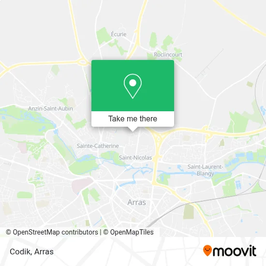
See Codik, Saint-Nicolas, on the map
Public Transit to Codik in Saint-Nicolas
Wondering how to get to Codik in Saint-Nicolas? Moovit helps you find the best way to get to Codik with step-by-step directions from the nearest public transit station.
Moovit provides free maps and live directions to help you navigate through your city. View schedules, routes, timetables, and find out how long does it take to get to Codik in real time.
Looking for the nearest stop or station to Codik? Check out this list of stops closest to your destination: Verts Coteaux; L'Ardrésis; St-Nicolas Cruppes; Hauts De Côte; Mairie De Ste-Catherine; Route De Béthune.
Bus: L8, DIM, L3, C9, L1, L12, LD1, C6, L11, C10.
Want to see if there’s another route that gets you there at an earlier time? Moovit helps you find alternative routes or times. Get directions from and directions to Codik easily from the Moovit App or Website.
We make riding to Codik easy, which is why over 1.5 million users, including users in Saint-Nicolas, trust Moovit as the best app for public transit. You don’t need to download an individual bus app or train app, Moovit is your all-in-one transit app that helps you find the best bus time or train time available.
For information on prices of bus, costs and ride fares to Codik, please check the Moovit app.
Use the app to navigate to popular places including to the airport, hospital, stadium, grocery store, mall, coffee shop, school, college, and university.
Codik Address: 21 Clos Jules Catoire 62223 Saint-Nicolas street in Saint-Nicolas
- Clos Des Champs : 28 Maisons Et 40 Appartements,
- Electra,
- Théry,
- Zone D'Emploi Les Alouettes,
- Centre Social Camille Corot,
- salle bonne humeur,
- Saint-Nicolas-lèz-Arras,
- 54 Rue du 11 Novembre,
- Ap Utilitaire,
- Résidence Des Pommiers,
- Jacqueline,
- Charluteau Jamet Cyril Jean Daniel,
- Maison De Santé « Le Ryonval »,
- Honoré Christiane,
- L'Auberge - Restaurant Brasserie,
- Débora Fayolle - Psychologue - Thérapeute Emdr,
- Itech Informatique et TEC,
- Drubay Sandrine,
- Ly Lu,
- Le Saint-Nicolas Café Tabac
Places Near Codik (Saint-Nicolas)
- Lycée Robespierre, Arras,
- Le Set Famous Club Roclincourt, Arras,
- Lycée Du Bâtiment Jacques Le Caron, Arras,
- lycée Baudimont St-Charles, Arras,
- Auchan Arras, Arras,
- Marché De Noël, Arras,
- Centre Commercial Auchan, Arras,
- Lycée Polyvalent Guy Mollet, Arras,
- Lycée Privé Baudimont Saint-Charles, Arras,
- Lfb Group Arras, Bailleul-Sir-Berthoult,
- Lycée Professionnel Alain Savary, Arras,
- Main Square Festival, Arras,
- Citadelle D'Arras, Arras,
- Université D'Artois, Arras,
- Lycée Général Gambetta Carnot, Arras,
- Grand'Place, Arras,
- Hôpital Privé Arras Les Bonnettes, Arras,
- Centre Hospitalier D'Arras, Arras,
- Artois-Expo, Saint-Laurent-Blangy,
- Caf, Arras
How to get to popular places in Arras with public transit
Get around Saint-Nicolas by public transit!
Traveling around Saint-Nicolas has never been so easy. See step by step directions as you travel to any attraction, street or major public transit station. View bus and train schedules, arrival times, service alerts and detailed routes on a map, so you know exactly how to get to anywhere in Saint-Nicolas.
When traveling to any destination around Saint-Nicolas use Moovit's Live Directions with Get Off Notifications to know exactly where and how far to walk, how long to wait for your line, and how many stops are left. Moovit will alert you when it's time to get off — no need to constantly re-check whether yours is the next stop.
Wondering how to use public transit in Saint-Nicolas or how to pay for public transit in Saint-Nicolas? Moovit public transit app can help you navigate your way with public transit easily, and at minimum cost. It includes public transit fees, ticket prices, and costs. Looking for a map of Saint-Nicolas public transit lines? Moovit public transit app shows all public transit maps in Saint-Nicolas with all bus routes and stops on an interactive map.
Arras has 1 transit type(s), including: bus, operated by several transit agencies, including Artis