How to get to Cohousing Collaborative by bus?
Click on the bus route to see step by step directions with maps, line arrival times and updated time schedules.
From Chinese Embassy Visa Section, Washington
82 minFrom Hilton McLean Tysons Corner, Fairfax County
34 minFrom Tysons Corner Center, Fairfax County
28 minFrom Chinese Embassy, Washington
81 minFrom Glover Park Hotel Georgetown, Washington
83 minFrom Cia Headquarters, Fairfax County
37 minFrom Army-Navy Country Club (ARL), Arlington County
70 minFrom Georgetown Flea Market, Washington
79 minFrom Days Inn by Wyndham Arlington Pentagon, Arlington County
53 minFrom Georgetown Cupcake, Washington
54 min
How to get to Cohousing Collaborative by metro?
Click on the metro route to see step by step directions with maps, line arrival times and updated time schedules.
Bus stop near Cohousing Collaborative in Falls Church
- W Broad St+S Oak St, 2 min walk,VIEW
Metro station near Cohousing Collaborative in Falls Church
- East Falls Church, 27 min walk,VIEW
Bus lines to Cohousing Collaborative in Falls Church
- F20, East To King St-Old Town,VIEW
What are the closest stations to Cohousing Collaborative?
The closest stations to Cohousing Collaborative are:
- W Broad St+S Oak St is 118 yards away, 2 min walk.
- East Falls Church is 2247 yards away, 27 min walk.
Which bus line stops near Cohousing Collaborative?
F20 (East To King St-Old Town)
Which metro lines stop near Cohousing Collaborative?
These metro lines stop near Cohousing Collaborative: ORANGE, SILVER.
What’s the nearest metro station to Cohousing Collaborative in Falls Church?
The nearest metro station to Cohousing Collaborative in Falls Church is East Falls Church. It’s a 27 min walk away.
What’s the nearest bus station to Cohousing Collaborative in Falls Church?
The nearest bus station to Cohousing Collaborative in Falls Church is W Broad St+S Oak St. It’s a 2 min walk away.
What time is the first metro to Cohousing Collaborative in Falls Church?
The ORANGE is the first metro that goes to Cohousing Collaborative in Falls Church. It stops nearby at 5:07 AM.
What time is the last metro to Cohousing Collaborative in Falls Church?
The SILVER is the last metro that goes to Cohousing Collaborative in Falls Church. It stops nearby at 12:31 AM.
What time is the first bus to Cohousing Collaborative in Falls Church?
The F20 is the first bus that goes to Cohousing Collaborative in Falls Church. It stops nearby at 4:54 AM.
What time is the last bus to Cohousing Collaborative in Falls Church?
The F20 is the last bus that goes to Cohousing Collaborative in Falls Church. It stops nearby at 2:09 AM.
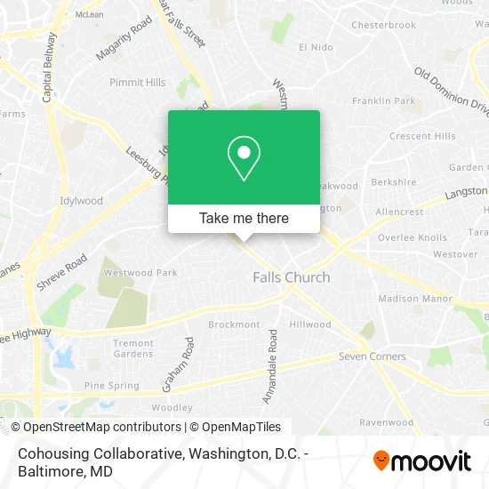
See Cohousing Collaborative, Falls Church, on the map
Public Transit to Cohousing Collaborative in Falls Church
Wondering how to get to Cohousing Collaborative in Falls Church? Moovit helps you find the best way to get to Cohousing Collaborative with step-by-step directions from the nearest public transit station.
Moovit provides free maps and live directions to help you navigate through your city. View schedules, routes, timetables, and find out how long does it take to get to Cohousing Collaborative in real time.
Looking for the nearest stop or station to Cohousing Collaborative? Check out this list of stops closest to your destination: W Broad St+S Oak St; East Falls Church.
Bus: F20.Metro: ORANGE, SILVER.
Want to see if there’s another route that gets you there at an earlier time? Moovit helps you find alternative routes or times. Get directions from and directions to Cohousing Collaborative easily from the Moovit App or Website.
We make riding to Cohousing Collaborative easy, which is why over 1.5 million users, including users in Falls Church, trust Moovit as the best app for public transit. You don’t need to download an individual bus app or train app, Moovit is your all-in-one transit app that helps you find the best bus time or train time available.
For information on prices of bus and metro, costs and ride fares to Cohousing Collaborative, please check the Moovit app.
Use the app to navigate to popular places including to the airport, hospital, stadium, grocery store, mall, coffee shop, school, college, and university.
Cohousing Collaborative Address: 800 W Broad St Falls Church, VA 22046 street in Falls Church
- Northwood High School,
- Together Rising,
- Pro Electric,
- Petzcharm,
- Sports Pt Lab, LLC,
- Falls Church City Public Schools (Escuelas Publicas de la Ciudad de Falls Church),
- Prometric Testing Center,
- Edible Arrangements,
- Canary Rose Retreat,
- Argent Place Law,
- Glotax,
- Group Purchasing Solutions,
- Ivy Rehab for Kids,
- Living in Arlington,
- Chrissy & Lisa Team - Remax Distinctive,
- Dixie Rapuano,
- The Northern Virginia Association of Realtors,
- Tracy Lavender, Re / Max West End (Tracy Casteuble Lavender-ZLLW),
- Capitol Cleaners,
- Equal Housing Opportunity
Places Near Cohousing Collaborative (Falls Church)
- Westfield Montgomery Mall, Montgomery County,
- National Mall, Washington,
- Museum Of The Bible, Washington,
- Georgetown, Washington,
- Basilica of the National Shrine, Washington,
- Washington DC VA Medical Center, Washington,
- Sibley Memorial Hospital, Washington,
- National Zoo, Washington,
- Marriott Marquis Washington, DC, Washington,
- PG Mall, Prince George's County,
- Amazon Hq2, Arlington County,
- Capital One Arena, Washington,
- The Anthem, Washington,
- Camden Yards, Baltimore,
- Washington National Cathedral, Washington,
- National Museum of African American History and Culture, Washington,
- Warner Theatre, Washington,
- Pennsylvania Ave NW (3rd st and pennsylvania), Washington,
- Rock Creek Tennis Center, Washington,
- M&T Bank Stadium, Baltimore
How to get to popular places in Washington, D.C. - Baltimore, MD with public transit
Get around Falls Church by public transit!
Traveling around Falls Church has never been so easy. See step by step directions as you travel to any attraction, street or major public transit station. View bus and train schedules, arrival times, service alerts and detailed routes on a map, so you know exactly how to get to anywhere in Falls Church.
When traveling to any destination around Falls Church use Moovit's Live Directions with Get Off Notifications to know exactly where and how far to walk, how long to wait for your line, and how many stops are left. Moovit will alert you when it's time to get off — no need to constantly re-check whether yours is the next stop.
Wondering how to use public transit in Falls Church or how to pay for public transit in Falls Church? Moovit public transit app can help you navigate your way with public transit easily, and at minimum cost. It includes public transit fees, ticket prices, and costs. Looking for a map of Falls Church public transit lines? Moovit public transit app shows all public transit maps in Falls Church with all Bus, Train, Metro, Light Rail and Ferry routes and stops on an interactive map.
Washington, D.C. - Baltimore, MD has 5 transit type(s), including: Bus, Train, Metro, Light Rail and Ferry, operated by several transit agencies, including WMATA, Montgomery County Ride On, Fairfax Connector, TheBus, PRTC, DASH - Alexandria, Arlington Transit (ART), RTA of Central Maryland, MDOT MTA, MDOT MTA Light RailLink, MDOT MTA Commuter Bus, MDOT MTA Local Bus, FXBGO!, Virginia Railway Express (VRE) and MARC