How to get to Coinme by bus?
Click on the bus route to see step by step directions with maps, line arrival times and updated time schedules.
From Lakeland Bus Stop, Parsippany-Troy Hills
44 minFrom Wayne, NJ, Wayne
121 minFrom Totowa, NJ, Totowa
82 minFrom Saint Barnabas Medical Center, Livingston
146 minFrom The Funplex, East Hanover
119 minFrom West Orange, NJ, West Orange
129 minFrom Orange, NJ, City Of Orange
152 minFrom Community Coach 77 Bus Stop, Livingston
128 minFrom Dover, NJ, Dover
35 min
How to get to Coinme by train?
Click on the train route to see step by step directions with maps, line arrival times and updated time schedules.
Bus stop near Coinme in Morris Plains
- Us-202 440's Of Briarcliff Rd, 3 min walk,VIEW
Train station near Coinme in Morris Plains
- Morris Plains, 30 min walk,VIEW
What are the closest stations to Coinme?
The closest stations to Coinme are:
- Us-202 440's Of Briarcliff Rd is 218 yards away, 3 min walk.
- Morris Plains is 2525 yards away, 30 min walk.
Which bus lines stop near Coinme?
These bus lines stop near Coinme: 871, 872, 873, 880.
Which train line stops near Coinme?
MEL (Dover)
What’s the nearest train station to Coinme in Morris Plains?
The nearest train station to Coinme in Morris Plains is Morris Plains. It’s a 30 min walk away.
What’s the nearest bus station to Coinme in Morris Plains?
The nearest bus station to Coinme in Morris Plains is Us-202 440's Of Briarcliff Rd. It’s a 3 min walk away.
What time is the first train to Coinme in Morris Plains?
The MEL is the first train that goes to Coinme in Morris Plains. It stops nearby at 4:23 AM.
What time is the last train to Coinme in Morris Plains?
The MEL is the last train that goes to Coinme in Morris Plains. It stops nearby at 2:13 AM.
What time is the first bus to Coinme in Morris Plains?
The 872 is the first bus that goes to Coinme in Morris Plains. It stops nearby at 6:25 AM.
What time is the last bus to Coinme in Morris Plains?
The 880 is the last bus that goes to Coinme in Morris Plains. It stops nearby at 7:52 PM.
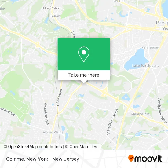
See Coinme, Morris Plains, on the map
Public Transit to Coinme in Morris Plains
Wondering how to get to Coinme in Morris Plains? Moovit helps you find the best way to get to Coinme with step-by-step directions from the nearest public transit station.
Moovit provides free maps and live directions to help you navigate through your city. View schedules, routes, timetables, and find out how long does it take to get to Coinme in real time.
Looking for the nearest stop or station to Coinme? Check out this list of stops closest to your destination: Us-202 440's Of Briarcliff Rd; Morris Plains.
Bus: 871, 872, 873, 880.Train: MEL, MNE.
Want to see if there’s another route that gets you there at an earlier time? Moovit helps you find alternative routes or times. Get directions from and directions to Coinme easily from the Moovit App or Website.
We make riding to Coinme easy, which is why over 1.5 million users, including users in Morris Plains, trust Moovit as the best app for public transit. You don’t need to download an individual bus app or train app, Moovit is your all-in-one transit app that helps you find the best bus time or train time available.
For information on prices of bus and train, costs and ride fares to Coinme, please check the Moovit app.
Use the app to navigate to popular places including to the airport, hospital, stadium, grocery store, mall, coffee shop, school, college, and university.
Coinme Address: Stop & Shop, 245 Littleton Rd street in Morris Plains
- Stop & Shop #893,
- Keyme Locksmiths,
- Coinstar Kiosk - Bitcoin Atm,
- Shell Recharge,
- High Tech Innovations,
- Fieldstone Properties,
- Mgk Design,
- Super Stop & Shop,
- Western Union,
- Ecoatm,
- STARBUCKS,
- Shell,
- Cheryl Towey,
- Dennis Cassidy at Weichert Realtors,
- Barbara Ferguson - Weichert Realtors,
- Kimberly Brechka Real Estate,
- Team Williams Realty,
- Daniel Webb Realtor,
- Allie Malpere,
- Weichert Insurance Agency
Places Near Coinme (Morris Plains)
- Rockefeller Center, Manhattan,
- San Gennaro Feast, Manhattan,
- 26 Federal Plaza, Manhattan,
- 3 Stone St, Manhattan,
- 376 Hudson Street, Manhattan,
- Chinatown, Manhattan,
- Bellevue Hospital, Manhattan,
- Hudson Yards, Manhattan,
- Queens Center Mall, Queens,
- 911 Memorial, Manhattan,
- 111 Centre New York City Supreme Court, Manhattan,
- SoHo, Manhattan,
- Pier 83, Manhattan,
- 1 Police Plaza, Manhattan,
- Mountainside Hospital, Glen Ridge,
- qqqq, Manhattan,
- Wall Street, Manhattan,
- Katz's Deli, Manhattan,
- 66 John Street, Manhattan,
- Times Square, Manhattan
How to get to popular places in New York - New Jersey with public transit
Get around Morris Plains by public transit!
Traveling around Morris Plains has never been so easy. See step by step directions as you travel to any attraction, street or major public transit station. View bus and train schedules, arrival times, service alerts and detailed routes on a map, so you know exactly how to get to anywhere in Morris Plains.
When traveling to any destination around Morris Plains use Moovit's Live Directions with Get Off Notifications to know exactly where and how far to walk, how long to wait for your line, and how many stops are left. Moovit will alert you when it's time to get off — no need to constantly re-check whether yours is the next stop.
Wondering how to use public transit in Morris Plains or how to pay for public transit in Morris Plains? Moovit public transit app can help you navigate your way with public transit easily, and at minimum cost. It includes public transit fees, ticket prices, and costs. Looking for a map of Morris Plains public transit lines? Moovit public transit app shows all public transit maps in Morris Plains with all Bus, Train, Subway, Light Rail, Ferry and Cable Car routes and stops on an interactive map.
New York - New Jersey has 6 transit type(s), including: Bus, Train, Subway, Light Rail, Ferry and Cable Car, operated by several transit agencies, including MTA Subway, Metro-North Railroad, LIRR, PATH, MTA New York City Transit - Express routes, MTA Bus, NJ Transit, NYC Ferry, NICE bus, Bee-Line Bus, NJ Transit Rail, Norwalk Transit District, Hartford Line, River Valley Transit and HART