How to get to Coinsource by bus?
Click on the bus route to see step by step directions with maps, line arrival times and updated time schedules.
From Alligator Alley, Fort Lauderdale
38 minFrom W Commercial Blvd & 441 (SR 7), Fort Lauderdale
71 minFrom Coral Ridge Mall, Fort Lauderdale
39 minFrom Lauderhill Mall, Plantation
69 minFrom JP Taravella High School, Coral Springs-Margate
48 minFrom Tri-Rail-Deerfield Beach Station, Deerfield Beach
57 minFrom I-95, Fort Lauderdale
67 minFrom Walmart Supercenter, Fort Lauderdale
62 minFrom Swap Shop, Fort Lauderdale
65 minFrom Trapeze Swing Club, Fort Lauderdale
60 min
Train station near Coinsource in Pompano Beach
- Cypress Creek Station, 2 min walk,VIEW
Bus stops near Coinsource in Pompano Beach
Bus lines to Coinsource in Pompano Beach
What are the closest stations to Coinsource?
The closest stations to Coinsource are:
- Cypress Creek Station is 56 yards away, 2 min walk.
- Northwest 27th Avenue/Atlantic Boulevard is 68 yards away, 2 min walk.
- Atlantic Boulevard/Northwest 27th Avenue is 110 yards away, 2 min walk.
- Powerline Road/Atlantic Boulevard (North) is 316 yards away, 4 min walk.
Which bus lines stop near Coinsource?
These bus lines stop near Coinsource: 14, 42, 60.
What’s the nearest train station to Coinsource in Pompano Beach?
The nearest train station to Coinsource in Pompano Beach is Cypress Creek Station. It’s a 2 min walk away.
What’s the nearest bus station to Coinsource in Pompano Beach?
The nearest bus stations to Coinsource in Pompano Beach are Northwest 27th Avenue/Atlantic Boulevard and Atlantic Boulevard/Northwest 27th Avenue. The closest one is a 2 min walk away.
What time is the first train to Coinsource in Pompano Beach?
The TRIRAIL is the first train that goes to Coinsource in Pompano Beach. It stops nearby at 4:38 AM.
What time is the last train to Coinsource in Pompano Beach?
The TRIRAIL is the last train that goes to Coinsource in Pompano Beach. It stops nearby at 10:43 PM.
What time is the first bus to Coinsource in Pompano Beach?
The 14 is the first bus that goes to Coinsource in Pompano Beach. It stops nearby at 5:01 AM.
What time is the last bus to Coinsource in Pompano Beach?
The 14 is the last bus that goes to Coinsource in Pompano Beach. It stops nearby at 12:05 AM.
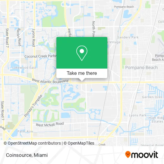
See Coinsource, Pompano Beach, on the map
Public Transit to Coinsource in Pompano Beach
Wondering how to get to Coinsource in Pompano Beach? Moovit helps you find the best way to get to Coinsource with step-by-step directions from the nearest public transit station.
Moovit provides free maps and live directions to help you navigate through your city. View schedules, routes, timetables, and find out how long does it take to get to Coinsource in real time.
Looking for the nearest stop or station to Coinsource? Check out this list of stops closest to your destination: Cypress Creek Station; Northwest 27th Avenue/Atlantic Boulevard; Atlantic Boulevard/Northwest 27th Avenue; Powerline Road/Atlantic Boulevard (North).
Bus: 14, 42, 60.Train: TRIRAIL.
Want to see if there’s another route that gets you there at an earlier time? Moovit helps you find alternative routes or times. Get directions from and directions to Coinsource easily from the Moovit App or Website.
We make riding to Coinsource easy, which is why over 1.5 million users, including users in Pompano Beach, trust Moovit as the best app for public transit. You don’t need to download an individual bus app or train app, Moovit is your all-in-one transit app that helps you find the best bus time or train time available.
For information on prices of bus and train, costs and ride fares to Coinsource, please check the Moovit app.
Use the app to navigate to popular places including to the airport, hospital, stadium, grocery store, mall, coffee shop, school, college, and university.
Coinsource Address: 2665 W Atlantic Blvd Pompano Beach, FL 33069 street in Pompano Beach
- Action Labor,
- Intoxalock Ignition Interlock,
- Sohail Rangoonwala,
- Rent A Tire 304,
- Classy Girl Beauty Supply,
- ATM,
- Cryptobase Bitcoin ATM,
- Rami Petroleum,
- Tilapia Fish and Chicken,
- Pompano Appliance Repair,
- Yissel Fernandez S Den,
- Chambers Automotive Locksmith,
- Atlantic Construction,
- Exxon,
- U-Haul,
- All About Taxes,
- RCN Floor Cleaning Services,
- Huma Enterprises,
- Matias Handyman and Home Improvement,
- K.K.D.S
Places Near Coinsource (Pompano Beach)
- Aventura Mall, Miami,
- Miami Freedom Park, Miami,
- Dolphin Mall, Miami,
- Sawgrass Mall, Miami,
- Little Havana, Miami,
- Marlins Park, Miami,
- Wynwood, Miami,
- Zoo Miami, Miami,
- Brickell City Centre, Miami,
- Miami-Dade County Courthouse, Miami,
- Bayside Marketplace, Miami,
- Richard E. Gerstein Justice Building, Miami,
- Dolphin Mall Bus, Miami,
- Keiser University Flagship Campus, West Palm Beach,
- Hard Rock Stadium, Miami Gardens,
- Miami VA Hospital, Miami,
- Sawgrass mall ( FL ), Miami Beach,
- Aventura Mall, Miami Beach,
- Miami Design District, Miami,
- Port of Miami Cruise Terminal, Miami
How to get to popular places in Miami with public transit
Get around Pompano Beach by public transit!
Traveling around Pompano Beach has never been so easy. See step by step directions as you travel to any attraction, street or major public transit station. View bus and train schedules, arrival times, service alerts and detailed routes on a map, so you know exactly how to get to anywhere in Pompano Beach.
When traveling to any destination around Pompano Beach use Moovit's Live Directions with Get Off Notifications to know exactly where and how far to walk, how long to wait for your line, and how many stops are left. Moovit will alert you when it's time to get off — no need to constantly re-check whether yours is the next stop.
Wondering how to use public transit in Pompano Beach or how to pay for public transit in Pompano Beach? Moovit public transit app can help you navigate your way with public transit easily, and at minimum cost. It includes public transit fees, ticket prices, and costs. Looking for a map of Pompano Beach public transit lines? Moovit public transit app shows all public transit maps in Pompano Beach with all Bus, Train, Light Rail and Ferry routes and stops on an interactive map.
Miami has 4 transit type(s), including: Bus, Train, Light Rail and Ferry, operated by several transit agencies, including Broward County Transit, Miami-Dade Transit, Metrorail, Palm Tran, Tri-Rail, Brightline, MARTY, City of Homestead Trolley, Key West Transit, Treasure Coast Connector, GoLine IRT, Amtrak, Greyhound-us, FlixBus-us and Aventura Express Shuttle Bus