How to get to Coinstar by bus?
Click on the bus route to see step by step directions with maps, line arrival times and updated time schedules.
From Flagler & 57 Ave, Miami
47 minFrom Ministerio El Rey Jesus, Kendale Lakes-Tamiami
73 minFrom Miami - Dade County Turner Guilford Knight Correctional Center, North Westside
81 minFrom Turnpike Exit @ Doral Blvd. (NW 41 Street), North Westside
76 minFrom Felix Varela High School, Kendale Lakes-Tamiami
76 minFrom W 72 Ave & Flagler St, Miami
42 minFrom SW 88th St / SW 107th Ave, Kendall-Palmetto Bay
57 minFrom Nicklaus Children's Hospital, Miami
83 minFrom Mall Of The Americas Food Court, North Westside
44 min
Bus stops near Coinstar in Kendale Lakes-Tamiami
Bus lines to Coinstar in Kendale Lakes-Tamiami
What are the closest stations to Coinstar?
The closest stations to Coinstar are:
- Sw 122 Av & Sw 10 St is 159 yards away, 3 min walk.
- Walsh Bd & Sw 5 St is 780 yards away, 10 min walk.
Which bus line stops near Coinstar?
8 (8 - SW 26 St/152 Av)
What’s the nearest bus station to Coinstar in Kendale Lakes-Tamiami?
The nearest bus station to Coinstar in Kendale Lakes-Tamiami is Sw 122 Av & Sw 10 St. It’s a 3 min walk away.
What time is the first bus to Coinstar in Kendale Lakes-Tamiami?
The 8 is the first bus that goes to Coinstar in Kendale Lakes-Tamiami. It stops nearby at 4:39 AM.
What time is the last bus to Coinstar in Kendale Lakes-Tamiami?
The 8 is the last bus that goes to Coinstar in Kendale Lakes-Tamiami. It stops nearby at 1:38 AM.
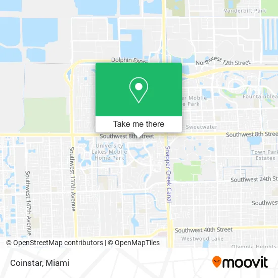
See Coinstar, Kendale Lakes-Tamiami, on the map
Public Transit to Coinstar in Kendale Lakes-Tamiami
Wondering how to get to Coinstar in Kendale Lakes-Tamiami? Moovit helps you find the best way to get to Coinstar with step-by-step directions from the nearest public transit station.
Moovit provides free maps and live directions to help you navigate through your city. View schedules, routes, timetables, and find out how long does it take to get to Coinstar in real time.
Looking for the nearest stop or station to Coinstar? Check out this list of stops closest to your destination: Sw 122 Av & Sw 10 St; Walsh Bd & Sw 5 St.
Bus: 8, 137.
Want to see if there’s another route that gets you there at an earlier time? Moovit helps you find alternative routes or times. Get directions from and directions to Coinstar easily from the Moovit App or Website.
We make riding to Coinstar easy, which is why over 1.5 million users, including users in Kendale Lakes-Tamiami, trust Moovit as the best app for public transit. You don’t need to download an individual bus app or train app, Moovit is your all-in-one transit app that helps you find the best bus time or train time available.
For information on prices of bus, costs and ride fares to Coinstar, please check the Moovit app.
Use the app to navigate to popular places including to the airport, hospital, stadium, grocery store, mall, coffee shop, school, college, and university.
Coinstar Address: 12254 SW 8th St Miami, FL 33184 street in Kendale Lakes-Tamiami
- Rene Mendez,
- Dulcinea Bakery and Cake Supply,
- Massages by Lourdes,
- Vicky's Banquet Hall,
- Valsan of Southwest,
- Master Superior Home Care Services,
- Building Services Unlm,
- Cute Puppies,
- An Image,
- La Casa del Alfarero,
- Excel Accounting G,
- 90 Millas,
- Alberto Rando sous MD,
- Terraza Cafeteria,
- Miami Fl,
- Medical Office Dr. Hilda Brito,
- La Bodega,
- Marana Travel,
- King Turf,
- The Family Barber Shop
Places Near Coinstar (Kendale Lakes-Tamiami)
- Miami Design District, Miami,
- Little Havana, Miami,
- Brickell City Centre, Miami,
- Keiser University Flagship Campus, West Palm Beach,
- Miami VA Hospital, Miami,
- Bayside Marketplace, Miami,
- Zoo Miami, Miami,
- Dolphin Mall Bus, Miami,
- Port of Miami Cruise Terminal, Miami,
- Miami-Dade County Courthouse, Miami,
- Aventura Mall, Miami Beach,
- Wynwood, Miami,
- Sawgrass Mall, Miami,
- Richard E. Gerstein Justice Building, Miami,
- Hard Rock Stadium, Miami Gardens,
- Dolphin Mall, Miami,
- Miami Freedom Park, Miami,
- Aventura Mall, Miami,
- Marlins Park, Miami,
- Sawgrass mall ( FL ), Miami Beach
How to get to popular places in Miami with public transit
Get around Kendale Lakes-Tamiami by public transit!
Traveling around Kendale Lakes-Tamiami has never been so easy. See step by step directions as you travel to any attraction, street or major public transit station. View bus and train schedules, arrival times, service alerts and detailed routes on a map, so you know exactly how to get to anywhere in Kendale Lakes-Tamiami.
When traveling to any destination around Kendale Lakes-Tamiami use Moovit's Live Directions with Get Off Notifications to know exactly where and how far to walk, how long to wait for your line, and how many stops are left. Moovit will alert you when it's time to get off — no need to constantly re-check whether yours is the next stop.
Wondering how to use public transit in Kendale Lakes-Tamiami or how to pay for public transit in Kendale Lakes-Tamiami? Moovit public transit app can help you navigate your way with public transit easily, and at minimum cost. It includes public transit fees, ticket prices, and costs. Looking for a map of Kendale Lakes-Tamiami public transit lines? Moovit public transit app shows all public transit maps in Kendale Lakes-Tamiami with all Bus, Train, Light Rail and Ferry routes and stops on an interactive map.
Miami has 4 transit type(s), including: Bus, Train, Light Rail and Ferry, operated by several transit agencies, including Broward County Transit, Miami-Dade Transit, Metrorail, Palm Tran, Tri-Rail, Brightline, MARTY, City of Homestead Trolley, Key West Transit, Treasure Coast Connector, GoLine IRT, Amtrak, Greyhound-us, FlixBus-us and Aventura Express Shuttle Bus