How to get to Coinstar by bus?
Click on the bus route to see step by step directions with maps, line arrival times and updated time schedules.
From NW 37th Ave, Miami
42 minFrom SR 826 Palmetto Expressway South, Hialeah
94 minFrom The Salvation Army, Miami
51 minFrom Miami Springs, FL, Miami
86 minFrom Florida International University-Biscayne Bay, Miami
46 minFrom Barbara Goleman Senior High, Hialeah
105 minFrom Ives Dairy Road & 441, Miami
63 minFrom Tropicana Flea Market, Miami
50 minFrom Florida International University-Biscayne Bay (FIU-Biscayne Bay), Miami
46 minFrom Hialeah-Miami Lakes Senior High School, Hialeah
79 min
How to get to Coinstar by train?
Click on the train route to see step by step directions with maps, line arrival times and updated time schedules.
Bus stops near Coinstar in Miami
Train station near Coinstar in Miami
- Opa-Locka Station, 18 min walk,VIEW
Bus lines to Coinstar in Miami
What are the closest stations to Coinstar?
The closest stations to Coinstar are:
- Top Value Plaza is 185 yards away, 3 min walk.
- Nw 27 Av & Wilmington St is 347 yards away, 5 min walk.
- Nw 27 Av & # 13831 (N/m) is 348 yards away, 5 min walk.
- Opa-Locka Blvd @ Nw27 Ave is 501 yards away, 7 min walk.
- Opa-Locka Station is 1475 yards away, 18 min walk.
Which bus lines stop near Coinstar?
These bus lines stop near Coinstar: 135, 27.
Which train line stops near Coinstar?
TRIRAIL (Northbound To Mangonia Park)
What’s the nearest train station to Coinstar in Miami?
The nearest train station to Coinstar in Miami is Opa-Locka Station. It’s a 18 min walk away.
What’s the nearest bus station to Coinstar in Miami?
The nearest bus station to Coinstar in Miami is Top Value Plaza. It’s a 3 min walk away.
What time is the first train to Coinstar in Miami?
The TRIRAIL is the first train that goes to Coinstar in Miami. It stops nearby at 4:02 AM.
What time is the last train to Coinstar in Miami?
The TRIRAIL is the last train that goes to Coinstar in Miami. It stops nearby at 10:29 PM.
What time is the first bus to Coinstar in Miami?
The 27 is the first bus that goes to Coinstar in Miami. It stops nearby at 3:00 AM.
What time is the last bus to Coinstar in Miami?
The 27 is the last bus that goes to Coinstar in Miami. It stops nearby at 3:03 AM.
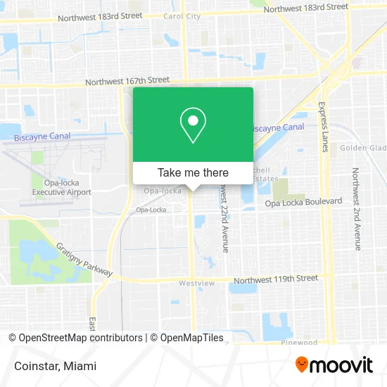
See Coinstar, Miami, on the map
Public Transit to Coinstar in Miami
Wondering how to get to Coinstar in Miami? Moovit helps you find the best way to get to Coinstar with step-by-step directions from the nearest public transit station.
Moovit provides free maps and live directions to help you navigate through your city. View schedules, routes, timetables, and find out how long does it take to get to Coinstar in real time.
Looking for the nearest stop or station to Coinstar? Check out this list of stops closest to your destination: Top Value Plaza; Nw 27 Av & Wilmington St; Nw 27 Av & # 13831 (N/m); Opa-Locka Blvd @ Nw27 Ave; Opa-Locka Station.
Bus: 135, 27, OPALKAN, OPALCKA.Train: TRIRAIL.
Want to see if there’s another route that gets you there at an earlier time? Moovit helps you find alternative routes or times. Get directions from and directions to Coinstar easily from the Moovit App or Website.
We make riding to Coinstar easy, which is why over 1.5 million users, including users in Miami, trust Moovit as the best app for public transit. You don’t need to download an individual bus app or train app, Moovit is your all-in-one transit app that helps you find the best bus time or train time available.
For information on prices of bus and train, costs and ride fares to Coinstar, please check the Moovit app.
Use the app to navigate to popular places including to the airport, hospital, stadium, grocery store, mall, coffee shop, school, college, and university.
Coinstar Address: 13931 NW 27th Ave Opa-Locka, FL 33054 street in Miami
- Amazon Locker-Zachi,
- Libertyx Bitcoin Cashier,
- ATM,
- Eli Li Jewelry,
- Aqua Laundry II,
- Opalocka Coin Laundry,
- Empire Enterprises USA Corporation,
- SBF Refinishing Company,
- Amazon Locker-Humid,
- Swagger Cutz,
- Bayahibe Restaurant,
- FCAA Banquet Hall,
- Crisscross Concrete,
- MoneyGram,
- Coral Cay BK,
- Super Stone, Inc,
- Murphy USA,
- Ysra Edme - Intuit Turbotax Verified Pro,
- G G Auto Service,
- Steps of Faith Impact Ministry
Places Near Coinstar (Miami)
- Richard E. Gerstein Justice Building, Miami,
- Hard Rock Stadium, Miami Gardens,
- Sawgrass Mall, Miami,
- Wynwood, Miami,
- Miami Design District, Miami,
- Miami VA Hospital, Miami,
- Miami-Dade County Courthouse, Miami,
- Little Havana, Miami,
- Bayside Marketplace, Miami,
- Miami Freedom Park, Miami,
- Dolphin Mall Bus, Miami,
- Keiser University Flagship Campus, West Palm Beach,
- Port of Miami Cruise Terminal, Miami,
- Dolphin Mall, Miami,
- Aventura Mall, Miami Beach,
- Sawgrass mall ( FL ), Miami Beach,
- Zoo Miami, Miami,
- Marlins Park, Miami,
- Aventura Mall, Miami,
- Brickell City Centre, Miami
How to get to popular places in Miami with public transit
Get around Miami by public transit!
Traveling around Miami has never been so easy. See step by step directions as you travel to any attraction, street or major public transit station. View bus and train schedules, arrival times, service alerts and detailed routes on a map, so you know exactly how to get to anywhere in Miami.
When traveling to any destination around Miami use Moovit's Live Directions with Get Off Notifications to know exactly where and how far to walk, how long to wait for your line, and how many stops are left. Moovit will alert you when it's time to get off — no need to constantly re-check whether yours is the next stop.
Wondering how to use public transit in Miami or how to pay for public transit in Miami? Moovit public transit app can help you navigate your way with public transit easily, and at minimum cost. It includes public transit fees, ticket prices, and costs. Looking for a map of Miami public transit lines? Moovit public transit app shows all public transit maps in Miami with all Bus, Train, Light Rail and Ferry routes and stops on an interactive map.
Miami has 4 transit type(s), including: Bus, Train, Light Rail and Ferry, operated by several transit agencies, including Broward County Transit, Miami-Dade Transit, Metrorail, Palm Tran, Tri-Rail, Brightline, MARTY, City of Homestead Trolley, Key West Transit, Treasure Coast Connector, GoLine IRT, Amtrak, Greyhound-us, FlixBus-us and Aventura Express Shuttle Bus