How to get to Coldwell Banker Financial Data by bus?
Click on the bus route to see step by step directions with maps, line arrival times and updated time schedules.
From Lake Worth, FL, Lake Worth
65 minFrom JFK Medical Center, Lake Worth
65 minFrom Palm Beach State College, Lake Worth
73 minFrom Lake Worth Tri Rail Station, Lake Worth
83 minFrom Greenacres, FL, Lake Worth
62 minFrom Ollie's Bargain Outlet, Boynton Beach-Delray Beach
31 minFrom I-95, Boynton Beach-Delray Beach
78 minFrom Somerset Academy Canyons Charter School, Sunshine Parkway
20 minFrom John I. Leonard High School, Lake Worth
56 minFrom Pretty in Palm Beach, Boynton Beach-Delray Beach
59 min
Bus stop near Coldwell Banker Financial Data in Boynton Beach-Delray Beach
- BOYNTON BCH BL at EL CLAIR RANCH RD, 9 min walk,VIEW
Bus lines to Coldwell Banker Financial Data in Boynton Beach-Delray Beach
- 73, Rt 73 Westbound,VIEW
What are the closest stations to Coldwell Banker Financial Data?
The closest stations to Coldwell Banker Financial Data are:
- BOYNTON BCH BL at EL CLAIR RANCH RD is 758 yards away, 9 min walk.
Which bus lines stop near Coldwell Banker Financial Data?
These bus lines stop near Coldwell Banker Financial Data: 3, 73.
What’s the nearest bus station to Coldwell Banker Financial Data in Boynton Beach-Delray Beach?
The nearest bus station to Coldwell Banker Financial Data in Boynton Beach-Delray Beach is BOYNTON BCH BL at EL CLAIR RANCH RD. It’s a 9 min walk away.
What time is the first bus to Coldwell Banker Financial Data in Boynton Beach-Delray Beach?
The 73 is the first bus that goes to Coldwell Banker Financial Data in Boynton Beach-Delray Beach. It stops nearby at 5:48 AM.
What time is the last bus to Coldwell Banker Financial Data in Boynton Beach-Delray Beach?
The 73 is the last bus that goes to Coldwell Banker Financial Data in Boynton Beach-Delray Beach. It stops nearby at 8:15 PM.
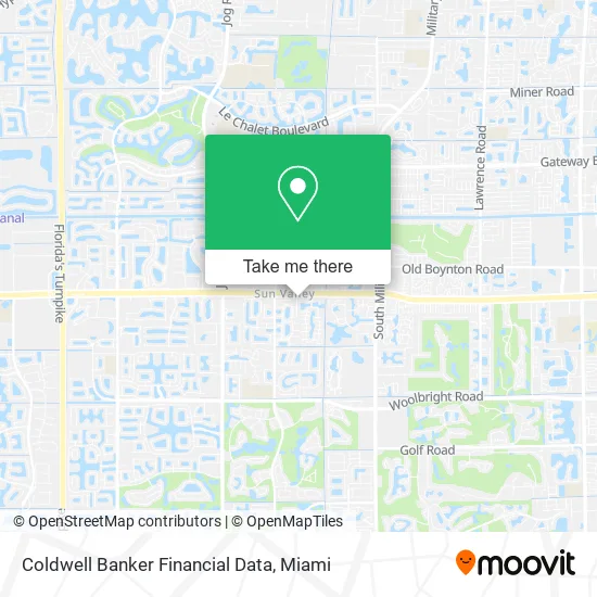
See Coldwell Banker Financial Data, Boynton Beach-Delray Beach, on the map
Public Transit to Coldwell Banker Financial Data in Boynton Beach-Delray Beach
Wondering how to get to Coldwell Banker Financial Data in Boynton Beach-Delray Beach? Moovit helps you find the best way to get to Coldwell Banker Financial Data with step-by-step directions from the nearest public transit station.
Moovit provides free maps and live directions to help you navigate through your city. View schedules, routes, timetables, and find out how long does it take to get to Coldwell Banker Financial Data in real time.
Looking for the nearest stop or station to Coldwell Banker Financial Data? Check out this list of stops closest to your destination: BOYNTON BCH BL at EL CLAIR RANCH RD.
Bus: 3, 73.
Want to see if there’s another route that gets you there at an earlier time? Moovit helps you find alternative routes or times. Get directions from and directions to Coldwell Banker Financial Data easily from the Moovit App or Website.
We make riding to Coldwell Banker Financial Data easy, which is why over 1.5 million users, including users in Boynton Beach-Delray Beach, trust Moovit as the best app for public transit. You don’t need to download an individual bus app or train app, Moovit is your all-in-one transit app that helps you find the best bus time or train time available.
For information on prices of bus and train, costs and ride fares to Coldwell Banker Financial Data, please check the Moovit app.
Use the app to navigate to popular places including to the airport, hospital, stadium, grocery store, mall, coffee shop, school, college, and university.
Coldwell Banker Financial Data Address: 10026 Andrea Ln Boynton Beach, FL 33437 street in Boynton Beach-Delray Beach
- Acaepi,
- Sun Valley, Florida,
- Boynton Beach Blvd. & El Clair Ranch Rd.,
- Maricarmen Quintero Dr,
- Personalized Orthopedics of the Palm Beaches,
- Mark J Rogovin do Faafp MD,
- Boynton Beach S & Real Estate for Sale,
- Execu Clean,
- Palm Beach Pediatrics,
- Trudell Doctor MD and Associates,
- M & M Provider Esolutions,
- The Club at Indian Lakes Tennis Office,
- Club at Indian Lakes Office,
- Kermes Interior Design,
- Hernan the Barber,
- Janorm Beauty,
- Boynton Beach S & Real Estate for Sale,
- Boca Lago Golf & Country Club,
- Banyan Springs Property Owners Association,
- Boynton Beach S & Real Estate for Sale
Places Near Coldwell Banker Financial Data (Boynton Beach-Delray Beach)
- Aventura Mall, Miami Beach,
- Dolphin Mall, Miami,
- Sawgrass Mall, Miami,
- Zoo Miami, Miami,
- Marlins Park, Miami,
- Richard E. Gerstein Justice Building, Miami,
- Bayside Marketplace, Miami,
- Dolphin Mall Bus, Miami,
- Wynwood, Miami,
- Hard Rock Stadium, Miami Gardens,
- Port of Miami Cruise Terminal, Miami,
- Miami Design District, Miami,
- Little Havana, Miami,
- Brickell City Centre, Miami,
- Miami VA Hospital, Miami,
- Keiser University Flagship Campus, West Palm Beach,
- Aventura Mall, Miami,
- Miami-Dade County Courthouse, Miami,
- Miami Freedom Park, Miami,
- Sawgrass mall ( FL ), Miami Beach
How to get to popular places in Miami with public transit
Get around Boynton Beach-Delray Beach by public transit!
Traveling around Boynton Beach-Delray Beach has never been so easy. See step by step directions as you travel to any attraction, street or major public transit station. View bus and train schedules, arrival times, service alerts and detailed routes on a map, so you know exactly how to get to anywhere in Boynton Beach-Delray Beach.
When traveling to any destination around Boynton Beach-Delray Beach use Moovit's Live Directions with Get Off Notifications to know exactly where and how far to walk, how long to wait for your line, and how many stops are left. Moovit will alert you when it's time to get off — no need to constantly re-check whether yours is the next stop.
Wondering how to use public transit in Boynton Beach-Delray Beach or how to pay for public transit in Boynton Beach-Delray Beach? Moovit public transit app can help you navigate your way with public transit easily, and at minimum cost. It includes public transit fees, ticket prices, and costs. Looking for a map of Boynton Beach-Delray Beach public transit lines? Moovit public transit app shows all public transit maps in Boynton Beach-Delray Beach with all Bus, Train, Light Rail and Ferry routes and stops on an interactive map.
Miami has 4 transit type(s), including: Bus, Train, Light Rail and Ferry, operated by several transit agencies, including Broward County Transit, Miami-Dade Transit, Metrorail, Palm Tran, Tri-Rail, Brightline, MARTY, City of Homestead Trolley, Key West Transit, Treasure Coast Connector, GoLine IRT, Amtrak, Greyhound-us, FlixBus-us and Aventura Express Shuttle Bus