How to get to Colegio Sarte Nascimento by bus?
Click on the bus route to see step by step directions with maps, line arrival times and updated time schedules.
From São João de Meriti, Nova Iguaçu
63 minFrom Bairro Amapá, Duque de Caxias, Duque De Caxias
119 minFrom Sítio H20, Duque De Caxias
126 minFrom Hospital da Posse (HGNI), Nova Iguaçu
48 minFrom Rua Estados Unidos 300, Nova Iguaçu
57 minFrom Avenida Nilo Peçanha, Nova Iguaçu
62 minFrom UFRRJ Nova Iguaçu, Nova Iguaçu
54 minFrom Ponto da Van Central x Roncalli, Belford Roxo
80 minFrom Sesc Nova Iguaçu, Nova Iguaçu
59 minFrom Hospital Estadual Dr. Ricardo Cruz, Nova Iguaçu
56 min
Bus stop near Colegio Sarte Nascimento in Nova Iguaçu
- Estrada Federal De Tinguá, 3699-3705, 1 min walk,VIEW
Bus lines to Colegio Sarte Nascimento in Nova Iguaçu
What are the closest stations to Colegio Sarte Nascimento?
The closest stations to Colegio Sarte Nascimento are:
- Estrada Federal De Tinguá, 3699-3705 is 38 meters away, 1 min walk.
Which bus lines stop near Colegio Sarte Nascimento?
These bus lines stop near Colegio Sarte Nascimento: 423I, 901.
What’s the nearest bus station to Colegio Sarte Nascimento in Nova Iguaçu?
The nearest bus station to Colegio Sarte Nascimento in Nova Iguaçu is Estrada Federal De Tinguá, 3699-3705. It’s a 1 min walk away.
What time is the first bus to Colegio Sarte Nascimento in Nova Iguaçu?
The 901 is the first bus that goes to Colegio Sarte Nascimento in Nova Iguaçu. It stops nearby at 3:46 AM.
What time is the last bus to Colegio Sarte Nascimento in Nova Iguaçu?
The 901 is the last bus that goes to Colegio Sarte Nascimento in Nova Iguaçu. It stops nearby at 1:51 AM.
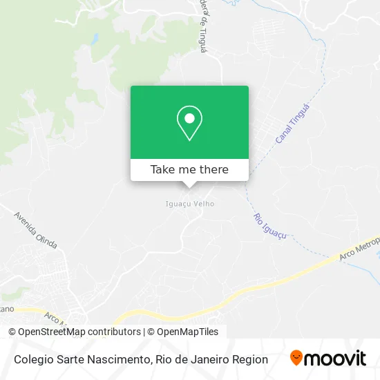
See Colegio Sarte Nascimento, Nova Iguaçu, on the map
Public Transit to Colegio Sarte Nascimento in Nova Iguaçu
Wondering how to get to Colegio Sarte Nascimento in Nova Iguaçu? Moovit helps you find the best way to get to Colegio Sarte Nascimento with step-by-step directions from the nearest public transit station.
Moovit provides free maps and live directions to help you navigate through your city. View schedules, routes, timetables, and find out how long does it take to get to Colegio Sarte Nascimento in real time.
Looking for the nearest stop or station to Colegio Sarte Nascimento? Check out this list of stops closest to your destination: Estrada Federal De Tinguá.
Bus: 423I, 901, 492B.
Want to see if there’s another route that gets you there at an earlier time? Moovit helps you find alternative routes or times. Get directions from and directions to Colegio Sarte Nascimento easily from the Moovit App or Website.
We make riding to Colegio Sarte Nascimento easy, which is why over 1.5 million users, including users in Nova Iguaçu, trust Moovit as the best app for public transit. You don’t need to download an individual bus app or train app, Moovit is your all-in-one transit app that helps you find the best bus time or train time available.
For information on prices of bus, costs and ride fares to Colegio Sarte Nascimento, please check the Moovit app.
Use the app to navigate to popular places including to the airport, hospital, stadium, grocery store, mall, coffee shop, school, college, and university.
Location: Nova Iguaçu, Rio de Janeiro Region
- Alameda Rio Cachimbal / Rua Tabelião Joaquim Lima Faria,
- Sitio Vitória,
- Avenida Barão de Tinguá 672,
- Bom Farma,
- Clínica de Neurologia e Eeg de Nova Iguaçu,
- Iguaçu Velho,
- Espaço Iguaçu Festas,
- Samara Gestão Multidisciplinar,
- Kaká Bazar,
- Rua Tenente Joaquim Pedro de Andrade,
- Rua Saldanha Da Gama,
- Rua Miguel Ferreira Lopes, 1,
- Pet Luxo,
- Estrada Zumbi dos Palmares, 1,
- Tingua Fazenda Cata Vento,
- Ej Kit Festas e Salgados,
- Primeira Igreja Batista Em Iguaçu - Pibig,
- Casa Silveira de Utilidades,
- Recreio Paço da Marambaia,
- Sitio do Velhinho Para Eventos
Places Near Colegio Sarte Nascimento (Nova Iguaçu)
- Avenida Venezuela 134, Saúde,
- Rua Ulysses Guimarães 16, Cidade Nova,
- Shopping Rio Sul, Botafogo,
- Rio De Janeiro,
- Shopping Nova América, Del Castilho,
- Feira Livre da Gloria, Glória,
- Shopping Downtown, Barra Da Tijuca,
- Rodoviária Novo Rio (Rodoviária do Rio de Janeiro), Santo Cristo,
- Avenida Rio Branco, Centro,
- Rua Licínio Cardoso, São Francisco Xavier,
- Shopping RioSul, Botafogo,
- Hospital Municipal Ronaldo Gazolla, Acari,
- Museu Do Amanhã, Centro,
- Norte Shopping, Cachambi,
- Feirão De Malhas, Duque De Caxias,
- Hospital Federal Do Andaraí, Andaraí,
- Hospital Federal Cardoso Fontes, Jacarepaguá,
- Praia do Arpoador, Ipanema,
- Niterói, Niterói,
- Hospital Pedro Ernesto, Vila Isabel
How to get to popular places in Rio de Janeiro Region with public transit
Get around Nova Iguaçu by public transit!
Traveling around Nova Iguaçu has never been so easy. See step by step directions as you travel to any attraction, street or major public transit station. View bus and train schedules, arrival times, service alerts and detailed routes on a map, so you know exactly how to get to anywhere in Nova Iguaçu.
When traveling to any destination around Nova Iguaçu use Moovit's Live Directions with Get Off Notifications to know exactly where and how far to walk, how long to wait for your line, and how many stops are left. Moovit will alert you when it's time to get off — no need to constantly re-check whether yours is the next stop.
Wondering how to use public transit in Nova Iguaçu or how to pay for public transit in Nova Iguaçu? Moovit public transit app can help you navigate your way with public transit easily, and at minimum cost. It includes public transit fees, ticket prices, and costs. Looking for a map of Nova Iguaçu public transit lines? Moovit public transit app shows all public transit maps in Nova Iguaçu with all Bus, Train, Metro, Light Rail, Ferry, Cable Car, Gondola and Funicular routes and stops on an interactive map.
Rio de Janeiro Region has 8 transit type(s), including: Bus, Train, Metro, Light Rail, Ferry, Cable Car, Gondola and Funicular, operated by several transit agencies, including TrensRJ, Metrô Rio, VLT Carioca, Barcas Rio, BRT MOBI-Rio, Auto Viação Alpha, Auto Viação Tijuca, Gire Transportes, Transurb, Viação Nossa Senhora das Graças, Consórcio INTERSUL, Braso Lisboa (Municipal), Caprichosa Auto Ônibus, Auto Viação Três Amigos and Rodoviária Âncora Matias