How to get to Coletti Claudio by bus?
Click on the bus route to see step by step directions with maps, line arrival times and updated time schedules.
From Radicofani, Union of Municipalities of Amiata Val d'Orcia
85 minFrom San Donato-Emergency Room, Arezzo
129 minFrom Valdichiana Outlet Village, Foiano Della Chiana
90 minFrom Abbadia San Salvatore, Union of Municipalities of Amiata Val d'Orcia
81 minFrom San Zeno, Arezzo
129 minFrom Arezzo Equestrian Center, Arezzo
123 minFrom Rapolano Terme, Rapolano Terme
103 minFrom Piancastagnaio, Piancastagnaio
87 minFrom Antica Querciolaia Thermal Baths, Rapolano Terme
116 min
Bus stops near Coletti Claudio in Montepulciano
Bus lines to Coletti Claudio in Montepulciano
What are the closest stations to Coletti Claudio?
The closest stations to Coletti Claudio are:
- Via Dell'Opio Nel Corso, 38 is 86 meters away, 2 min walk.
- Porta Delle Farine is 159 meters away, 3 min walk.
Which bus lines stop near Coletti Claudio?
These bus lines stop near Coletti Claudio: 139, B22, FT4, FT5, ST3, T4B.
What’s the nearest bus station to Coletti Claudio in Montepulciano?
The nearest bus station to Coletti Claudio in Montepulciano is Via Dell'Opio Nel Corso, 38. It’s a 2 min walk away.
What time is the first bus to Coletti Claudio in Montepulciano?
The T4B is the first bus that goes to Coletti Claudio in Montepulciano. It stops nearby at 9:41 AM.
What time is the last bus to Coletti Claudio in Montepulciano?
The FT1 is the last bus that goes to Coletti Claudio in Montepulciano. It stops nearby at 7:12 PM.
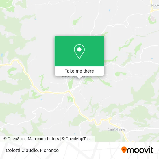
See Coletti Claudio, Montepulciano, on the map
Public Transit to Coletti Claudio in Montepulciano
Wondering how to get to Coletti Claudio in Montepulciano? Moovit helps you find the best way to get to Coletti Claudio with step-by-step directions from the nearest public transit station.
Moovit provides free maps and live directions to help you navigate through your city. View schedules, routes, timetables, and find out how long does it take to get to Coletti Claudio in real time.
Looking for the nearest stop or station to Coletti Claudio? Check out this list of stops closest to your destination: Via Dell'Opio Nel Corso; Porta Delle Farine.
Bus: 139, B22, FT4, FT5, ST3, T4B, FT1, 112, 112.
Want to see if there’s another route that gets you there at an earlier time? Moovit helps you find alternative routes or times. Get directions from and directions to Coletti Claudio easily from the Moovit App or Website.
We make riding to Coletti Claudio easy, which is why over 1.5 million users, including users in Montepulciano, trust Moovit as the best app for public transit. You don’t need to download an individual bus app or train app, Moovit is your all-in-one transit app that helps you find the best bus time or train time available.
For information on prices of bus and train, costs and ride fares to Coletti Claudio, please check the Moovit app.
Use the app to navigate to popular places including to the airport, hospital, stadium, grocery store, mall, coffee shop, school, college, and university.
Coletti Claudio Address: Via dell'Opio nel Corso, 7 53045 Montepulciano street in Montepulciano
- Uscio e Bottega by Pisanzio Alessandra,
- Verderame by Marta Fortunati,
- Opio Seven,
- Bread and Tulips,
- Bae Ceramics by Roberta Rocchi,
- Gessica La Pira,
- Gessica la Pira Artist - The Ladies Gallery,
- Carletti Historic House,
- Franco Garosi,
- Artistic Mosaic Workshop by Mazzetti Albo,
- W Trade by Crociani Enrico,
- New Poliziani,
- Voice Research Center,
- Cagnano Trattoria Restaurant,
- Meublé Evoè & Dimora del Corso,
- Di Cagnano,
- Civico 34 Clothing,
- Dr. Giancarlo d'Avanzo,
- School District 47,
- Meublè Evoè
Places Near Coletti Claudio (Montepulciano)
- Tobacco Manufacture, Florence,
- Torregalli Hospital Scandicci *, Scandicci,
- Piero Palagi Hospital Facility-Florence, Florence,
- Michelangelo Square, Florence,
- Mandela Forum (Nelson Mandela Forum), Florence,
- Verdi Theater, Florence,
- I Gigli, Campi Bisenzio,
- Wanny Palace, Florence,
- IKEA Florence, Sesto Fiorentino,
- Field of Mars, Florence,
- Viola Park, Bagno a Ripoli,
- Asmana, Campi Bisenzio,
- Michelangelo Square, Florence,
- Artemio Franchi Municipal Stadium, Florence,
- Nelson Mandela Forum, Florence,
- Campi Bisenzio, Campi Bisenzio,
- OOO, Florence,
- Cascine Park, Florence,
- Santa Maria Nuova Hospital, Florence,
- Santa Maria Novella Station, Florence
How to get to popular places in Florence with public transit
Get around Montepulciano by public transit!
Traveling around Montepulciano has never been so easy. See step by step directions as you travel to any attraction, street or major public transit station. View bus and train schedules, arrival times, service alerts and detailed routes on a map, so you know exactly how to get to anywhere in Montepulciano.
When traveling to any destination around Montepulciano use Moovit's Live Directions with Get Off Notifications to know exactly where and how far to walk, how long to wait for your line, and how many stops are left. Moovit will alert you when it's time to get off — no need to constantly re-check whether yours is the next stop.
Wondering how to use public transit in Montepulciano or how to pay for public transit in Montepulciano? Moovit public transit app can help you navigate your way with public transit easily, and at minimum cost. It includes public transit fees, ticket prices, and costs. Looking for a map of Montepulciano public transit lines? Moovit public transit app shows all public transit maps in Montepulciano with all Bus, Train, Light Rail, Ferry and Funicular routes and stops on an interactive map.
Florence has 5 transit type(s), including: Bus, Train, Light Rail, Ferry and Funicular, operated by several transit agencies, including Florence Urban - Tuscan Bus Lines, GEST, Florence and Province - Tuscan Bus Lines, Livorno and Province - Tuscan Bus Lines, Arezzo, Florence and Provinces - Tuscan Bus Lines, Prato and Province - Tuscan Bus Lines, Massa, Carrara and Province - Tuscan Bus Lines, Pisa and Province - Tuscan Bus Lines, Grosseto, Siena and Provinces - Tuscan Bus Lines, Arezzo, Siena and Provinces - Tuscan Bus Lines, Pistoia and Province - Tuscan Bus Lines, Siena and Province - Tuscan Bus Lines, Arezzo and Province - Tuscan Bus Lines, Lucca and Province - Tuscan Bus Lines and Trenitalia