How to get to Collab by bus?
Click on the bus route to see step by step directions with maps, line arrival times and updated time schedules.
From TERRA Environmental Research Institute, Kendale Lakes-Tamiami
70 minFrom Four Seasons Hotel Miami, Miami
77 minFrom Sawgrass Mall, Miami
74 minFrom SW 8th St / SW 62nd Ave, Miami
69 minFrom Calle Ocho, Miami
111 minFrom Casa, Miami
51 minFrom Hampton Inn Suites by Hilton Miami Downtown Brickell, Miami
88 minFrom Hampton Inn & Suites by Hilton - Miami/Brickell-Downtown, Miami
88 minFrom Jose Marti Park, Miami
106 minFrom Southwest Miami Senior High School, South Westside
40 min
How to get to Collab by train?
Click on the train route to see step by step directions with maps, line arrival times and updated time schedules.
Bus stops near Collab in Miami
Train station near Collab in Miami
- South Miami, 5 min walk,VIEW
Bus lines to Collab in Miami
What are the closest stations to Collab?
The closest stations to Collab are:
- Ponce De Leon Bd & S Alhambra Cr is 312 yards away, 4 min walk.
- South Miami is 376 yards away, 5 min walk.
- Ponce De Leon Bd & Dickenson Dr is 399 yards away, 5 min walk.
- University Metrorail Station is 600 yards away, 8 min walk.
Which bus lines stop near Collab?
These bus lines stop near Collab: 37, 56, 57, 72, 73.
Which train lines stop near Collab?
These train lines stop near Collab: GREEN, ORANGE.
What’s the nearest train station to Collab in Miami?
The nearest train station to Collab in Miami is South Miami. It’s a 5 min walk away.
What’s the nearest bus station to Collab in Miami?
The nearest bus station to Collab in Miami is Ponce De Leon Bd & S Alhambra Cr. It’s a 4 min walk away.
What time is the first train to Collab in Miami?
The GREEN is the first train that goes to Collab in Miami. It stops nearby at 5:02 AM.
What time is the last train to Collab in Miami?
The GREEN is the last train that goes to Collab in Miami. It stops nearby at 1:04 AM.
What time is the first bus to Collab in Miami?
The 400 is the first bus that goes to Collab in Miami. It stops nearby at 3:22 AM.
What time is the last bus to Collab in Miami?
The 400 is the last bus that goes to Collab in Miami. It stops nearby at 2:35 AM.
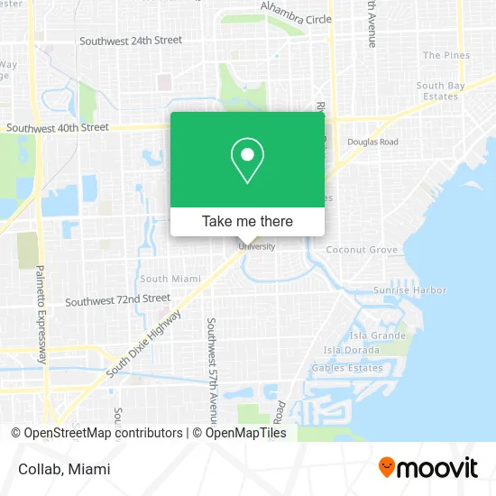
See Collab, Miami, on the map
Public Transit to Collab in Miami
Wondering how to get to Collab in Miami? Moovit helps you find the best way to get to Collab with step-by-step directions from the nearest public transit station.
Moovit provides free maps and live directions to help you navigate through your city. View schedules, routes, timetables, and find out how long does it take to get to Collab in real time.
Looking for the nearest stop or station to Collab? Check out this list of stops closest to your destination: Ponce De Leon Bd & S Alhambra Cr; South Miami; Ponce De Leon Bd & Dickenson Dr; University Metrorail Station.
Bus: 37, 56, 57, 72, 73, CGABDT, 400.Train: GREEN, ORANGE.
Want to see if there’s another route that gets you there at an earlier time? Moovit helps you find alternative routes or times. Get directions from and directions to Collab easily from the Moovit App or Website.
We make riding to Collab easy, which is why over 1.5 million users, including users in Miami, trust Moovit as the best app for public transit. You don’t need to download an individual bus app or train app, Moovit is your all-in-one transit app that helps you find the best bus time or train time available.
For information on prices of bus, train and light rail, costs and ride fares to Collab, please check the Moovit app.
Use the app to navigate to popular places including to the airport, hospital, stadium, grocery store, mall, coffee shop, school, college, and university.
Collab Address: 1350 S Dixie Hwy Miami, FL 33146 street in Miami
- LPC Paseo de la Riv T,
- White Rose Wax & B,
- Dr. Rebecca Lenard : All Smiles Pediatric Dentistry,
- J'Nat Hair Studio,
- Shasta Destination Skin,
- Skinglo Spa,
- The Lux Lash,
- Hydrology Wellness,
- Thesis Hotel Miami,
- Florida Natural Medicine,
- Goodwill,
- University Of Miami Health Center,
- Birlidis V Properties,
- Paul Martin, MD,
- Miami BCM,
- University of Miami Farmers Market,
- B & L Advertising,
- Marca Hispanic,
- Bascom Palmer Eye Ap,
- Erik X Alonso
Places Near Collab (Miami)
- Miami Freedom Park, Miami,
- Hard Rock Stadium, Miami Gardens,
- Aventura Mall, Miami,
- Little Havana, Miami,
- Miami Design District, Miami,
- Zoo Miami, Miami,
- Brickell City Centre, Miami,
- Aventura Mall, Miami Beach,
- Dolphin Mall Bus, Miami,
- Sawgrass mall ( FL ), Miami Beach,
- Wynwood, Miami,
- Richard E. Gerstein Justice Building, Miami,
- Dolphin Mall, Miami,
- Sawgrass Mall, Miami,
- Port of Miami Cruise Terminal, Miami,
- Miami VA Hospital, Miami,
- Marlins Park, Miami,
- Miami-Dade County Courthouse, Miami,
- Bayside Marketplace, Miami,
- Keiser University Flagship Campus, West Palm Beach
How to get to popular places in Miami with public transit
Get around Miami by public transit!
Traveling around Miami has never been so easy. See step by step directions as you travel to any attraction, street or major public transit station. View bus and train schedules, arrival times, service alerts and detailed routes on a map, so you know exactly how to get to anywhere in Miami.
When traveling to any destination around Miami use Moovit's Live Directions with Get Off Notifications to know exactly where and how far to walk, how long to wait for your line, and how many stops are left. Moovit will alert you when it's time to get off — no need to constantly re-check whether yours is the next stop.
Wondering how to use public transit in Miami or how to pay for public transit in Miami? Moovit public transit app can help you navigate your way with public transit easily, and at minimum cost. It includes public transit fees, ticket prices, and costs. Looking for a map of Miami public transit lines? Moovit public transit app shows all public transit maps in Miami with all Bus, Train, Light Rail and Ferry routes and stops on an interactive map.
Miami has 4 transit type(s), including: Bus, Train, Light Rail and Ferry, operated by several transit agencies, including Broward County Transit, Miami-Dade Transit, Metrorail, Palm Tran, Tri-Rail, Brightline, MARTY, City of Homestead Trolley, Key West Transit, Treasure Coast Connector, GoLine IRT, Amtrak, Greyhound-us, FlixBus-us and Aventura Express Shuttle Bus