How to get to Colle by bus?
Click on the bus route to see step by step directions with maps, line arrival times and updated time schedules.
From Saltocchio, Lucca
379 minFrom Tonfano, Pietrasanta
111 minFrom Pescia Hospital, Pescia
298 minFrom Cisanello Hospital, Pisa
350 minFrom Ship, Lucca
161 minFrom CEP, Pisa
351 minFrom Sixth Door, Pisa
287 minFrom Chini-Michelangelo Institute, Camaiore
88 minFrom Porta Nuova Educational Center, Pisa
286 minFrom Mathematics Department, Pisa
284 min
Which bus lines stop near Colle?
These bus lines stop near Colle: E28, E40.
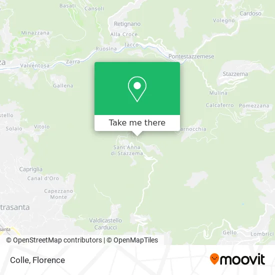
See Colle, Stazzema, on the map
Public Transit to Colle in Stazzema
Wondering how to get to Colle in Stazzema? Moovit helps you find the best way to get to Colle with step-by-step directions from the nearest public transit station.
Moovit provides free maps and live directions to help you navigate through your city. View schedules, routes, timetables, and find out how long does it take to get to Colle in real time.
Bus: E28, E40.
Want to see if there’s another route that gets you there at an earlier time? Moovit helps you find alternative routes or times. Get directions from and directions to Colle easily from the Moovit App or Website.
We make riding to Colle easy, which is why over 1.5 million users, including users in Stazzema, trust Moovit as the best app for public transit. You don’t need to download an individual bus app or train app, Moovit is your all-in-one transit app that helps you find the best bus time or train time available.
For information on prices of bus and train, costs and ride fares to Colle, please check the Moovit app.
Use the app to navigate to popular places including to the airport, hospital, stadium, grocery store, mall, coffee shop, school, college, and university.
Colle Address: Duilio Pieri Street street in Stazzema
- Sant'Anna Stazzema,
- Sant'Anna,
- Sant'Anna Church of Stazzema,
- Gamba Grocery Bar,
- Sant'Anna di Stazzema,
- Sant'Anna di Stazzema Historical Museum,
- Historical Museum of Resistance,
- Stazzema Municipality,
- Ossuary,
- Belvedere Pizzo Vallecava,
- Le Basse of Monte Arsiccio,
- Il Cannone,
- Public Schools,
- Cultural Center S. Frediano Club,
- Magnificent Tordello Festival of Farnocchia,
- Archeomineral Site of Calcaferro,
- The Cradle,
- Eurocasa Real Estate by Laura Guidi,
- Montebello Castle,
- Bertagna Technical Studio
Places Near Colle (Stazzema)
- I Gigli, Campi Bisenzio,
- Michelangelo Square, Florence,
- Piero Palagi Hospital Facility-Florence, Florence,
- Cascine Park, Florence,
- Asmana, Campi Bisenzio,
- Viola Park, Bagno a Ripoli,
- Santa Maria Nuova Hospital, Florence,
- Tobacco Manufacture, Florence,
- Michelangelo Square, Florence,
- Artemio Franchi Municipal Stadium, Florence,
- Field of Mars, Florence,
- OOO, Florence,
- Nelson Mandela Forum, Florence,
- Campi Bisenzio, Campi Bisenzio,
- Santa Maria Novella Station, Florence,
- Verdi Theater, Florence,
- Mandela Forum (Nelson Mandela Forum), Florence,
- Wanny Palace, Florence,
- IKEA Florence, Sesto Fiorentino,
- Torregalli Hospital Scandicci *, Scandicci
How to get to popular places in Florence with public transit
Get around Stazzema by public transit!
Traveling around Stazzema has never been so easy. See step by step directions as you travel to any attraction, street or major public transit station. View bus and train schedules, arrival times, service alerts and detailed routes on a map, so you know exactly how to get to anywhere in Stazzema.
When traveling to any destination around Stazzema use Moovit's Live Directions with Get Off Notifications to know exactly where and how far to walk, how long to wait for your line, and how many stops are left. Moovit will alert you when it's time to get off — no need to constantly re-check whether yours is the next stop.
Wondering how to use public transit in Stazzema or how to pay for public transit in Stazzema? Moovit public transit app can help you navigate your way with public transit easily, and at minimum cost. It includes public transit fees, ticket prices, and costs. Looking for a map of Stazzema public transit lines? Moovit public transit app shows all public transit maps in Stazzema with all Bus, Train, Light Rail, Ferry and Funicular routes and stops on an interactive map.
Florence has 5 transit type(s), including: Bus, Train, Light Rail, Ferry and Funicular, operated by several transit agencies, including Florence Urban - Tuscan Bus Lines, GEST, Florence and Province - Tuscan Bus Lines, Livorno and Province - Tuscan Bus Lines, Arezzo, Florence and Provinces - Tuscan Bus Lines, Prato and Province - Tuscan Bus Lines, Massa, Carrara and Province - Tuscan Bus Lines, Pisa and Province - Tuscan Bus Lines, Grosseto, Siena and Provinces - Tuscan Bus Lines, Arezzo, Siena and Provinces - Tuscan Bus Lines, Pistoia and Province - Tuscan Bus Lines, Siena and Province - Tuscan Bus Lines, Arezzo and Province - Tuscan Bus Lines, Lucca and Province - Tuscan Bus Lines and Trenitalia