How to get to Colmant by bus?
Click on the bus route to see step by step directions with maps, line arrival times and updated time schedules.
From Goldberg, Großbottwar
118 minFrom Kaufland, Vereinbarte Verwaltungsgemeinschaft Der Stadt Bietigheim-Bissingen
69 minFrom Pflanzen Mauk, Verwaltungsgemeinschaft Lauffen am Neckar
99 minFrom Breuningerland, Ludwigsburg
154 minFrom Steinheim an der Murr, Gemeindeverwaltungsverband Steinheim-Murr
73 minFrom Breuningerland Ludwigsburg, Ludwigsburg
153 minFrom Heilbronner Straße 86, Verwaltungsgemeinschaft Brackenheim
101 minFrom Breuninger im Breuningerland, Ludwigsburg
153 minFrom Schlosshotel Monrepos Ludwigsburg, Ludwigsburg
159 minFrom OBI, Vereinbarte Verwaltungsgemeinschaft Der Stadt Bietigheim-Bissingen
88 min
How to get to Colmant by train?
Click on the train route to see step by step directions with maps, line arrival times and updated time schedules.
Bus stops near Colmant in Gemeindeverwaltungsverband Besigheim
Train stations near Colmant in Gemeindeverwaltungsverband Besigheim
- Kirchheim (N), 35 min walk,VIEW
Bus lines to Colmant in Gemeindeverwaltungsverband Besigheim
- 573, Ottmarsheim Carl-Zeiss-Str.,VIEW
- 573, Gemmrigheim Adlerweg,VIEW
- 568A, Besigheim Jahnstraße,VIEW
- 574A, Walheim Bf,VIEW
- N58, Bietigheim Zob,VIEW
- 574A, Gemmrigh. Niedere Klinge,VIEW
- 568A, Besigheim Bf Bstg 2 - Besigheim Jahnstraße,VIEW
- N58, Bietigheim ZOB Bstg 7 - Bietigheim ZOB Bstg 7,VIEW
- N58, Bietigheim ZOB Bstg 8 - Bietigheim ZOB Bstg 8,VIEW
- 574, Besigheim Jahnstraße,VIEW
- 574, Bönnigheim Burgplatz,VIEW
What are the closest stations to Colmant?
The closest stations to Colmant are:
- Gemmrigheim Amselweg is 173 meters away, 3 min walk.
- Gemmrigh. Niedere Klinge is 684 meters away, 9 min walk.
- Gemmrigheim Fährgergasse is 1009 meters away, 14 min walk.
- Kirchheim (N) is 2675 meters away, 35 min walk.
Which bus lines stop near Colmant?
These bus lines stop near Colmant: 459, 573, 574, 646.
Which train line stops near Colmant?
MEX12 (Heilbronn Hbf)
What’s the nearest bus station to Colmant in Gemeindeverwaltungsverband Besigheim?
The nearest bus station to Colmant in Gemeindeverwaltungsverband Besigheim is Gemmrigheim Amselweg. It’s a 3 min walk away.
What time is the first train to Colmant in Gemeindeverwaltungsverband Besigheim?
The MEX18 is the first train that goes to Colmant in Gemeindeverwaltungsverband Besigheim. It stops nearby at 4:43 AM.
What time is the last train to Colmant in Gemeindeverwaltungsverband Besigheim?
The MEX12 is the last train that goes to Colmant in Gemeindeverwaltungsverband Besigheim. It stops nearby at 12:47 AM.
What time is the first bus to Colmant in Gemeindeverwaltungsverband Besigheim?
The 574 is the first bus that goes to Colmant in Gemeindeverwaltungsverband Besigheim. It stops nearby at 5:40 AM.
What time is the last bus to Colmant in Gemeindeverwaltungsverband Besigheim?
The 574 is the last bus that goes to Colmant in Gemeindeverwaltungsverband Besigheim. It stops nearby at 9:53 PM.
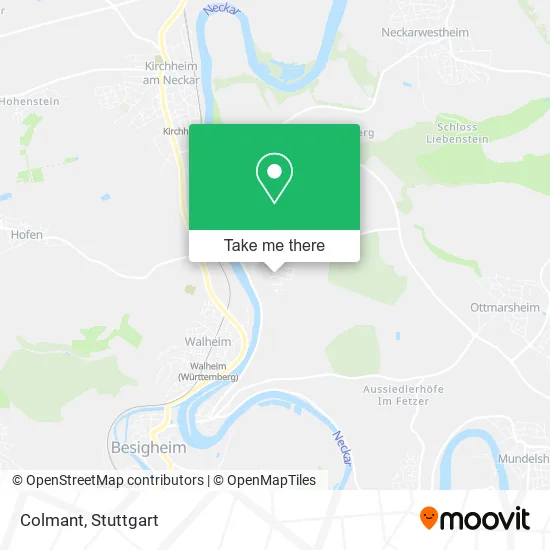
See Colmant, Gemeindeverwaltungsverband Besigheim, on the map
Public Transit to Colmant in Gemeindeverwaltungsverband Besigheim
Wondering how to get to Colmant in Gemeindeverwaltungsverband Besigheim? Moovit helps you find the best way to get to Colmant with step-by-step directions from the nearest public transit station.
Moovit provides free maps and live directions to help you navigate through your city. View schedules, routes, timetables, and find out how long does it take to get to Colmant in real time.
Looking for the nearest stop or station to Colmant? Check out this list of stops closest to your destination: Gemmrigheim Amselweg; Gemmrigh. Niedere Klinge; Gemmrigheim Fährgergasse; Kirchheim (N).
Bus: 459, 573, 574, 646, 568A, 574A, N58, 574A.Train: MEX12, RB8, MEX18, RE8, MEX18.
Want to see if there’s another route that gets you there at an earlier time? Moovit helps you find alternative routes or times. Get directions from and directions to Colmant easily from the Moovit App or Website.
We make riding to Colmant easy, which is why over 1.5 million users, including users in Gemeindeverwaltungsverband Besigheim, trust Moovit as the best app for public transit. You don’t need to download an individual bus app or train app, Moovit is your all-in-one transit app that helps you find the best bus time or train time available.
For information on prices of bus and train, costs and ride fares to Colmant, please check the Moovit app.
Use the app to navigate to popular places including to the airport, hospital, stadium, grocery store, mall, coffee shop, school, college, and university.
Colmant Address: Fasanenweg 12 74376 Gemmrigheim street in Gemeindeverwaltungsverband Besigheim
- Emma's Mobiles Kaffeecatering,
- Tino Metz,
- Emmas Mobiles Kaffeecatering Inh. Tino Metz,
- Wolfgang Bauer,
- Sonnenhof,
- Dr. med. Ralph-M. Schulte,
- Silvi die Haushaltshilfe,
- Aleksandra Mayer,
- Anna-Lea Popp,
- Schober It,
- Fischer Maschinenbau,
- Helpona Pflege,
- Wörner,
- Landesverband Nordrhein-Westfalen,
- Korny Tattoo,
- Hammerl,
- Folien und Noppenmatten,
- Bellezza,
- Reifenpannen d,
- Immo-Lb Immobilienvermittlung Petra Eisenmann
Places Near Colmant (Gemeindeverwaltungsverband Besigheim)
- Geilhaus Haus 33a, Reutlingen-Betzingen,
- Hauptbahnhof Stuttgart, Stuttgart-Mitte,
- Mercedes-Benz Museum (Mercedes Museum Stuttgart), Bad Cannstatt,
- SI-Centrum, Möhringen,
- Wilhelma (U-Bahn Wilhelma), Bad Cannstatt,
- Hanns-Martin-Schleyer-Halle, Bad Cannstatt,
- Mettingen Eros-Center Puff Laufhaus, Esslingen Am Neckar,
- Hanns-Martin-Schleyer-Halle (Stuttgart Hans-Martin-Schleyerhalle), Bad Cannstatt,
- Marmorsaal Im Weissenburgpark, Stuttgart-Süd,
- Pariser Platz Stuttgart, Stuttgart-Mitte,
- Im Wizemann (Halle), Bad Cannstatt,
- Klinikum Stuttgart - Katharinenhospital, Stuttgart-Mitte,
- Porsche-Arena, Bad Cannstatt,
- Schleyerhalle, Bad Cannstatt,
- Gasometer Pforzheim, Pforzheim,
- FlixBus Haltestelle, Stuttgart,
- Mercedes-Benz Museum, Bad Cannstatt,
- Waldfriedhof, Degerloch,
- Gleis 101/102 (tief), Stuttgart-Mitte,
- Porsche Museum, Zuffenhausen
How to get to popular places in Stuttgart with public transit
Get around Gemeindeverwaltungsverband Besigheim by public transit!
Traveling around Gemeindeverwaltungsverband Besigheim has never been so easy. See step by step directions as you travel to any attraction, street or major public transit station. View bus and train schedules, arrival times, service alerts and detailed routes on a map, so you know exactly how to get to anywhere in Gemeindeverwaltungsverband Besigheim.
When traveling to any destination around Gemeindeverwaltungsverband Besigheim use Moovit's Live Directions with Get Off Notifications to know exactly where and how far to walk, how long to wait for your line, and how many stops are left. Moovit will alert you when it's time to get off — no need to constantly re-check whether yours is the next stop.
Wondering how to use public transit in Gemeindeverwaltungsverband Besigheim or how to pay for public transit in Gemeindeverwaltungsverband Besigheim? Moovit public transit app can help you navigate your way with public transit easily, and at minimum cost. It includes public transit fees, ticket prices, and costs. Looking for a map of Gemeindeverwaltungsverband Besigheim public transit lines? Moovit public transit app shows all public transit maps in Gemeindeverwaltungsverband Besigheim with all Bus, Train, Subway, Light Rail, Ferry, S-Bahn and Funicular routes and stops on an interactive map.
Stuttgart has 7 transit type(s), including: Bus, Train, Subway, Light Rail, Ferry, S-Bahn and Funicular, operated by several transit agencies, including SSB - Stadtbahn, SSB, SSB - Seilbahn / Zacke, S-Bahn Stuttgart, Rhein-Neckar-Verkehr GmbH (rnv), Karlsruher Verkehrsverbund, DB AG, DB Regiobus BW, Arverio Baden-Württemberg GmbH, DB RegioNetz Verkehrs GmbH Westfrankenbahn, DB Regio AG Baden-Württemberg, Südwestdeutsche Verkehrs-AG, DB Regio AG Mitte Region Hessen, DB and Bodensee-Oberschwaben-Bahn