Directions to Color Tile (Harrisonburg) with public transportation
The following transit lines have routes that pass near Color Tile
 Bus: BRCC NORTH, 1, 1-B, EXT 1, 2.
Bus stops near Color Tile in Harrisonburg
Bus lines to Color Tile in Harrisonburg
- 1, Route 1,VIEW
- 1-B, Route 1-B,VIEW
- EXT 1, Extended Route 1,VIEW
- 2, Route 2,VIEW
- 2-B, Route 2-B,VIEW
- EXT 2, Extended Route 2,VIEW
- 3, Route 3,VIEW
- 3-B, Route 3-B,VIEW
- EXT 3, Extended Route 3,VIEW
- 5, Route 5,VIEW
- 5-B, Route 5-B,VIEW
- EXT 5, Extended Route 5,VIEW
- 6, Route 6,VIEW
- 6-B, Route 6-B,VIEW
- EXT 6, Extended Route 6,VIEW
- SHOP, JMU Sunday Shopper,VIEW
- SHOP, JMU Shopper,VIEW
- BLACK, JMU Black Line,VIEW
- BLUE, JMU Blue Line,VIEW
- GOLD, JMU Gold (Weekdays),VIEW
- Tacos El Primo,
- Uglybug Termite and Pest Control,
- Dennis (Master Barber),
- Kangnam Style,
- Hernandez Fashions,
- Reservoir Street & College Station,
- Harrisonburg Health & Rehabilitation Center,
- Mfa Centers,
- Neff Ginger LPC,
- Phillips Allen D DDS,
- Harrisonburg Center for Healing,
- Ava Care of Harrisonburg,
- Ava Care for You,
- Harrisonburg Pregnancy Center,
- Macrosoft.Com,
- Heating & Cooling Repair Near Me,
- Veterans Administration Outpatient Clinic,
- Sentara Home Care Services,
- Davita - Harrisonburg Dialysis,
- Hardee's
Places Near Color Tile (Harrisonburg)
- M&T Bank Stadium, Baltimore,
- Westfield Montgomery Mall, Montgomery County,
- National Theatre, Washington,
- Rock Creek Tennis Center, Washington,
- Washington National Cathedral, Washington,
- The Anthem, Washington,
- National Zoo, Washington,
- Georgetown, Washington,
- Amazon Hq2, Arlington County,
- Warner Theatre, Washington,
- Washington DC VA Medical Center, Washington,
- Capital One Arena, Washington,
- Museum Of The Bible, Washington,
- Pennsylvania Ave NW (3rd st and pennsylvania), Washington,
- PG Mall, Prince George's County,
- Sibley Memorial Hospital, Washington,
- Camden Yards, Baltimore,
- National Museum of African American History and Culture, Washington,
- Marriott Marquis Washington, DC, Washington,
- Basilica of the National Shrine, Washington
How to get to popular places in Washington, D.C. - Baltimore, MD with public transit
What are the closest stations to Color Tile?
The closest stations to Color Tile are:
- Carlton St. @ Cloverleaf Shopping Center is 180 yards away, 3 min walk.
- East Market St. @ Cloverleaf Shopping Center (Shelter) is 280 yards away, 4 min walk.
- Reservoir St. @ Holly Ct. is 585 yards away, 8 min walk.
- Harrisonburg Crossing @ Walmart (Shelter) is 910 yards away, 11 min walk.
- Carrier Dr. @ Festival (Shelter) is 1228 yards away, 15 min walk.
Which bus line stops near Color Tile?
BRCC NORTH (Brcc)
What’s the nearest bus station to Color Tile in Harrisonburg?
The nearest bus station to Color Tile in Harrisonburg is Carlton St. @ Cloverleaf Shopping Center. It’s a 3 min walk away.
What time is the first bus to Color Tile in Harrisonburg?
The 2 is the first bus that goes to Color Tile in Harrisonburg. It stops nearby at 6:35 AM.
What time is the last bus to Color Tile in Harrisonburg?
The 5-B is the last bus that goes to Color Tile in Harrisonburg. It stops nearby at 10:39 PM.
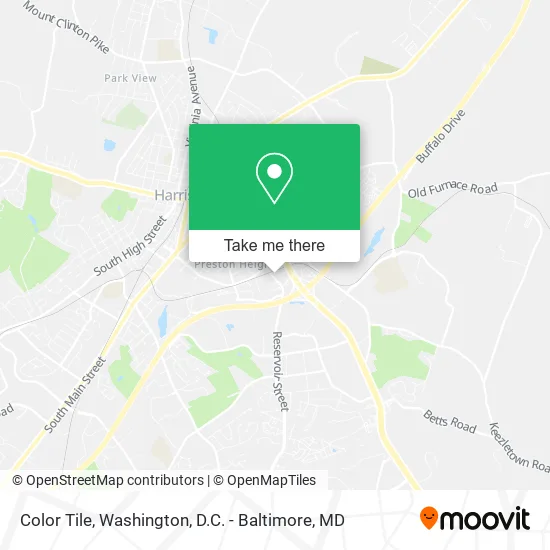
See Color Tile, Harrisonburg, on the map
Public Transit to Color Tile in Harrisonburg
Wondering how to get to Color Tile in Harrisonburg? Moovit helps you find the best way to get to Color Tile with step-by-step directions from the nearest public transit station.
Moovit provides free maps and live directions to help you navigate through your city. View schedules, routes, timetables, and find out how long does it take to get to Color Tile in real time.
Looking for the nearest stop or station to Color Tile? Check out this list of stops closest to your destination: Carlton St. @ Cloverleaf Shopping Center; East Market St. @ Cloverleaf Shopping Center (Shelter); Reservoir St. @ Holly Ct.; Harrisonburg Crossing @ Walmart (Shelter); Carrier Dr. @ Festival (Shelter).
Bus: BRCC NORTH, 1, 1-B, EXT 1, 2, 2-B, EXT 2, 3, 3-B, 6, 6-B, EXT 6, SHOP, SHOP, BLACK, BLUE, GOLD, GOLD, ICS.
Want to see if there’s another route that gets you there at an earlier time? Moovit helps you find alternative routes or times. Get directions from and directions to Color Tile easily from the Moovit App or Website.
We make riding to Color Tile easy, which is why over 1.5 million users, including users in Harrisonburg, trust Moovit as the best app for public transit. You don’t need to download an individual bus app or train app, Moovit is your all-in-one transit app that helps you find the best bus time or train time available.
For information on prices of train and bus, costs and ride fares to Color Tile, please check the Moovit app.
Use the app to navigate to popular places including to the airport, hospital, stadium, grocery store, mall, coffee shop, school, college, and university.
Color Tile Address: 1110 Reservoir St Harrisonburg, VA 22801 street in Harrisonburg
Get around Harrisonburg by public transit!
Traveling around Harrisonburg has never been so easy. See step by step directions as you travel to any attraction, street or major public transit station. View bus and train schedules, arrival times, service alerts and detailed routes on a map, so you know exactly how to get to anywhere in Harrisonburg.
When traveling to any destination around Harrisonburg use Moovit's Live Directions with Get Off Notifications to know exactly where and how far to walk, how long to wait for your line, and how many stops are left. Moovit will alert you when it's time to get off — no need to constantly re-check whether yours is the next stop.
Wondering how to use public transit in Harrisonburg or how to pay for public transit in Harrisonburg? Moovit public transit app can help you navigate your way with public transit easily, and at minimum cost. It includes public transit fees, ticket prices, and costs. Looking for a map of Harrisonburg public transit lines? Moovit public transit app shows all public transit maps in Harrisonburg with all Bus, Train, Metro, Light Rail and Ferry routes and stops on an interactive map.
Washington, D.C. - Baltimore, MD has 5 transit type(s), including: Bus, Train, Metro, Light Rail and Ferry, operated by several transit agencies, including WMATA, Montgomery County Ride On, Fairfax Connector, TheBus, PRTC, DASH - Alexandria, Arlington Transit (ART), RTA of Central Maryland, MDOT MTA, MDOT MTA Light RailLink, MDOT MTA Commuter Bus, MDOT MTA Local Bus, FXBGO!, Virginia Railway Express (VRE) and MARC