Directions to Coltenba (Cic) with public transportation
The following transit lines have routes that pass near Coltenba
How to get to Coltenba by bus?
Click on the bus route to see step by step directions with maps, line arrival times and updated time schedules.
From Seminário, Seminário
47 minFrom Avenida Presidente Kennedy 2377, Guaíra
43 minFrom Avenida Manoel Ribas 1226, Mercês
46 minFrom Avenida Cândido Hartmann 570, Bigorrilho
44 minFrom Estação Tubo Paiol, Prado Velho
56 minFrom Rua Voluntários da Pátria 400, Centro
42 minFrom Rua Visconde do Rio Branco 1488, Centro
44 minFrom Mercês, Mercês
45 minFrom Praça Afonso Botelho, Água Verde
62 minFrom Mercês, Mercês
45 min
Bus stops near Coltenba in Cic
- Av. Juscelino Kubitschek De Oliveira, 8063, 1 min walk,VIEW
- R. Desembargador Cid Campelo, 5815, 4 min walk,VIEW
- UPA CIC (R. Senador Accioly Filho, 3323), 7 min walk,VIEW
- R. Antônio Pastre, 56, 8 min walk,VIEW
- R. Arthur Martins Franco, 2408, 8 min walk,VIEW
- R. Manoel Eurico De Miranda, 304, 12 min walk,VIEW
Bus lines to Coltenba in Cic
- X55 REFORÇO CIC / AV. J.K., Av. JK (Viaduto Eduardo Sprada) → Terminal CIC ,VIEW
- 060 INTERBAIRROS VI, Terminal Campo Comprido → Terminal Pinheirinho,VIEW
- 826 CAMPO COMPRIDO / CIC, Terminal CIC → Terminal Campo Comprido,VIEW
- 712 JARDIM INDEPENDÊNCIA / CIC, Terminal CIC → Terminal Fazendinha,VIEW
- X41 REFORÇO SABARÁ, Terminal Capão Raso → Sabará,VIEW
- 658 CAPÃO RASO / CAIUÁ, Terminal Caiuá → Terminal Capão Raso,VIEW
- 653 SABARÁ, Moradias Corbélia → Terminal CIC,VIEW
- 545 TRABALHADOR, Terminal Fazendinha → Terminal Boqueirão,VIEW
- 709 VILA TIRADENTES / CIC, Terminal CIC → Vila Tiradentes (Recolhe),VIEW
- 721 MÁRIO JORGE, Mario Jorge → Terminal Caiuá,VIEW
What are the closest stations to Coltenba?
The closest stations to Coltenba are:
- Av. Juscelino Kubitschek De Oliveira, 8063 is 52 meters away, 1 min walk.
- R. Desembargador Cid Campelo, 5815 is 247 meters away, 4 min walk.
- UPA CIC (R. Senador Accioly Filho, 3323) is 454 meters away, 7 min walk.
- R. Antônio Pastre, 56 is 547 meters away, 8 min walk.
- R. Arthur Martins Franco, 2408 is 585 meters away, 8 min walk.
- R. Manoel Eurico De Miranda, 304 is 894 meters away, 12 min walk.
Which bus lines stop near Coltenba?
These bus lines stop near Coltenba: 060 INTERBAIRROS VI, 712 JARDIM INDEPENDÊNCIA / CIC.
What’s the nearest bus station to Coltenba in Cic?
The nearest bus station to Coltenba in Cic is Av. Juscelino Kubitschek De Oliveira, 8063. It’s a 1 min walk away.
What time is the first bus to Coltenba in Cic?
The 721 MÁRIO JORGE is the first bus that goes to Coltenba in Cic. It stops nearby at 4:52 AM.
What time is the last bus to Coltenba in Cic?
The 721 MÁRIO JORGE is the last bus that goes to Coltenba in Cic. It stops nearby at 1:01 AM.
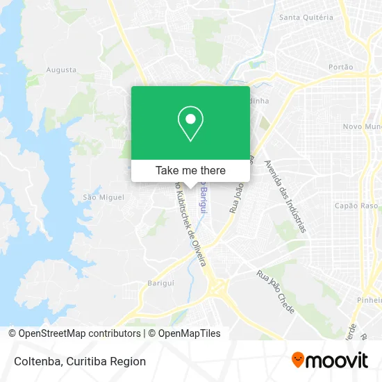
See Coltenba, Cic, on the map
Public Transit to Coltenba in Cic
Wondering how to get to Coltenba in Cic? Moovit helps you find the best way to get to Coltenba with step-by-step directions from the nearest public transit station.
Moovit provides free maps and live directions to help you navigate through your city. View schedules, routes, timetables, and find out how long does it take to get to Coltenba in real time.
Looking for the nearest stop or station to Coltenba? Check out this list of stops closest to your destination: Av. Juscelino Kubitschek De Oliveira; R. Desembargador Cid Campelo; UPA CIC (R. Senador Accioly Filho; R. Antônio Pastre; R. Arthur Martins Franco; R. Manoel Eurico De Miranda.
Bus: 060 INTERBAIRROS VI, 712 JARDIM INDEPENDÊNCIA / CIC, X55 REFORÇO CIC / AV. J.K., 826 CAMPO COMPRIDO / CIC, X41 REFORÇO SABARÁ, 658 CAPÃO RASO / CAIUÁ, 653 SABARÁ, 545 TRABALHADOR, 709 VILA TIRADENTES / CIC, 721 MÁRIO JORGE.
Want to see if there’s another route that gets you there at an earlier time? Moovit helps you find alternative routes or times. Get directions from and directions to Coltenba easily from the Moovit App or Website.
We make riding to Coltenba easy, which is why over 1.5 million users, including users in Cic, trust Moovit as the best app for public transit. You don’t need to download an individual bus app or train app, Moovit is your all-in-one transit app that helps you find the best bus time or train time available.
For information on prices of bus, costs and ride fares to Coltenba, please check the Moovit app.
Use the app to navigate to popular places including to the airport, hospital, stadium, grocery store, mall, coffee shop, school, college, and university.
Coltenba Address: Rua Pérola Negra, 144 Cidade Industrial de Curitiba Curitiba-PR 81350-163 street in Cic
- Serrana Servico e Comercio de Estrutura e Ferragens,
- Rosa de Sharon,
- Rua Doutor Rafael Simille Ribeiro,
- Trader Maximus,
- Loja Alice Presentes,
- Distribuidora de Bebidas Altas Horas,
- Gbr Comércio de Alimentos,
- Wd Prime Celulares,
- Cia da Carne,
- Delicias d'Adry,
- C. M. E. I. Nova Barigui,
- Boutique Brechó Infantil,
- Prospere P&a Confecções e Artigos do Vestuario,
- Auto Peças Globo,
- Baratao do Jeans,
- Viiber Boutique,
- Salao Jc,
- Galpão do Chopp,
- Di-Frio,
- Krull Salvados
Places Near Coltenba (Cic)
- Pontifícia Universidade Católica do Paraná (PUCPR), Prado Velho,
- Jardim Botânico de Curitiba PR, Centro,
- Hospital Angelina Caron, Campina Grande Do Sul,
- Shopping Palladium, Portão,
- Hhhhh, Fazendinha,
- Hospital Do Senhor - Madre Virgínia, São José Dos Pinhais,
- Hospital de Clínicas (HC - UFPR), Centro,
- Hospital Universitário Evangélico de Curitiba, Bigorrilho,
- Park Shopping Barigüi, Mossunguê,
- Shopping Estação, Rebouças,
- Jockey Plaza Shopping Center, Tarumã,
- Hospital do Rocio, Campo,
- Hospital Erasto Gaertner, Jardim Das Américas,
- Hospital Madalena Sofia, Bairro Alto,
- Arena Da Baixada - Curitiba,
- Rua General Mário Tourinho, Campina Do Siqueira,
- Hospital Da Cruz Vermelha, Batel,
- Rua Martim Afonso 558, Mercês,
- Parque Barigui, Mercês,
- Hospital Nossa Senhora Das Graças, Mercês
How to get to popular places in Curitiba Region with public transit
Get around Cic by public transit!
Traveling around Cic has never been so easy. See step by step directions as you travel to any attraction, street or major public transit station. View bus and train schedules, arrival times, service alerts and detailed routes on a map, so you know exactly how to get to anywhere in Cic.
When traveling to any destination around Cic use Moovit's Live Directions with Get Off Notifications to know exactly where and how far to walk, how long to wait for your line, and how many stops are left. Moovit will alert you when it's time to get off — no need to constantly re-check whether yours is the next stop.
Wondering how to use public transit in Cic or how to pay for public transit in Cic? Moovit public transit app can help you navigate your way with public transit easily, and at minimum cost. It includes public transit fees, ticket prices, and costs. Looking for a map of Cic public transit lines? Moovit public transit app shows all public transit maps in Cic with all Bus and Cable Car routes and stops on an interactive map.
Curitiba Region has 2 transit type(s), including: Bus and Cable Car, operated by several transit agencies, including Sistema Integrado de Mobilidade (URBS), Sistema Integrado de Mobilidade (AMEP), URBS (Cartões bancários e Dinheiro), URBS (Cartões bancários / Cartão URBS), AMEP (Cartões bancários / Cartão MetroCard), AMEP (Cartões bancários / Cartão MetroCard / Dinheiro), Viação Colombo (Dinheiro), TRIAR (Cartão TRIAR / Dinheiro), Empresa Curitiba Cerro Azul (Dinheiro), Expresso Nossa Senhora da Penha (Dinheiro), Empresa Campo Alto Tijucas (Dinheiro), Auto Viação São José (Cartão VEM / Dinheiro), BRT S/A (Cartão VEM / Dinheiro), TransPiedade (Cartão Cidadão / Dinheiro) and Oceânica Sul (Cartão Transporte / Dinheiro)