How to get to Colzi by bus?
Click on the bus route to see step by step directions with maps, line arrival times and updated time schedules.
From Monte Oliveto Street, Florence
47 minFrom Pasquale Paoli Avenue, Florence
56 minFrom Affrico Riverside Street, Florence
63 minFrom San Salvi Street 12, Florence
62 minFrom Edmondo de Amicis Avenue, Florence
64 minFrom Grifone Hotel, Florence
57 minFrom Republic Square, Florence
53 minFrom Trespiano Cemetery, Florence
61 minFrom Villa Ulivella and Glicini, Florence
40 minFrom Leonardo da Vinci Higher Education Institute, Florence
34 min
How to get to Colzi by train?
Click on the train route to see step by step directions with maps, line arrival times and updated time schedules.
From Pasquale Paoli Avenue, Florence
120 minFrom Affrico Riverside Street, Florence
129 minFrom San Salvi Street 12, Florence
129 minFrom Edmondo de Amicis Avenue, Florence
128 minFrom Grifone Hotel, Florence
131 minFrom Republic Square, Florence
114 minFrom Trespiano Cemetery, Florence
89 minFrom Villa Ulivella and Glicini, Florence
118 minFrom Leonardo da Vinci Higher Education Institute, Florence
76 min
Bus stops near Colzi in Florence
Train station near Colzi in Florence
- Le Piagge, 16 min walk,VIEW
Light Rail stations near Colzi in Florence
- Peretola Airport, 51 min walk,VIEW
Bus lines to Colzi in Florence
What are the closest stations to Colzi?
The closest stations to Colzi are:
- First of May Schools is 324 meters away, 5 min walk.
- Pistoiese Nave Di Brozzi is 638 meters away, 9 min walk.
- Pistoiese Brozzi is 712 meters away, 10 min walk.
- Nave Di Brozzi is 800 meters away, 11 min walk.
- Le Piagge is 1218 meters away, 16 min walk.
- Peretola Airport is 3897 meters away, 51 min walk.
Which bus lines stop near Colzi?
These bus lines stop near Colzi: 35, 56.
Which train line stops near Colzi?
R (Florence)
What’s the nearest train station to Colzi in Florence?
The nearest train station to Colzi in Florence is Le Piagge. It’s a 16 min walk away.
What’s the nearest bus station to Colzi in Florence?
The nearest bus station to Colzi in Florence is First of May Schools. It’s a 5 min walk away.
What time is the first light rail to Colzi in Florence?
The T2 is the first light rail that goes to Colzi in Florence. It stops nearby at 5:00 AM.
What time is the last light rail to Colzi in Florence?
The T2 is the last light rail that goes to Colzi in Florence. It stops nearby at 12:53 AM.
What time is the first train to Colzi in Florence?
The R is the first train that goes to Colzi in Florence. It stops nearby at 5:15 AM.
What time is the last train to Colzi in Florence?
The R is the last train that goes to Colzi in Florence. It stops nearby at 12:51 AM.
What time is the first bus to Colzi in Florence?
The 56 is the first bus that goes to Colzi in Florence. It stops nearby at 5:47 AM.
What time is the last bus to Colzi in Florence?
The 35 is the last bus that goes to Colzi in Florence. It stops nearby at 1:25 AM.
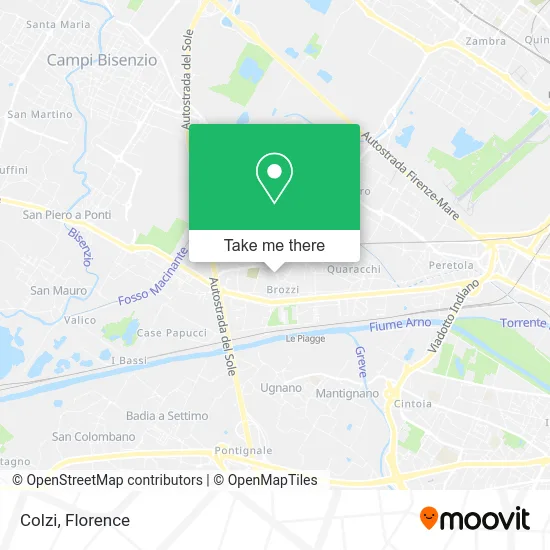
See Colzi, Florence, on the map
Public Transit to Colzi in Florence
Wondering how to get to Colzi in Florence? Moovit helps you find the best way to get to Colzi with step-by-step directions from the nearest public transit station.
Moovit provides free maps and live directions to help you navigate through your city. View schedules, routes, timetables, and find out how long does it take to get to Colzi in real time.
Looking for the nearest stop or station to Colzi? Check out this list of stops closest to your destination: First of May Schools; Pistoiese Nave Di Brozzi; Pistoiese Brozzi; Nave Di Brozzi; Le Piagge; Peretola Airport.
Bus: 35, 56, 66, 68, 51PQF, 213, 303.Train: R.
Want to see if there’s another route that gets you there at an earlier time? Moovit helps you find alternative routes or times. Get directions from and directions to Colzi easily from the Moovit App or Website.
We make riding to Colzi easy, which is why over 1.5 million users, including users in Florence, trust Moovit as the best app for public transit. You don’t need to download an individual bus app or train app, Moovit is your all-in-one transit app that helps you find the best bus time or train time available.
For information on prices of bus and train, costs and ride fares to Colzi, please check the Moovit app.
Use the app to navigate to popular places including to the airport, hospital, stadium, grocery store, mall, coffee shop, school, college, and university.
Colzi Address: Via dei Cattani, 36 50145 Firenze street in Florence
- Via de' Cattani 1,
- Trolese,
- Vittorio Leather Goods,
- De Deo Luciano Moving Services,
- Padel le Mura Brozzi,
- Curzio Malaparte Street,
- Diarpell S.R.L,
- Pre Service,
- Miccio Sandwich Shop-Lampredotto,
- Ciambellotti Piera Condominium Administrations,
- Silvia Boncinelli,
- St. Rocco Street, 15 Parking,
- Biemme,
- Community of Piagge,
- Line 68-Brozzi Cemetery,
- Borgi Studio - Labor Consultant,
- Madonna of Loreto,
- Diarpell Rubriche,
- Hope Florence,
- Safety
Places Near Colzi (Florence)
- OOO, Florence,
- Tobacco Manufacture, Florence,
- Michelangelo Square, Florence,
- Campi Bisenzio, Campi Bisenzio,
- Santa Maria Nuova Hospital, Florence,
- Nelson Mandela Forum, Florence,
- Artemio Franchi Municipal Stadium, Florence,
- Cascine Park, Florence,
- Michelangelo Square, Florence,
- Mandela Forum (Nelson Mandela Forum), Florence,
- I Gigli, Campi Bisenzio,
- Torregalli Hospital Scandicci *, Scandicci,
- Asmana, Campi Bisenzio,
- Field of Mars, Florence,
- Santa Maria Novella Station, Florence,
- Wanny Palace, Florence,
- Piero Palagi Hospital Facility-Florence, Florence,
- Viola Park, Bagno a Ripoli,
- Verdi Theater, Florence,
- IKEA Florence, Sesto Fiorentino
How to get to popular places in Florence with public transit
Get around Florence by public transit!
Traveling around Florence has never been so easy. See step by step directions as you travel to any attraction, street or major public transit station. View bus and train schedules, arrival times, service alerts and detailed routes on a map, so you know exactly how to get to anywhere in Florence.
When traveling to any destination around Florence use Moovit's Live Directions with Get Off Notifications to know exactly where and how far to walk, how long to wait for your line, and how many stops are left. Moovit will alert you when it's time to get off — no need to constantly re-check whether yours is the next stop.
Wondering how to use public transit in Florence or how to pay for public transit in Florence? Moovit public transit app can help you navigate your way with public transit easily, and at minimum cost. It includes public transit fees, ticket prices, and costs. Looking for a map of Florence public transit lines? Moovit public transit app shows all public transit maps in Florence with all Bus, Train, Light Rail, Ferry and Funicular routes and stops on an interactive map.
Florence has 5 transit type(s), including: Bus, Train, Light Rail, Ferry and Funicular, operated by several transit agencies, including Florence Urban - Tuscan Bus Lines, GEST, Florence and Province - Tuscan Bus Lines, Livorno and Province - Tuscan Bus Lines, Arezzo, Florence and Provinces - Tuscan Bus Lines, Prato and Province - Tuscan Bus Lines, Massa, Carrara and Province - Tuscan Bus Lines, Pisa and Province - Tuscan Bus Lines, Grosseto, Siena and Provinces - Tuscan Bus Lines, Arezzo, Siena and Provinces - Tuscan Bus Lines, Pistoia and Province - Tuscan Bus Lines, Siena and Province - Tuscan Bus Lines, Arezzo and Province - Tuscan Bus Lines, Lucca and Province - Tuscan Bus Lines and Trenitalia