How to get to Come Quickly.Com by bus?
Click on the bus route to see step by step directions with maps, line arrival times and updated time schedules.
From Congressional Cemetery, Washington
66 minFrom Rayburn House Office Building, Washington
50 minFrom Festival Grounds at RFK Campus, Washington
71 minFrom Birchmere, Alexandria
96 minFrom Baileys Crossroads, Fairfax County
89 minFrom Shirlington, Arlington County
75 minFrom 9th & F St NW, Washington
48 minFrom Fairfield Inn & Suites Washington, DC/New York Avenue, Washington
85 minFrom ULTRABAR, Washington
49 minFrom Ruth's Chris Steak House, Washington
46 min
How to get to Come Quickly.Com by metro?
Click on the metro route to see step by step directions with maps, line arrival times and updated time schedules.
Bus stops near Come Quickly.Com in Washington
Metro station near Come Quickly.Com in Washington
- Tenleytown Metro Station, 29 min walk,VIEW
Bus lines to Come Quickly.Com in Washington
What are the closest stations to Come Quickly.Com?
The closest stations to Come Quickly.Com are:
- Wisconsin Av Nw+Woodley Rd NW is 59 yards away, 1 min walk.
- Woodley Rd Nw+Wisconsin Av NW is 83 yards away, 2 min walk.
- Massachusetts Av Nw+Wisconsin Av NW is 416 yards away, 6 min walk.
- Massachusetts Av Nw+Idaho Av NW is 459 yards away, 6 min walk.
- Tenleytown Metro Station is 2425 yards away, 29 min walk.
Which bus lines stop near Come Quickly.Com?
These bus lines stop near Come Quickly.Com: C51, D80, D82.
Which metro line stops near Come Quickly.Com?
RED (Shady Grove)
What’s the nearest metro station to Come Quickly.Com in Washington?
The nearest metro station to Come Quickly.Com in Washington is Tenleytown Metro Station. It’s a 29 min walk away.
What’s the nearest bus station to Come Quickly.Com in Washington?
The nearest bus station to Come Quickly.Com in Washington is Wisconsin Av Nw+Woodley Rd NW. It’s a 1 min walk away.
What time is the first metro to Come Quickly.Com in Washington?
The RED is the first metro that goes to Come Quickly.Com in Washington. It stops nearby at 5:21 AM.
What time is the last metro to Come Quickly.Com in Washington?
The RED is the last metro that goes to Come Quickly.Com in Washington. It stops nearby at 12:19 AM.
What time is the first bus to Come Quickly.Com in Washington?
The D80 is the first bus that goes to Come Quickly.Com in Washington. It stops nearby at 3:08 AM.
What time is the last bus to Come Quickly.Com in Washington?
The D80 is the last bus that goes to Come Quickly.Com in Washington. It stops nearby at 3:19 AM.
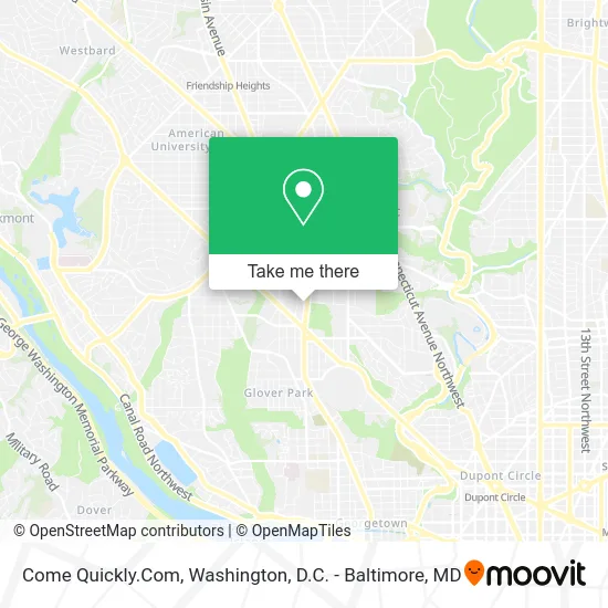
See Come Quickly.Com, Washington, on the map
Public Transit to Come Quickly.Com in Washington
Wondering how to get to Come Quickly.Com in Washington? Moovit helps you find the best way to get to Come Quickly.Com with step-by-step directions from the nearest public transit station.
Moovit provides free maps and live directions to help you navigate through your city. View schedules, routes, timetables, and find out how long does it take to get to Come Quickly.Com in real time.
Looking for the nearest stop or station to Come Quickly.Com? Check out this list of stops closest to your destination: Wisconsin Av Nw+Woodley Rd NW; Woodley Rd Nw+Wisconsin Av NW; Massachusetts Av Nw+Wisconsin Av NW; Massachusetts Av Nw+Idaho Av NW; Tenleytown Metro Station.
Bus: C51, D80, D82, C85, D90, D96.Metro: RED.
Want to see if there’s another route that gets you there at an earlier time? Moovit helps you find alternative routes or times. Get directions from and directions to Come Quickly.Com easily from the Moovit App or Website.
We make riding to Come Quickly.Com easy, which is why over 1.5 million users, including users in Washington, trust Moovit as the best app for public transit. You don’t need to download an individual bus app or train app, Moovit is your all-in-one transit app that helps you find the best bus time or train time available.
For information on prices of bus and metro, costs and ride fares to Come Quickly.Com, please check the Moovit app.
Use the app to navigate to popular places including to the airport, hospital, stadium, grocery store, mall, coffee shop, school, college, and university.
Come Quickly.Com Address: 3140 Wisconsin Ave NW street in Washington
- Elaine,
- Washington National Cathedral ,
- Open City,
- Woodley Rd NW (38th st nw & Woodley Rd NW),
- Chase,
- National Cathedral School,
- Mathnasium,
- 2 Amys,
- 96 Metrobus to Tenleytown,
- Washington National Cathedral,
- The National Gurdwara,
- Top Level,
- Barcelona Wine Bar,
- President Woodrow Wilson Grave, National Cathedral,
- Washington Ballet,
- Solidcore Cathedral Commons,
- Barcelona Cathedral Heights,
- Raku at Cathederal,
- St Albans Church,
- Asg-Lot 78-National CA
Places Near Come Quickly.Com (Washington)
- Amazon Hq2, Arlington County,
- National Mall, Washington,
- Marriott Marquis Washington, DC, Washington,
- Camden Yards, Baltimore,
- National Zoo, Washington,
- Warner Theatre, Washington,
- Museum Of The Bible, Washington,
- Rock Creek Tennis Center, Washington,
- Sibley Memorial Hospital, Washington,
- Washington DC VA Medical Center, Washington,
- Capital One Arena, Washington,
- M&T Bank Stadium, Baltimore,
- Westfield Montgomery Mall, Montgomery County,
- The Anthem, Washington,
- Basilica of the National Shrine, Washington,
- National Museum of African American History and Culture, Washington,
- Georgetown, Washington,
- Pennsylvania Ave NW (3rd st and pennsylvania), Washington,
- PG Mall, Prince George's County,
- Washington National Cathedral, Washington
How to get to popular places in Washington, D.C. - Baltimore, MD with public transit
Get around Washington by public transit!
Traveling around Washington has never been so easy. See step by step directions as you travel to any attraction, street or major public transit station. View bus and train schedules, arrival times, service alerts and detailed routes on a map, so you know exactly how to get to anywhere in Washington.
When traveling to any destination around Washington use Moovit's Live Directions with Get Off Notifications to know exactly where and how far to walk, how long to wait for your line, and how many stops are left. Moovit will alert you when it's time to get off — no need to constantly re-check whether yours is the next stop.
Wondering how to use public transit in Washington or how to pay for public transit in Washington? Moovit public transit app can help you navigate your way with public transit easily, and at minimum cost. It includes public transit fees, ticket prices, and costs. Looking for a map of Washington public transit lines? Moovit public transit app shows all public transit maps in Washington with all Bus, Train, Metro, Light Rail and Ferry routes and stops on an interactive map.
Washington, D.C. - Baltimore, MD has 5 transit type(s), including: Bus, Train, Metro, Light Rail and Ferry, operated by several transit agencies, including WMATA, Montgomery County Ride On, Fairfax Connector, TheBus, PRTC, DASH - Alexandria, Arlington Transit (ART), RTA of Central Maryland, MDOT MTA, MDOT MTA Light RailLink, MDOT MTA Commuter Bus, MDOT MTA Local Bus, FXBGO!, Virginia Railway Express (VRE) and MARC