How to get to Comfort Cars by bus?
Click on the bus route to see step by step directions with maps, line arrival times and updated time schedules.
From Athis-Mons, Athis-Mons
77 minFrom Marcoussis, Marcoussis
36 minFrom Massy-Palaiseau, Massy
86 minFrom Wissous, Wissous
95 minFrom Opéra de Massy, Massy
87 minFrom Ballainvilliers, Ballainvilliers
66 minFrom ibis Paris Coeur d Orly Airport, Orly
90 minFrom Clinique du Mousseau, Evry
43 minFrom Draveil, Draveil
55 minFrom Centre Hospitalier Corbeil-Essonnes, Corbeil-Essonnes
75 min
Bus stops near Comfort Cars in Sainte-Genevieve-Des-Bois
Bus lines to Comfort Cars in Sainte-Genevieve-Des-Bois
- 4571, Lycée Einstein,VIEW
- 4573, Gare de Sainte-Geneviève-Des-Bois,VIEW
- 4574, Lycée Einstein,VIEW
- 4575, Marché,VIEW
- 4577, Hôpital Henri Manhès,VIEW
- 4512, Gare de Sainte-Geneviève-Des-Bois,VIEW
- 4201, Rue Berlioz,VIEW
- 4511, Gare de Sainte-Geneviève-Des-Bois,VIEW
- 4510, Gare de Sainte-Geneviève-Des-Bois,VIEW
- 4280, Place de L'Europe,VIEW
What are the closest stations to Comfort Cars?
The closest stations to Comfort Cars are:
- Lycée Einstein is 177 meters away, 3 min walk.
- Le Canal is 304 meters away, 4 min walk.
- Pierre Mendès France is 350 meters away, 5 min walk.
- Collège Paul Eluard is 515 meters away, 7 min walk.
Which bus lines stop near Comfort Cars?
These bus lines stop near Comfort Cars: 4201, 4505, 4512, 4641.
What’s the nearest bus station to Comfort Cars in Sainte-Genevieve-Des-Bois?
The nearest bus station to Comfort Cars in Sainte-Genevieve-Des-Bois is Lycée Einstein. It’s a 3 min walk away.
What time is the first bus to Comfort Cars in Sainte-Genevieve-Des-Bois?
The 4201 is the first bus that goes to Comfort Cars in Sainte-Genevieve-Des-Bois. It stops nearby at 5:11 AM.
What time is the last bus to Comfort Cars in Sainte-Genevieve-Des-Bois?
The 4512 is the last bus that goes to Comfort Cars in Sainte-Genevieve-Des-Bois. It stops nearby at 12:34 AM.
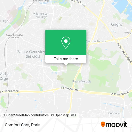
See Comfort Cars, Sainte-Genevieve-Des-Bois, on the map
Public Transit to Comfort Cars in Sainte-Genevieve-Des-Bois
Wondering how to get to Comfort Cars in Sainte-Genevieve-Des-Bois? Moovit helps you find the best way to get to Comfort Cars with step-by-step directions from the nearest public transit station.
Moovit provides free maps and live directions to help you navigate through your city. View schedules, routes, timetables, and find out how long does it take to get to Comfort Cars in real time.
Looking for the nearest stop or station to Comfort Cars? Check out this list of stops closest to your destination: Lycée Einstein; Le Canal; Pierre Mendès France; Collège Paul Eluard.
Bus: 4201, 4505, 4512, 4641, 4571, 4573, 4574, 4575, 4577, 4511, 4510, 4280.
Want to see if there’s another route that gets you there at an earlier time? Moovit helps you find alternative routes or times. Get directions from and directions to Comfort Cars easily from the Moovit App or Website.
We make riding to Comfort Cars easy, which is why over 1.5 million users, including users in Sainte-Genevieve-Des-Bois, trust Moovit as the best app for public transit. You don’t need to download an individual bus app or train app, Moovit is your all-in-one transit app that helps you find the best bus time or train time available.
For information on prices of bus and light rail, costs and ride fares to Comfort Cars, please check the Moovit app.
Use the app to navigate to popular places including to the airport, hospital, stadium, grocery store, mall, coffee shop, school, college, and university.
Comfort Cars Address: 1 Avenue du Canal 91700 Sainte-Geneviève-des-Bois street in Sainte-Genevieve-Des-Bois
- Lycée Einstein,
- Lycée Albert Einstein,
- 12 Avenue Charlie Chaplin,
- Maison des Services Publics - Claude Rolland,
- Le Canal,
- Canal des Aunettes,
- Ditsia Phumu,
- Distribution 91,
- La Piscine d'en Face,
- Hercule-Insertion,
- Lpdf,
- Epicerie Solidaire l'Escale,
- La Place Rouge (Saint-Hubert),
- Alex Rénovations,
- Knid Éducation,
- Vtc-Aeroports.Com,
- Stade Leo Lagrange,
- Stade de Football,
- Cimetière Russe de Sainte Geneviève des Bois,
- La Piscine D'En Face
Places Near Comfort Cars (Sainte-Genevieve-Des-Bois)
- Hôpital Pitié Salpêtrière, Paris,
- Théâtre Mogador, Paris,
- Beaugrenelle, Paris,
- Fondation Louis Vuitton, Paris,
- Galeries Lafayette, Paris,
- Marché Saint-Pierre, Paris,
- 29 Rue Manin, Paris,
- Centre Hospitalier des 15/20, Paris,
- Hopital Foch, Suresnes,
- Hôpital Henri Mondor, Creteil,
- Atelier Des Lumieres, Paris,
- Galeries Lafayette Haussmann, Paris,
- Hopital Lariboisière, Paris,
- Hôpital Saint-Joseph, Paris,
- Hôpital Necker, Paris,
- Hôpital de la Pitié-Salpêtrière, Paris,
- Gare Routière Flixbus, Paris,
- Hôpital Cochin, Paris,
- Créteil Soleil, Creteil,
- Hôpital Beaujon, Clichy
How to get to popular places in Paris with public transit
Get around Sainte-Genevieve-Des-Bois by public transit!
Traveling around Sainte-Genevieve-Des-Bois has never been so easy. See step by step directions as you travel to any attraction, street or major public transit station. View bus and train schedules, arrival times, service alerts and detailed routes on a map, so you know exactly how to get to anywhere in Sainte-Genevieve-Des-Bois.
When traveling to any destination around Sainte-Genevieve-Des-Bois use Moovit's Live Directions with Get Off Notifications to know exactly where and how far to walk, how long to wait for your line, and how many stops are left. Moovit will alert you when it's time to get off — no need to constantly re-check whether yours is the next stop.
Wondering how to use public transit in Sainte-Genevieve-Des-Bois or how to pay for public transit in Sainte-Genevieve-Des-Bois? Moovit public transit app can help you navigate your way with public transit easily, and at minimum cost. It includes public transit fees, ticket prices, and costs. Looking for a map of Sainte-Genevieve-Des-Bois public transit lines? Moovit public transit app shows all public transit maps in Sainte-Genevieve-Des-Bois with all Bus, Train, Metro, Light Rail, RER, Funicular and Gondola routes and stops on an interactive map.
Paris has 7 transit type(s), including: Bus, Train, Metro, Light Rail, RER, Funicular and Gondola, operated by several transit agencies, including RATP, RER, RER Bus de remplacement, Train, Train Bus de remplacement, Tramway Bus de remplacement, TER, ADP, Magical Shuttle, Argenteuil - Boucles de Seine, Autocars Dominique, Bièvre, Brie et 2 Morin, Le Bus - C.C. du Clermontois and Cœur d’Essonne