Commandants Way @ Williams St stop - Sunday schedule
| Line | Direction | Time |
|---|---|---|
| 112 | Wood Island Via Market Basket & Admiral's Hill | 8:30 AM |
| 112 | Wellington Via Admiral's Hill & Market Basket | 9:14 AM |
| 112 | Wood Island Via Market Basket & Admiral's Hill | 9:25 AM |
| 112 | Wellington Via Admiral's Hill & Market Basket | 10:11 AM |
| 112 | Wood Island Via Market Basket & Admiral's Hill | 10:22 AM |
| 112 | Wellington Via Admiral's Hill & Market Basket | 11:09 AM |
| 112 | Wood Island Via Market Basket & Admiral's Hill | 11:20 AM |
| 112 | Wellington Via Admiral's Hill & Market Basket | 12:09 PM |
| 112 | Wood Island Via Market Basket & Admiral's Hill | 12:19 PM |
| 112 | Wellington Via Admiral's Hill & Market Basket | 1:13 PM |
| 112 | Wood Island Via Market Basket & Admiral's Hill | 1:24 PM |
| 112 | Wellington Via Admiral's Hill & Market Basket | 2:18 PM |
| 112 | Wood Island Via Market Basket & Admiral's Hill | 2:30 PM |
| 112 | Wellington Via Admiral's Hill & Market Basket | 3:23 PM |
| 112 | Wood Island Via Market Basket & Admiral's Hill | 3:36 PM |
| 112 | Wellington Via Admiral's Hill & Market Basket | 4:29 PM |
| 112 | Wood Island Via Market Basket & Admiral's Hill | 4:40 PM |
| 112 | Wellington Via Admiral's Hill & Market Basket | 5:33 PM |
| 112 | Wood Island Via Market Basket & Admiral's Hill | 5:44 PM |
| 112 | Wellington Via Admiral's Hill & Market Basket | 6:36 PM |
| 112 | Wood Island Via Market Basket & Admiral's Hill | 6:44 PM |
| 112 | Wood Island Via Market Basket & Admiral's Hill | 7:46 PM |
Directions to Commandants Way @ Williams St stop (Chelsea) with public transit
The following transit lines have routes that pass near Commandants Way @ Williams St
 Bus: 104, 111, 116, SL3, 112.
- Train: NEWBURYPORT/ROCKPORT.
- Subway: BLUE LINE.
How to get to Commandants Way @ Williams St stop by bus?
Click on the bus route to see step by step directions with maps, line arrival times and updated time schedules.
How to get to Commandants Way @ Williams St stop by train?
Click on the train route to see step by step directions with maps, line arrival times and updated time schedules.
How to get to Commandants Way @ Williams St stop by subway?
Click on the subway route to see step by step directions with maps, line arrival times and updated time schedules.
Bus stops near Commandants Way @ Williams St stop in Chelsea
- Spruce St @ Williams St, 1 min walk,
- 45 Spruce St, 4 min walk,
- Beacon St @ Broadway, 7 min walk,
- Market Basket/Chelsea Station, 8 min walk,
Train stations near Commandants Way @ Williams St station in Chelsea
- Chelsea, 9 min walk,
Subway stations near Commandants Way @ Williams St station in Chelsea
- Airport, 34 min walk,
Bus lines to Commandants Way @ Williams St stop in Chelsea
- 112, Wood Island Via Market Basket & Admiral's Hill,
- 104, Malden,
- 114, Maverick,
- 111, Woodlawn,
- LOWER MYSTIC LINK, Market Basket/Chelsea Station,
What are the closest stations to Commandants Way @ Williams St?
The closest stations to Commandants Way @ Williams St are:
- Spruce St @ Williams St stop is 22 yards away, 1 min walk.
- 45 Spruce St stop is 262 yards away, 4 min walk.
- Beacon St @ Broadway stop is 564 yards away, 7 min walk.
- Market Basket/Chelsea Station is 682 yards away, 8 min walk.
- Chelsea station is 745 yards away, 9 min walk.
- Airport station is 2927 yards away, 34 min walk.
Which bus lines stop near Commandants Way @ Williams St?
These bus lines stop near Commandants Way @ Williams St: 104, 111, 116, SL3.
Which train line stops near Commandants Way @ Williams St?
NEWBURYPORT/ROCKPORT (#148 | North Station)
Which subway line stops near Commandants Way @ Williams St?
BLUE LINE (Wonderland)
What’s the nearest train station to Commandants Way @ Williams St in Chelsea?
The nearest train station to Commandants Way @ Williams St in Chelsea is Chelsea. It’s a 9 min walk away.
What’s the nearest bus station to Commandants Way @ Williams St in Chelsea?
The nearest bus station to Commandants Way @ Williams St in Chelsea is Spruce St @ Williams St. It’s a 1 min walk away.
What time is the first subway to Commandants Way @ Williams St in Chelsea?
The BLUE LINE is the first subway that goes to Commandants Way @ Williams St in Chelsea. It stops nearby at 5:10 AM.
What time is the last subway to Commandants Way @ Williams St in Chelsea?
The BLUE LINE is the last subway that goes to Commandants Way @ Williams St in Chelsea. It stops nearby at 1:02 AM.
What time is the first train to Commandants Way @ Williams St in Chelsea?
The NEWBURYPORT/ROCKPORT is the first train that goes to Commandants Way @ Williams St in Chelsea. It stops nearby at 5:40 AM.
What time is the last train to Commandants Way @ Williams St in Chelsea?
The NEWBURYPORT/ROCKPORT is the last train that goes to Commandants Way @ Williams St in Chelsea. It stops nearby at 12:06 AM.
What time is the first bus to Commandants Way @ Williams St in Chelsea?
The 104 is the first bus that goes to Commandants Way @ Williams St in Chelsea. It stops nearby at 4:35 AM.
What time is the last bus to Commandants Way @ Williams St in Chelsea?
The 111 is the last bus that goes to Commandants Way @ Williams St in Chelsea. It stops nearby at 2:23 AM.
Commandants Way @ Williams St station
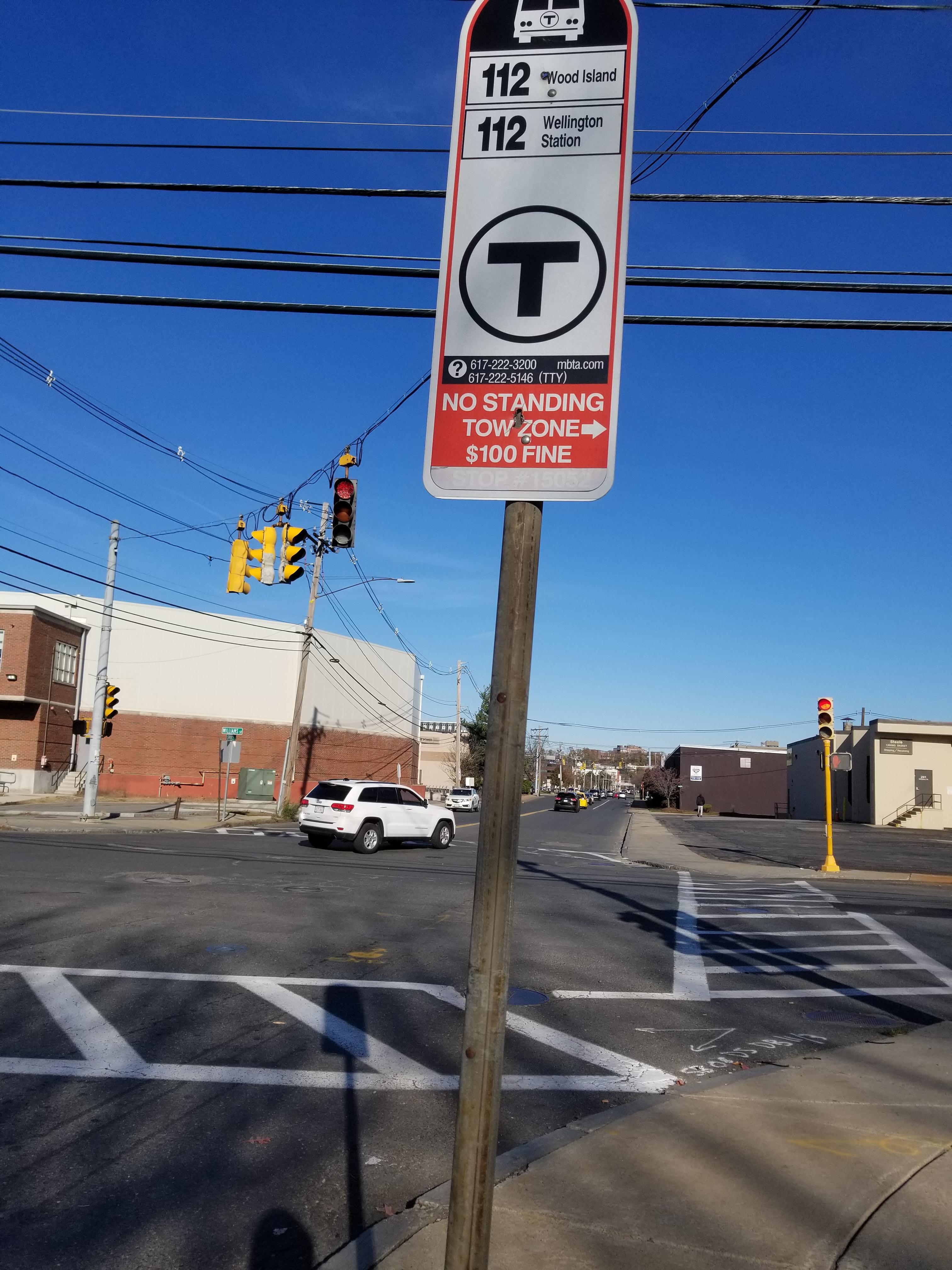 Taken by Anonymous
See Commandants Way @ Williams St stop, Chelsea, on the map
Public transit to Commandants Way @ Williams St stop (ID: 15052) in Chelsea
Looking for directions to Commandants Way @ Williams St in Chelsea, United States?
Download the Moovit App to find the current schedule and step-by-step directions for Bus, Subway or Train routes that pass through Commandants Way @ Williams St.
Looking for the nearest stops closest to Commandants Way @ Williams St ? Check out this list of closest stops to your destination: Spruce St @ Williams St; 45 Spruce St; Beacon St @ Broadway; Market Basket/Chelsea Station; Chelsea; Airport.
Bus: 104, 111, 116, SL3, 112, 114, LOWER MYSTIC LINK.Train: NEWBURYPORT/ROCKPORT.Subway: BLUE LINE.
We make riding on public transit to Commandants Way @ Williams St easy, which is why over 1.7 billion users, including users in Chelsea trust Moovit as the best app for public transit.
Use the app to navigate to popular places including to the airport, hospital, stadium, grocery store, mall, coffee shop, school, college, and university.
Commandants Way @ Williams St stop’s code is 15052
The first line to this stop is 112, at 8:30 AM, and the last line is 112 at 7:46 PM.
202 Williams Street, Chelsea, MA, USA
This stop serves MBTA’s lines
- Spruce St @ Williams St,
- 45 Spruce St,
- Beacon St @ Broadway,
- Market Basket/Chelsea Station
Bus stops near Commandants Way @ Williams St stop
- Chelsea
Train station near Commandants Way @ Williams St station
- Airport
Subway station near Commandants Way @ Williams St station
- Alford St @ Main St,
- Meadow Glen Mall @ Main Entrance,
- Sullivan Square,
- Hanscom Field Dr @ Old Bedford Rd,
- Andover St Opp Buttonwood Ln,
- Stony Brook,
- Fellsway @ Malden St,
- Park & Ride Lot, Rte 3 & 228,
- Square One Mall @ Sears,
- Main St @ Winthrop St,
- Good Samaritan Hospital,
- School St @ Hancock St,
- Humboldt Ave @ Homestead St,
- Cedar Grove,
- 14 Summer St,
- Wonderland,
- Seaman's Bank @ Route 6, Eastham,
- Good Harbor Beach Footbridge,
- Broadway @ Everett Sq,
- Warren St @ Townsend St
Popular public transit stations in Chelsea
Get around Chelsea by public transit!
Traveling around Chelsea has never been so easy. See step by step directions as you travel to any attraction, street or major public transit station. View bus and train schedules, arrival times, service alerts and detailed routes on a map, so you know exactly how to get to anywhere in Chelsea.
When traveling to any destination around Chelsea use Moovit's Live Directions with Get Off Notifications to know exactly where and how far to walk, how long to wait for your line, and how many stops are left. Moovit will alert you when it's time to get off — no need to constantly re-check whether yours is the next stop.
Wondering how to use public transit in Chelsea or how to pay for public transit in Chelsea? Moovit public transit app can help you navigate your way with public transit easily, and at minimum cost. It includes public transit fees, ticket prices, and costs. Looking for a map of Chelsea public transit lines? Moovit public transit app shows all public transit maps in Chelsea with all Bus, Train, Subway and Ferry routes and stops on an interactive map.
Boston has 4 transit type(s), including: Bus, Train, Subway and Ferry, operated by several transit agencies, including MBTA, Southeastern Regional Transit Authority, MetroWest Regional Transit Authority, Rhode Island Public Transit Authority, WRTA, Lowell Regional Transit Authority, Merrimack Valley Transit, Montachusett Regional Transit Authority, Cape Cod Regional Transit Authority, Brockton Area Transit Authority, Martha's Vineyard Transit Authority, Nantucket Regional Transit Authority, GATRA, Cape Ann Transportation Authority and Massport