How to get to Commercial ATM Systems by bus?
Click on the bus route to see step by step directions with maps, line arrival times and updated time schedules.
From Hard Rock Stadium, Miami Gardens
59 minFrom NW 79th St / NW 32nd Ave, Miami
39 minFrom La Quinta Inn & Suites-Miami, Miami
36 minFrom 16900 NW 12th Ave, Miami Gardens
64 minFrom Hyatt Place Miami Airport-East, Miami
38 minFrom Rapids Water Park, Miami
51 minFrom North Miami Senior Highschool, Miami
40 minFrom North Shore Medical Center, Miami
65 minFrom Clarion Inn & Suites Miami Airport, Miami
42 minFrom Ramada by Wyndham Miami Springs Miami International Airport, Miami
42 min
How to get to Commercial ATM Systems by train?
Click on the train route to see step by step directions with maps, line arrival times and updated time schedules.
Bus stops near Commercial ATM Systems in Miami
Train station near Commercial ATM Systems in Miami
- Opa-Locka Station, 12 min walk,VIEW
Bus lines to Commercial ATM Systems in Miami
What are the closest stations to Commercial ATM Systems?
The closest stations to Commercial ATM Systems are:
- Nw 37/42 Av@nw 135 St is 94 yards away, 2 min walk.
- Nw 135 St & Nw 37/42 Av Connecto is 171 yards away, 3 min walk.
- Nw 37 Av @ Fisherman St is 564 yards away, 7 min walk.
- Ali Baba Av@sesame St is 776 yards away, 10 min walk.
- Opa-Locka Tri-Rail Station is 985 yards away, 12 min walk.
- Opa-Locka Station is 1008 yards away, 12 min walk.
Which bus lines stop near Commercial ATM Systems?
These bus lines stop near Commercial ATM Systems: 32, 42.
Which train line stops near Commercial ATM Systems?
TRIRAIL (Southbound To Miami Airport)
What’s the nearest train station to Commercial ATM Systems in Miami?
The nearest train station to Commercial ATM Systems in Miami is Opa-Locka Station. It’s a 12 min walk away.
What’s the nearest bus station to Commercial ATM Systems in Miami?
The nearest bus station to Commercial ATM Systems in Miami is Nw 37/42 Av@nw 135 St. It’s a 2 min walk away.
What time is the first train to Commercial ATM Systems in Miami?
The TRIRAIL is the first train that goes to Commercial ATM Systems in Miami. It stops nearby at 4:02 AM.
What time is the last train to Commercial ATM Systems in Miami?
The TRIRAIL is the last train that goes to Commercial ATM Systems in Miami. It stops nearby at 10:29 PM.
What time is the first bus to Commercial ATM Systems in Miami?
The 135 is the first bus that goes to Commercial ATM Systems in Miami. It stops nearby at 5:00 AM.
What time is the last bus to Commercial ATM Systems in Miami?
The 32 is the last bus that goes to Commercial ATM Systems in Miami. It stops nearby at 11:55 PM.
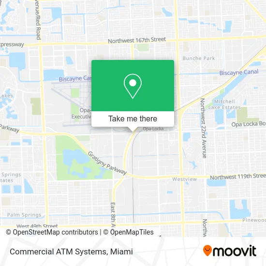
See Commercial ATM Systems, Miami, on the map
Public Transit to Commercial ATM Systems in Miami
Wondering how to get to Commercial ATM Systems in Miami? Moovit helps you find the best way to get to Commercial ATM Systems with step-by-step directions from the nearest public transit station.
Moovit provides free maps and live directions to help you navigate through your city. View schedules, routes, timetables, and find out how long does it take to get to Commercial ATM Systems in real time.
Looking for the nearest stop or station to Commercial ATM Systems? Check out this list of stops closest to your destination: Nw 37/42 Av@nw 135 St; Nw 135 St & Nw 37/42 Av Connecto; Nw 37 Av @ Fisherman St; Ali Baba Av@sesame St; Opa-Locka Tri-Rail Station; Opa-Locka Station.
Bus: 32, 42, OPALKAN, OPALCKA, 135.Train: TRIRAIL.
Want to see if there’s another route that gets you there at an earlier time? Moovit helps you find alternative routes or times. Get directions from and directions to Commercial ATM Systems easily from the Moovit App or Website.
We make riding to Commercial ATM Systems easy, which is why over 1.5 million users, including users in Miami, trust Moovit as the best app for public transit. You don’t need to download an individual bus app or train app, Moovit is your all-in-one transit app that helps you find the best bus time or train time available.
For information on prices of bus and train, costs and ride fares to Commercial ATM Systems, please check the Moovit app.
Use the app to navigate to popular places including to the airport, hospital, stadium, grocery store, mall, coffee shop, school, college, and university.
Commercial ATM Systems Address: 3705 NW 135th St Opa-Locka, FL 33054 street in Miami
- Opa Locka Service Station,
- Benny's Carwash,
- Navy Federal Credit Union,
- Licking Food Court,
- (24 FB) B&G Opa Holdin,
- U Gas,
- Reddy Ice,
- Frozen Art Jewelry LL,
- Intoxalock Ignition Interlock,
- JRS Auto Windowtinting,
- 305 Auto Repair,
- Heat Buster Inc,
- Jay Auto Sales,
- H & S Automotive Corporation,
- Donata Skinfood,
- Vibez Customs,
- Central Transport,
- Magic City Wrestling Federation,
- Emergency Garage Repair Services,
- Everglades Recycling
Places Near Commercial ATM Systems (Miami)
- Marlins Park, Miami,
- Zoo Miami, Miami,
- Wynwood, Miami,
- Miami Design District, Miami,
- Port of Miami Cruise Terminal, Miami,
- Dolphin Mall Bus, Miami,
- Aventura Mall, Miami Beach,
- Sawgrass mall ( FL ), Miami Beach,
- Miami-Dade County Courthouse, Miami,
- Dolphin Mall, Miami,
- Hard Rock Stadium, Miami Gardens,
- Bayside Marketplace, Miami,
- Aventura Mall, Miami,
- Little Havana, Miami,
- Miami Freedom Park, Miami,
- Richard E. Gerstein Justice Building, Miami,
- Sawgrass Mall, Miami,
- Brickell City Centre, Miami,
- Miami VA Hospital, Miami,
- Keiser University Flagship Campus, West Palm Beach
How to get to popular places in Miami with public transit
Get around Miami by public transit!
Traveling around Miami has never been so easy. See step by step directions as you travel to any attraction, street or major public transit station. View bus and train schedules, arrival times, service alerts and detailed routes on a map, so you know exactly how to get to anywhere in Miami.
When traveling to any destination around Miami use Moovit's Live Directions with Get Off Notifications to know exactly where and how far to walk, how long to wait for your line, and how many stops are left. Moovit will alert you when it's time to get off — no need to constantly re-check whether yours is the next stop.
Wondering how to use public transit in Miami or how to pay for public transit in Miami? Moovit public transit app can help you navigate your way with public transit easily, and at minimum cost. It includes public transit fees, ticket prices, and costs. Looking for a map of Miami public transit lines? Moovit public transit app shows all public transit maps in Miami with all Bus, Train, Light Rail and Ferry routes and stops on an interactive map.
Miami has 4 transit type(s), including: Bus, Train, Light Rail and Ferry, operated by several transit agencies, including Broward County Transit, Miami-Dade Transit, Metrorail, Palm Tran, Tri-Rail, Brightline, MARTY, City of Homestead Trolley, Key West Transit, Treasure Coast Connector, GoLine IRT, Amtrak, Greyhound-us, FlixBus-us and Aventura Express Shuttle Bus