How to get to Commonwealth Assisted Living by bus?
Click on the bus route to see step by step directions with maps, line arrival times and updated time schedules.
Bus stop near Commonwealth Assisted Living in Hampton
- Big Bethel & Old Big Bethel, 4 min walk,VIEW
Bus lines to Commonwealth Assisted Living in Hampton
- 110, Va Peninsula Community College,VIEW
What are the closest stations to Commonwealth Assisted Living?
The closest stations to Commonwealth Assisted Living are:
- Big Bethel & Old Big Bethel is 243 yards away, 4 min walk.
Which bus lines stop near Commonwealth Assisted Living?
These bus lines stop near Commonwealth Assisted Living: 110, 112.
What’s the nearest bus station to Commonwealth Assisted Living in Hampton?
The nearest bus station to Commonwealth Assisted Living in Hampton is Big Bethel & Old Big Bethel. It’s a 4 min walk away.
What time is the first bus to Commonwealth Assisted Living in Hampton?
The 110 is the first bus that goes to Commonwealth Assisted Living in Hampton. It stops nearby at 6:35 AM.
What time is the last bus to Commonwealth Assisted Living in Hampton?
The 110 is the last bus that goes to Commonwealth Assisted Living in Hampton. It stops nearby at 10:38 PM.
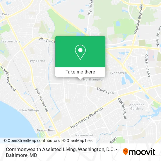
See Commonwealth Assisted Living, Hampton, on the map
Public Transit to Commonwealth Assisted Living in Hampton
Wondering how to get to Commonwealth Assisted Living in Hampton? Moovit helps you find the best way to get to Commonwealth Assisted Living with step-by-step directions from the nearest public transit station.
Moovit provides free maps and live directions to help you navigate through your city. View schedules, routes, timetables, and find out how long does it take to get to Commonwealth Assisted Living in real time.
Looking for the nearest stop or station to Commonwealth Assisted Living? Check out this list of stops closest to your destination: Big Bethel & Old Big Bethel.
Bus: 110, 112.
Want to see if there’s another route that gets you there at an earlier time? Moovit helps you find alternative routes or times. Get directions from and directions to Commonwealth Assisted Living easily from the Moovit App or Website.
We make riding to Commonwealth Assisted Living easy, which is why over 1.5 million users, including users in Hampton, trust Moovit as the best app for public transit. You don’t need to download an individual bus app or train app, Moovit is your all-in-one transit app that helps you find the best bus time or train time available.
For information on prices of bus and train, costs and ride fares to Commonwealth Assisted Living, please check the Moovit app.
Use the app to navigate to popular places including to the airport, hospital, stadium, grocery store, mall, coffee shop, school, college, and university.
Commonwealth Assisted Living Address: 1034 Topping Ln Hampton, VA 23666 street in Hampton
- Commonwealth Senior Living at Hampton,
- Stay at Home Personal Care,
- Ace Aquarium & Pond Designs,
- Northampton Presbyterian Church Epc,
- Peninsula Islamic Community Center,
- Northampton Nursing & Rehabilitation Center,
- Meissner Custom Knives & Pens,
- Topping Village,
- Heads and Tails,
- Angel's Image Body Care & Salon,
- Kiki Does Taxes,
- Pink Petal,
- Hampton Fire Station 6,
- Fire Station 6 - Northampton,
- Liberty Baptist Church Recrtn,
- Faith Church of God,
- Jasper N Watts,
- Clark Feed,
- Anna Seafood Restaurant,
- Liberty Park
Places Near Commonwealth Assisted Living (Hampton)
- Sibley Memorial Hospital, Washington,
- Washington National Cathedral, Washington,
- Westfield Montgomery Mall, Montgomery County,
- National Theatre, Washington,
- Basilica of the National Shrine, Washington,
- Rock Creek Tennis Center, Washington,
- The Anthem, Washington,
- Amazon Hq2, Arlington County,
- Capital One Arena, Washington,
- Museum Of The Bible, Washington,
- Camden Yards, Baltimore,
- M&T Bank Stadium, Baltimore,
- Georgetown, Washington,
- Marriott Marquis Washington, DC, Washington,
- National Museum of African American History and Culture, Washington,
- Pennsylvania Ave NW (3rd st and pennsylvania), Washington,
- National Zoo, Washington,
- Warner Theatre, Washington,
- Washington DC VA Medical Center, Washington,
- PG Mall, Prince George's County
How to get to popular places in Washington, D.C. - Baltimore, MD with public transit
Get around Hampton by public transit!
Traveling around Hampton has never been so easy. See step by step directions as you travel to any attraction, street or major public transit station. View bus and train schedules, arrival times, service alerts and detailed routes on a map, so you know exactly how to get to anywhere in Hampton.
When traveling to any destination around Hampton use Moovit's Live Directions with Get Off Notifications to know exactly where and how far to walk, how long to wait for your line, and how many stops are left. Moovit will alert you when it's time to get off — no need to constantly re-check whether yours is the next stop.
Wondering how to use public transit in Hampton or how to pay for public transit in Hampton? Moovit public transit app can help you navigate your way with public transit easily, and at minimum cost. It includes public transit fees, ticket prices, and costs. Looking for a map of Hampton public transit lines? Moovit public transit app shows all public transit maps in Hampton with all Bus, Train, Metro, Light Rail and Ferry routes and stops on an interactive map.
Washington, D.C. - Baltimore, MD has 5 transit type(s), including: Bus, Train, Metro, Light Rail and Ferry, operated by several transit agencies, including WMATA, Montgomery County Ride On, Fairfax Connector, TheBus, PRTC, DASH - Alexandria, Arlington Transit (ART), RTA of Central Maryland, MDOT MTA, MDOT MTA Light RailLink, MDOT MTA Commuter Bus, MDOT MTA Local Bus, FXBGO!, Virginia Railway Express (VRE) and MARC