How to get to Commserv by bus?
Click on the bus route to see step by step directions with maps, line arrival times and updated time schedules.
From Medstar Harbor Hospital, Baltimore
51 minFrom Hippodrome Theatre, Baltimore
32 minFrom Megabus Stop - White Marsh Park & Ride, Baltimore County
64 minFrom National Aquarium, Baltimore
26 minFrom Dundalk, Maryland, Baltimore County
63 minFrom Baltimore Soundstage, Baltimore
25 minFrom Hopkins Plaza, Baltimore
32 minFrom Baltimore Penn Station, Baltimore
59 minFrom Mva, Baltimore
45 minFrom I-695 @ Exit 27 (Dulaney Valley Road/MD 146), Baltimore County
44 min
Bus stop near Commserv in Baltimore
- Harford Rd & Montebello Ter FS Nb, 2 min walk,VIEW
What are the closest stations to Commserv?
The closest stations to Commserv are:
- Harford Rd & Montebello Ter FS Nb is 115 yards away, 2 min walk.
Which bus lines stop near Commserv?
These bus lines stop near Commserv: 28, 54.
What’s the nearest bus station to Commserv in Baltimore?
The nearest bus station to Commserv in Baltimore is Harford Rd & Montebello Ter FS Nb. It’s a 2 min walk away.
What time is the first bus to Commserv in Baltimore?
The 54 is the first bus that goes to Commserv in Baltimore. It stops nearby at 4:14 AM.
What time is the last bus to Commserv in Baltimore?
The 54 is the last bus that goes to Commserv in Baltimore. It stops nearby at 3:17 AM.
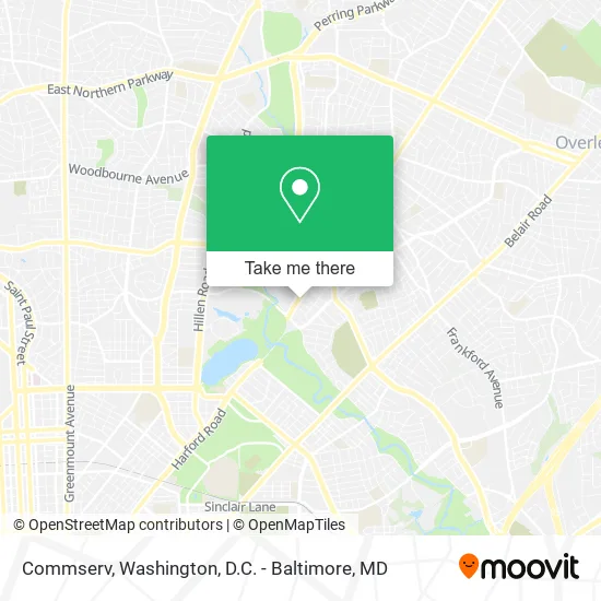
See Commserv, Baltimore, on the map
Public Transit to Commserv in Baltimore
Wondering how to get to Commserv in Baltimore? Moovit helps you find the best way to get to Commserv with step-by-step directions from the nearest public transit station.
Moovit provides free maps and live directions to help you navigate through your city. View schedules, routes, timetables, and find out how long does it take to get to Commserv in real time.
Looking for the nearest stop or station to Commserv? Check out this list of stops closest to your destination: Harford Rd & Montebello Ter FS Nb.
Bus: 28, 54, 154.
Want to see if there’s another route that gets you there at an earlier time? Moovit helps you find alternative routes or times. Get directions from and directions to Commserv easily from the Moovit App or Website.
We make riding to Commserv easy, which is why over 1.5 million users, including users in Baltimore, trust Moovit as the best app for public transit. You don’t need to download an individual bus app or train app, Moovit is your all-in-one transit app that helps you find the best bus time or train time available.
For information on prices of bus, costs and ride fares to Commserv, please check the Moovit app.
Use the app to navigate to popular places including to the airport, hospital, stadium, grocery store, mall, coffee shop, school, college, and university.
Commserv Address: 4319 Harford Rd Baltimore, MD 21214 street in Baltimore
- Michele's Beauty Salon,
- Found Studio,
- Hydro Hippie House Plants,
- Flourish,
- Four Hour Day Lutherie,
- Value Drugstore,
- American Lock & Key,
- Classic Carpet Cleaning,
- Coinstar - Bitcoin ATM,
- Garage,
- Dominick's,
- Volta,
- Amazon Locker-Cosset,
- Covid-19 Testing Site: Quest Diagnostics - Inside Harford Rd Safeway Store,
- Mercedes Sherwood Designs,
- Beverly Hills, Maryland,
- Argonne Dr Harford Rd,
- MD Prop MGMT System LLC-Ultimate Home Buyers,
- Fire Department-Station 42,
- LVH
Places Near Commserv (Baltimore)
- National Zoo, Washington,
- Amazon Hq2, Arlington County,
- M&T Bank Stadium, Baltimore,
- Pennsylvania Ave NW (3rd st and pennsylvania), Washington,
- Rock Creek Tennis Center, Washington,
- Warner Theatre, Washington,
- Washington National Cathedral, Washington,
- The Anthem, Washington,
- Westfield Montgomery Mall, Montgomery County,
- Basilica of the National Shrine, Washington,
- National Mall, Washington,
- Georgetown, Washington,
- Washington DC VA Medical Center, Washington,
- Capital One Arena, Washington,
- Marriott Marquis Washington, DC, Washington,
- PG Mall, Prince George's County,
- Museum Of The Bible, Washington,
- National Museum of African American History and Culture, Washington,
- Sibley Memorial Hospital, Washington,
- Camden Yards, Baltimore
How to get to popular places in Washington, D.C. - Baltimore, MD with public transit
Get around Baltimore by public transit!
Traveling around Baltimore has never been so easy. See step by step directions as you travel to any attraction, street or major public transit station. View bus and train schedules, arrival times, service alerts and detailed routes on a map, so you know exactly how to get to anywhere in Baltimore.
When traveling to any destination around Baltimore use Moovit's Live Directions with Get Off Notifications to know exactly where and how far to walk, how long to wait for your line, and how many stops are left. Moovit will alert you when it's time to get off — no need to constantly re-check whether yours is the next stop.
Wondering how to use public transit in Baltimore or how to pay for public transit in Baltimore? Moovit public transit app can help you navigate your way with public transit easily, and at minimum cost. It includes public transit fees, ticket prices, and costs. Looking for a map of Baltimore public transit lines? Moovit public transit app shows all public transit maps in Baltimore with all Bus, Train, Metro, Light Rail and Ferry routes and stops on an interactive map.
Washington, D.C. - Baltimore, MD has 5 transit type(s), including: Bus, Train, Metro, Light Rail and Ferry, operated by several transit agencies, including WMATA, Montgomery County Ride On, Fairfax Connector, TheBus, PRTC, DASH - Alexandria, Arlington Transit (ART), RTA of Central Maryland, MDOT MTA, MDOT MTA Light RailLink, MDOT MTA Commuter Bus, MDOT MTA Local Bus, FXBGO!, Virginia Railway Express (VRE) and MARC