How to get to Communications Express by bus?
Click on the bus route to see step by step directions with maps, line arrival times and updated time schedules.
From Hilton Alexandria Mark Center, Alexandria
77 minFrom National Geospatial-Intelligence Agency (NGA), Fairfax County
90 minFrom Lorton, VA, Fairfax County
86 minFrom Inova employee Shuttle, Fairfax County
72 minFrom Lorton, VA - Amtrak Auto Train Station (LOR), Fairfax County
92 minFrom Mosaic District, Fairfax County
77 minFrom Navy Federal Credit Union, Fairfax County
140 minFrom Springhill Suites Alexandria Old Town/Southwest, Alexandria
68 minFrom Eden Center, Falls Church
65 min
Bus stops near Communications Express in Fairfax County
Bus lines to Communications Express in Fairfax County
What are the closest stations to Communications Express?
The closest stations to Communications Express are:
- Braddock Rd & Ravensworth Rd is 2254 yards away, 27 min walk.
- Braddock Rd @ Ravensworth Rd is 2271 yards away, 27 min walk.
Which bus lines stop near Communications Express?
These bus lines stop near Communications Express: 306, F26.
What time is the first bus to Communications Express in Fairfax County?
The F29 is the first bus that goes to Communications Express in Fairfax County. It stops nearby at 6:27 AM.
What time is the last bus to Communications Express in Fairfax County?
The F29 is the last bus that goes to Communications Express in Fairfax County. It stops nearby at 7:28 PM.
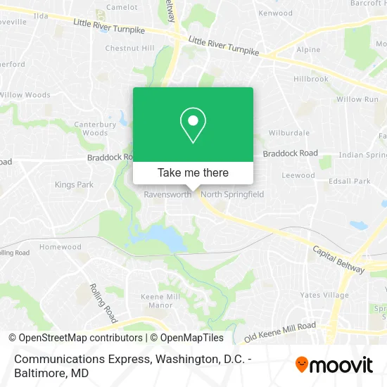
See Communications Express, Fairfax County, on the map
Public Transit to Communications Express in Fairfax County
Wondering how to get to Communications Express in Fairfax County? Moovit helps you find the best way to get to Communications Express with step-by-step directions from the nearest public transit station.
Moovit provides free maps and live directions to help you navigate through your city. View schedules, routes, timetables, and find out how long does it take to get to Communications Express in real time.
Looking for the nearest stop or station to Communications Express? Check out this list of stops closest to your destination: Braddock Rd & Ravensworth Rd; Braddock Rd @ Ravensworth Rd.
Bus: 306, F26, F29.
Want to see if there’s another route that gets you there at an earlier time? Moovit helps you find alternative routes or times. Get directions from and directions to Communications Express easily from the Moovit App or Website.
We make riding to Communications Express easy, which is why over 1.5 million users, including users in Fairfax County, trust Moovit as the best app for public transit. You don’t need to download an individual bus app or train app, Moovit is your all-in-one transit app that helps you find the best bus time or train time available.
For information on prices of bus and metro, costs and ride fares to Communications Express, please check the Moovit app.
Use the app to navigate to popular places including to the airport, hospital, stadium, grocery store, mall, coffee shop, school, college, and university.
Communications Express Address: 5407 Port Royal Rd Ste C street in Fairfax County
- 1-800 Radiator & A/C,
- Floors Depot,
- ADI Construction,
- Vancelectric,
- Virginia Academy Of Fencing,
- Scoops2u,
- Autumn Contracting,
- Evergreen Toner Inc.,
- Springfield Trophies,
- Happy Homes Remodeling,
- Connor's Pest Pros,
- B H Floors,
- Topline Paving & Construction,
- DC Slices,
- Any Pest of Alexandria,
- VMW Express,
- Chelsy Contracting Group,
- Iglesia Proclamadores de Cristo,
- Music Technology Inc,
- Sky Zone
Places Near Communications Express (Fairfax County)
- Museum Of The Bible, Washington,
- Warner Theatre, Washington,
- Rock Creek Tennis Center, Washington,
- Washington National Cathedral, Washington,
- Westfield Montgomery Mall, Montgomery County,
- Amazon Hq2, Arlington County,
- The Anthem, Washington,
- Sibley Memorial Hospital, Washington,
- Marriott Marquis Washington, DC, Washington,
- PG Mall, Prince George's County,
- Basilica of the National Shrine, Washington,
- M&T Bank Stadium, Baltimore,
- Camden Yards, Baltimore,
- National Zoo, Washington,
- Washington DC VA Medical Center, Washington,
- Capital One Arena, Washington,
- National Mall, Washington,
- Pennsylvania Ave NW (3rd st and pennsylvania), Washington,
- National Museum of African American History and Culture, Washington,
- Georgetown, Washington
How to get to popular places in Washington, D.C. - Baltimore, MD with public transit
Get around Fairfax County by public transit!
Traveling around Fairfax County has never been so easy. See step by step directions as you travel to any attraction, street or major public transit station. View bus and train schedules, arrival times, service alerts and detailed routes on a map, so you know exactly how to get to anywhere in Fairfax County.
When traveling to any destination around Fairfax County use Moovit's Live Directions with Get Off Notifications to know exactly where and how far to walk, how long to wait for your line, and how many stops are left. Moovit will alert you when it's time to get off — no need to constantly re-check whether yours is the next stop.
Wondering how to use public transit in Fairfax County or how to pay for public transit in Fairfax County? Moovit public transit app can help you navigate your way with public transit easily, and at minimum cost. It includes public transit fees, ticket prices, and costs. Looking for a map of Fairfax County public transit lines? Moovit public transit app shows all public transit maps in Fairfax County with all Bus, Train, Metro, Light Rail and Ferry routes and stops on an interactive map.
Washington, D.C. - Baltimore, MD has 5 transit type(s), including: Bus, Train, Metro, Light Rail and Ferry, operated by several transit agencies, including WMATA, Montgomery County Ride On, Fairfax Connector, TheBus, PRTC, DASH - Alexandria, Arlington Transit (ART), RTA of Central Maryland, MDOT MTA, MDOT MTA Light RailLink, MDOT MTA Commuter Bus, MDOT MTA Local Bus, FXBGO!, Virginia Railway Express (VRE) and MARC