How to get to Community Tire & Auto Service by bus?
Click on the bus route to see step by step directions with maps, line arrival times and updated time schedules.
Bus stop near Community Tire & Auto Service in Miami
- US 1 & Whispering Palms SB, 2 min walk,VIEW
Bus lines to Community Tire & Auto Service in Miami
- RT 12, North County Hub,VIEW
What are the closest stations to Community Tire & Auto Service?
The closest stations to Community Tire & Auto Service are:
- US 1 & Whispering Palms SB is 128 yards away, 2 min walk.
Which bus line stops near Community Tire & Auto Service?
RT 11 (Us 1 & Barber St. (Publix))
What’s the nearest bus station to Community Tire & Auto Service in Miami?
The nearest bus station to Community Tire & Auto Service in Miami is US 1 & Whispering Palms SB. It’s a 2 min walk away.
What time is the first bus to Community Tire & Auto Service in Miami?
The RT 12 is the first bus that goes to Community Tire & Auto Service in Miami. It stops nearby at 6:02 AM.
What time is the last bus to Community Tire & Auto Service in Miami?
The RT 12 is the last bus that goes to Community Tire & Auto Service in Miami. It stops nearby at 6:55 PM.
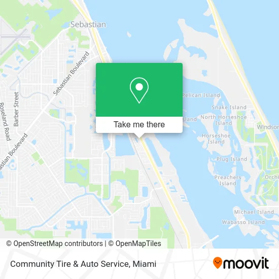
See Community Tire & Auto Service, Miami, on the map
Public Transit to Community Tire & Auto Service in Miami
Wondering how to get to Community Tire & Auto Service in Miami? Moovit helps you find the best way to get to Community Tire & Auto Service with step-by-step directions from the nearest public transit station.
Moovit provides free maps and live directions to help you navigate through your city. View schedules, routes, timetables, and find out how long does it take to get to Community Tire & Auto Service in real time.
Looking for the nearest stop or station to Community Tire & Auto Service? Check out this list of stops closest to your destination: US 1 & Whispering Palms SB.
Bus: RT 11, RT 12.
Want to see if there’s another route that gets you there at an earlier time? Moovit helps you find alternative routes or times. Get directions from and directions to Community Tire & Auto Service easily from the Moovit App or Website.
We make riding to Community Tire & Auto Service easy, which is why over 1.5 million users, including users in Miami, trust Moovit as the best app for public transit. You don’t need to download an individual bus app or train app, Moovit is your all-in-one transit app that helps you find the best bus time or train time available.
For information on prices of bus, costs and ride fares to Community Tire & Auto Service, please check the Moovit app.
Use the app to navigate to popular places including to the airport, hospital, stadium, grocery store, mall, coffee shop, school, college, and university.
Community Tire & Auto Service Address: 10425 US Highway 1 Sebastian, FL 32958 street in Miami
- St. Lucie Battery & Tire,
- Global Luxury CB Blog,
- Big Jims Plumbing,
- Palm Lake of Sebastian,
- Presto! ATM,
- Vitorios Pizza,
- Kelley Ryser - Unitedhealthcare Licensed Sales Agent,
- Waterman Real Estate,
- FPL EVolution,
- Shred Nations,
- Global Luxury CB Blog,
- Breath EZ Air,
- Captain Tees,
- Powerfly Products, Inc.,
- Adams and Rubin Fence,
- Pro Sport,
- Heretic Knives,
- Family Heating and Air,
- Ultimate Cabinet Supplies,
- The Sculpted Body Company
Places Near Community Tire & Auto Service (Miami)
- Dolphin Mall Bus, Miami,
- Hard Rock Stadium, Miami Gardens,
- Miami VA Hospital, Miami,
- Miami Design District, Miami,
- Dolphin Mall, Miami,
- Miami-Dade County Courthouse, Miami,
- Richard E. Gerstein Justice Building, Miami,
- Wynwood, Miami,
- Little Havana, Miami,
- Sawgrass mall ( FL ), Miami Beach,
- Aventura Mall, Miami Beach,
- Zoo Miami, Miami,
- Port of Miami Cruise Terminal, Miami,
- Marlins Park, Miami,
- Miami Freedom Park, Miami,
- Sawgrass Mall, Miami,
- Brickell City Centre, Miami,
- Aventura Mall, Miami,
- Keiser University Flagship Campus, West Palm Beach,
- Bayside Marketplace, Miami
How to get to popular places in Miami with public transit
Get around Miami by public transit!
Traveling around Miami has never been so easy. See step by step directions as you travel to any attraction, street or major public transit station. View bus and train schedules, arrival times, service alerts and detailed routes on a map, so you know exactly how to get to anywhere in Miami.
When traveling to any destination around Miami use Moovit's Live Directions with Get Off Notifications to know exactly where and how far to walk, how long to wait for your line, and how many stops are left. Moovit will alert you when it's time to get off — no need to constantly re-check whether yours is the next stop.
Wondering how to use public transit in Miami or how to pay for public transit in Miami? Moovit public transit app can help you navigate your way with public transit easily, and at minimum cost. It includes public transit fees, ticket prices, and costs. Looking for a map of Miami public transit lines? Moovit public transit app shows all public transit maps in Miami with all Bus, Train, Light Rail and Ferry routes and stops on an interactive map.
Miami has 4 transit type(s), including: Bus, Train, Light Rail and Ferry, operated by several transit agencies, including Broward County Transit, Miami-Dade Transit, Metrorail, Palm Tran, Tri-Rail, Brightline, MARTY, City of Homestead Trolley, Key West Transit, Treasure Coast Connector, GoLine IRT, Amtrak, Greyhound-us, FlixBus-us and Aventura Express Shuttle Bus