How to get to Compass Bridge Loans by bus?
Click on the bus route to see step by step directions with maps, line arrival times and updated time schedules.
From Thomas Jefferson High School for Science and Technology, Fairfax County
86 minFrom Carmine's Italian Restaurant Washington,DC, Washington
69 minFrom Residence Inn by Marriott Washington Capitol Hill Navy Yard, Washington
87 minFrom Roosevelt High School, Washington
85 minFrom Saint Marks Episcopal Church, Washington
78 minFrom Botanical Gardens, Washington
71 minFrom Thomas Jefferson Memorial, Washington
78 minFrom National Mall, Washington
72 minFrom Freddie Mac, Fairfax County
45 minFrom Ben's Chili Bowl, Washington
87 min
How to get to Compass Bridge Loans by metro?
Click on the metro route to see step by step directions with maps, line arrival times and updated time schedules.
From Carmine's Italian Restaurant Washington,DC, Washington
61 minFrom Residence Inn by Marriott Washington Capitol Hill Navy Yard, Washington
69 minFrom Roosevelt High School, Washington
83 minFrom Saint Marks Episcopal Church, Washington
66 minFrom Botanical Gardens, Washington
63 minFrom Thomas Jefferson Memorial, Washington
72 minFrom National Mall, Washington
60 minFrom Freddie Mac, Fairfax County
67 minFrom Ben's Chili Bowl, Washington
72 min
Metro station near Compass Bridge Loans in Arlington County
- Clarendon, 3 min walk,VIEW
Bus stops near Compass Bridge Loans in Arlington County
Bus lines to Compass Bridge Loans in Arlington County
What are the closest stations to Compass Bridge Loans?
The closest stations to Compass Bridge Loans are:
- Clarendon is 212 yards away, 3 min walk.
- Cherry Hill Rd Wb @ Lorcom Ln Ns is 312 yards away, 4 min walk.
- N Glebe Road, Nb & Lee Highway, Ns is 811 yards away, 10 min walk.
Which bus lines stop near Compass Bridge Loans?
These bus lines stop near Compass Bridge Loans: 55, A70.
Which metro lines stop near Compass Bridge Loans?
These metro lines stop near Compass Bridge Loans: ORANGE, SILVER.
What’s the nearest metro station to Compass Bridge Loans in Arlington County?
The nearest metro station to Compass Bridge Loans in Arlington County is Clarendon. It’s a 3 min walk away.
What’s the nearest bus station to Compass Bridge Loans in Arlington County?
The nearest bus station to Compass Bridge Loans in Arlington County is Cherry Hill Rd Wb @ Lorcom Ln Ns. It’s a 4 min walk away.
What time is the first metro to Compass Bridge Loans in Arlington County?
The ORANGE is the first metro that goes to Compass Bridge Loans in Arlington County. It stops nearby at 5:10 AM.
What time is the last metro to Compass Bridge Loans in Arlington County?
The SILVER is the last metro that goes to Compass Bridge Loans in Arlington County. It stops nearby at 12:31 AM.
What time is the first bus to Compass Bridge Loans in Arlington County?
The 55 is the first bus that goes to Compass Bridge Loans in Arlington County. It stops nearby at 5:09 AM.
What time is the last bus to Compass Bridge Loans in Arlington County?
The 55 is the last bus that goes to Compass Bridge Loans in Arlington County. It stops nearby at 1:30 AM.
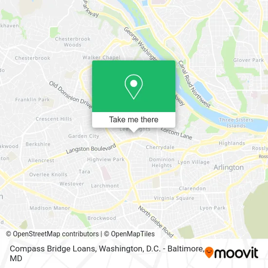
See Compass Bridge Loans, Arlington County, on the map
Public Transit to Compass Bridge Loans in Arlington County
Wondering how to get to Compass Bridge Loans in Arlington County? Moovit helps you find the best way to get to Compass Bridge Loans with step-by-step directions from the nearest public transit station.
Moovit provides free maps and live directions to help you navigate through your city. View schedules, routes, timetables, and find out how long does it take to get to Compass Bridge Loans in real time.
Looking for the nearest stop or station to Compass Bridge Loans? Check out this list of stops closest to your destination: Clarendon; Cherry Hill Rd Wb @ Lorcom Ln Ns; N Glebe Road.
Bus: 55, A70, 72.Metro: ORANGE, SILVER.
Want to see if there’s another route that gets you there at an earlier time? Moovit helps you find alternative routes or times. Get directions from and directions to Compass Bridge Loans easily from the Moovit App or Website.
We make riding to Compass Bridge Loans easy, which is why over 1.5 million users, including users in Arlington County, trust Moovit as the best app for public transit. You don’t need to download an individual bus app or train app, Moovit is your all-in-one transit app that helps you find the best bus time or train time available.
For information on prices of bus and metro, costs and ride fares to Compass Bridge Loans, please check the Moovit app.
Use the app to navigate to popular places including to the airport, hospital, stadium, grocery store, mall, coffee shop, school, college, and university.
Compass Bridge Loans Address: 2260 N Upton St Arlington, VA 22207 street in Arlington County
- Firearms Policy Coalition,
- B.A.S.S./Shimano Award,
- Outdoor Lifestyle Group,
- Public School Options,
- WESTERN UNION,
- Fort Jackson Library,
- Steam Pro Carpet Cleaners Carpet Cleaning,
- STARBUCKS,
- Mosquito Shield,
- Sam the Concrete Man Washington D.C,
- Cafe Colline,
- Woof Gang Bakery,
- Pat Shannon,
- J & A Properties,
- Collections Assessment for Preservation,
- Wendy Jessup and Associates, Inc.,
- Playworks Speech, Occupational, and Physical Therapies,
- Dcmay,
- Shaw Enterprises,
- Dorothy Hamm Middle School
Places Near Compass Bridge Loans (Arlington County)
- Washington DC VA Medical Center, Washington,
- Sibley Memorial Hospital, Washington,
- PG Mall, Prince George's County,
- Warner Theatre, Washington,
- Camden Yards, Baltimore,
- Westfield Montgomery Mall, Montgomery County,
- Marriott Marquis Washington, DC, Washington,
- Amazon Hq2, Arlington County,
- The Anthem, Washington,
- Georgetown, Washington,
- Basilica of the National Shrine, Washington,
- National Zoo, Washington,
- Rock Creek Tennis Center, Washington,
- Pennsylvania Ave NW (3rd st and pennsylvania), Washington,
- Museum Of The Bible, Washington,
- M&T Bank Stadium, Baltimore,
- National Museum of African American History and Culture, Washington,
- Washington National Cathedral, Washington,
- National Mall, Washington,
- Capital One Arena, Washington
How to get to popular places in Washington, D.C. - Baltimore, MD with public transit
Get around Arlington County by public transit!
Traveling around Arlington County has never been so easy. See step by step directions as you travel to any attraction, street or major public transit station. View bus and train schedules, arrival times, service alerts and detailed routes on a map, so you know exactly how to get to anywhere in Arlington County.
When traveling to any destination around Arlington County use Moovit's Live Directions with Get Off Notifications to know exactly where and how far to walk, how long to wait for your line, and how many stops are left. Moovit will alert you when it's time to get off — no need to constantly re-check whether yours is the next stop.
Wondering how to use public transit in Arlington County or how to pay for public transit in Arlington County? Moovit public transit app can help you navigate your way with public transit easily, and at minimum cost. It includes public transit fees, ticket prices, and costs. Looking for a map of Arlington County public transit lines? Moovit public transit app shows all public transit maps in Arlington County with all Bus, Train, Metro, Light Rail and Ferry routes and stops on an interactive map.
Washington, D.C. - Baltimore, MD has 5 transit type(s), including: Bus, Train, Metro, Light Rail and Ferry, operated by several transit agencies, including WMATA, Montgomery County Ride On, Fairfax Connector, TheBus, PRTC, DASH - Alexandria, Arlington Transit (ART), RTA of Central Maryland, MDOT MTA, MDOT MTA Light RailLink, MDOT MTA Commuter Bus, MDOT MTA Local Bus, FXBGO!, Virginia Railway Express (VRE) and MARC