Directions to Competitive Edge Baseball (Spotsylvania County) with public transportation
The following transit lines have routes that pass near Competitive Edge Baseball
 Bus: ROUTE 14.
- Train: FREDERICKSBURG LINE, CAROLINIAN, NORTHEAST REGIONAL, SILVER METEOR.
How to get to Competitive Edge Baseball by bus?
Click on the bus route to see step by step directions with maps, line arrival times and updated time schedules.
From Potomac Mills Mall, Prince William County
146 minFrom Lorton, VA, Fairfax County
155 minFrom Department of State SA 34, Fairfax County
234 minFrom Lorton, VA - Amtrak Auto Train Station (LOR), Fairfax County
161 minFrom Rose Gaming Resort, Prince William County
171 minFrom Woodbridge, VA, Prince William County
90 min
How to get to Competitive Edge Baseball by train?
Click on the train route to see step by step directions with maps, line arrival times and updated time schedules.
Bus stop near Competitive Edge Baseball in Spotsylvania County
- 17 - Dixon St. | Church St., 9 min walk,VIEW
Train station near Competitive Edge Baseball in Spotsylvania County
- Fredericksburg, 40 min walk,VIEW
Bus lines to Competitive Edge Baseball in Spotsylvania County
- ROUTE 14, Outbound,VIEW
What are the closest stations to Competitive Edge Baseball?
The closest stations to Competitive Edge Baseball are:
- 17 - Dixon St. | Church St. is 669 yards away, 9 min walk.
- Fredericksburg is 3288 yards away, 40 min walk.
Which bus line stops near Competitive Edge Baseball?
ROUTE 14 (Outbound)
Which train line stops near Competitive Edge Baseball?
FREDERICKSBURG LINE (Spotsylvania)
What’s the nearest bus station to Competitive Edge Baseball in Spotsylvania County?
The nearest bus station to Competitive Edge Baseball in Spotsylvania County is 17 - Dixon St. | Church St.. It’s a 9 min walk away.
What time is the first train to Competitive Edge Baseball in Spotsylvania County?
The SILVER METEOR is the first train that goes to Competitive Edge Baseball in Spotsylvania County. It stops nearby at 4:49 AM.
What time is the last train to Competitive Edge Baseball in Spotsylvania County?
The SILVER METEOR is the last train that goes to Competitive Edge Baseball in Spotsylvania County. It stops nearby at 4:49 AM.
What time is the first bus to Competitive Edge Baseball in Spotsylvania County?
The ROUTE 14 is the first bus that goes to Competitive Edge Baseball in Spotsylvania County. It stops nearby at 6:44 AM.
What time is the last bus to Competitive Edge Baseball in Spotsylvania County?
The ROUTE 14 is the last bus that goes to Competitive Edge Baseball in Spotsylvania County. It stops nearby at 8:04 PM.
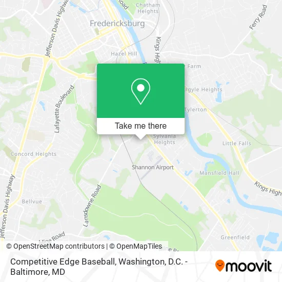
See Competitive Edge Baseball, Spotsylvania County, on the map
Public Transit to Competitive Edge Baseball in Spotsylvania County
Wondering how to get to Competitive Edge Baseball in Spotsylvania County? Moovit helps you find the best way to get to Competitive Edge Baseball with step-by-step directions from the nearest public transit station.
Moovit provides free maps and live directions to help you navigate through your city. View schedules, routes, timetables, and find out how long does it take to get to Competitive Edge Baseball in real time.
Looking for the nearest stop or station to Competitive Edge Baseball? Check out this list of stops closest to your destination: 17 - Dixon St. | Church St.; Fredericksburg.
Bus: ROUTE 14.Train: FREDERICKSBURG LINE, CAROLINIAN, NORTHEAST REGIONAL, SILVER METEOR.
Want to see if there’s another route that gets you there at an earlier time? Moovit helps you find alternative routes or times. Get directions from and directions to Competitive Edge Baseball easily from the Moovit App or Website.
We make riding to Competitive Edge Baseball easy, which is why over 1.5 million users, including users in Spotsylvania County, trust Moovit as the best app for public transit. You don’t need to download an individual bus app or train app, Moovit is your all-in-one transit app that helps you find the best bus time or train time available.
For information on prices of bus and train, costs and ride fares to Competitive Edge Baseball, please check the Moovit app.
Use the app to navigate to popular places including to the airport, hospital, stadium, grocery store, mall, coffee shop, school, college, and university.
Competitive Edge Baseball Address: 3475 Lee Hill Dr Fredericksburg, VA 22408 street in Spotsylvania County
- DUNKIN',
- Ferguson Hvac Supply,
- Oha Home Service,
- Tobacco Hut,
- Ars Rescue Rooter,
- World Harvest Cathedral,
- Benefit Oyster Roast,
- Salt: Saints Announcing the Living Testimony,
- Amazon Locker-Teenager,
- Credit Union 1,
- PNC Bank,
- Taqueria El Habanero Feliz,
- Melendez Motorsports,
- Precision Garage Door,
- Wallace Electrical, Inc., Tommy,
- High Definition Media,
- Cooper's Towing and Recovery,
- Black Magic Auto,
- Pinnacle Treatment,
- FCCR Fredericksburg
Places Near Competitive Edge Baseball (Spotsylvania County)
- Marriott Marquis Washington, DC, Washington,
- National Museum of African American History and Culture, Washington,
- Westfield Montgomery Mall, Montgomery County,
- M&T Bank Stadium, Baltimore,
- National Zoo, Washington,
- Basilica of the National Shrine, Washington,
- The Anthem, Washington,
- Washington DC VA Medical Center, Washington,
- National Mall, Washington,
- PG Mall, Prince George's County,
- Pennsylvania Ave NW (3rd st and pennsylvania), Washington,
- Rock Creek Tennis Center, Washington,
- Sibley Memorial Hospital, Washington,
- Georgetown, Washington,
- Washington National Cathedral, Washington,
- Museum Of The Bible, Washington,
- Amazon Hq2, Arlington County,
- Warner Theatre, Washington,
- Camden Yards, Baltimore,
- Capital One Arena, Washington
How to get to popular places in Washington, D.C. - Baltimore, MD with public transit
Get around Spotsylvania County by public transit!
Traveling around Spotsylvania County has never been so easy. See step by step directions as you travel to any attraction, street or major public transit station. View bus and train schedules, arrival times, service alerts and detailed routes on a map, so you know exactly how to get to anywhere in Spotsylvania County.
When traveling to any destination around Spotsylvania County use Moovit's Live Directions with Get Off Notifications to know exactly where and how far to walk, how long to wait for your line, and how many stops are left. Moovit will alert you when it's time to get off — no need to constantly re-check whether yours is the next stop.
Wondering how to use public transit in Spotsylvania County or how to pay for public transit in Spotsylvania County? Moovit public transit app can help you navigate your way with public transit easily, and at minimum cost. It includes public transit fees, ticket prices, and costs. Looking for a map of Spotsylvania County public transit lines? Moovit public transit app shows all public transit maps in Spotsylvania County with all Bus, Train, Metro, Light Rail and Ferry routes and stops on an interactive map.
Washington, D.C. - Baltimore, MD has 5 transit type(s), including: Bus, Train, Metro, Light Rail and Ferry, operated by several transit agencies, including WMATA, Montgomery County Ride On, Fairfax Connector, TheBus, PRTC, DASH - Alexandria, Arlington Transit (ART), RTA of Central Maryland, MDOT MTA, MDOT MTA Light RailLink, MDOT MTA Commuter Bus, MDOT MTA Local Bus, FXBGO!, Virginia Railway Express (VRE) and MARC