Directions to Complex Pixels (Richmond) with public transportation
The following transit lines have routes that pass near Complex Pixels
 Bus: BRT, FLIXBUS N2471, FLIXBUS N2601, GREYHOUND US0670, 14.
- Train: NORTHEAST REGIONAL.
How to get to Complex Pixels by bus?
Click on the bus route to see step by step directions with maps, line arrival times and updated time schedules.
From Lorton, VA - Amtrak Auto Train Station (LOR), Fairfax County
201 minFrom Hampton University, Hampton
279 minFrom Busch Gardens Williamsburg (Employee Parking Lot), James City County
126 minFrom Rose Gaming Resort, Prince William County
211 minFrom Lorton, VA, Fairfax County
195 minFrom Potomac Mills Mall, Prince William County
186 minFrom Amazon Fulfillment Center-Ric3, Richmond
68 minFrom Woodbridge, VA, Prince William County
130 minFrom UVA Hospital Medical Center, Charlottesville
296 min
How to get to Complex Pixels by train?
Click on the train route to see step by step directions with maps, line arrival times and updated time schedules.
Bus stops near Complex Pixels in Richmond
Train station near Complex Pixels in Richmond
- Pathrichmond Main Street Amtrak Station, 55 min walk,VIEW
Bus lines to Complex Pixels in Richmond
- 14, Hermitage/Azalea,VIEW
- 7A, Laburnum/Nine Mile,VIEW
- 7B, Nine Mile,VIEW
- 56, South Laburnum,VIEW
- BRT, Broad/Main/Rocketts,VIEW
- FLIXBUS N2601, Richmond (Main St Station Plaza),VIEW
- FLIXBUS 2605, New York Midtown (31st St & 8th Ave),VIEW
- FLIXBUS N2605, Brookline,VIEW
- GREYHOUND US0670, Raleigh Bus Station,VIEW
- GREYHOUND US0700, Charlotte Bus Station,VIEW
- FLIXBUS N2471, Atlanta Bus Station,VIEW
- FLIXBUS N2472, New York City Chinatown (28 Allen St),VIEW
- 95, 95x Richmond-Petersburg Express (Pbg),VIEW
What are the closest stations to Complex Pixels?
The closest stations to Complex Pixels are:
- Main + 18th is 182 yards away, 3 min walk.
- Broad + 18th is 249 yards away, 4 min walk.
- Main Street Station Eastbound Station is 346 yards away, 5 min walk.
- Richmond (E Grace St & Crane St) is 375 yards away, 5 min walk.
- Richmond (Main St Station Plaza) is 417 yards away, 6 min walk.
- 17th + Marshall is 453 yards away, 6 min walk.
- Pathrichmond Main Street Amtrak Station is 4701 yards away, 55 min walk.
Which bus lines stop near Complex Pixels?
These bus lines stop near Complex Pixels: BRT, FLIXBUS N2471, FLIXBUS N2601, GREYHOUND US0670.
Which train line stops near Complex Pixels?
NORTHEAST REGIONAL (Newport News)
What’s the nearest bus station to Complex Pixels in Richmond?
The nearest bus station to Complex Pixels in Richmond is Main + 18th. It’s a 3 min walk away.
What time is the first train to Complex Pixels in Richmond?
The NORTHEAST REGIONAL is the first train that goes to Complex Pixels in Richmond. It stops nearby at 5:19 AM.
What time is the last train to Complex Pixels in Richmond?
The NORTHEAST REGIONAL is the last train that goes to Complex Pixels in Richmond. It stops nearby at 6:52 PM.
What time is the first bus to Complex Pixels in Richmond?
The GREYHOUND US0700 is the first bus that goes to Complex Pixels in Richmond. It stops nearby at 3:35 AM.
What time is the last bus to Complex Pixels in Richmond?
The GREYHOUND US0670 is the last bus that goes to Complex Pixels in Richmond. It stops nearby at 2:10 PM.
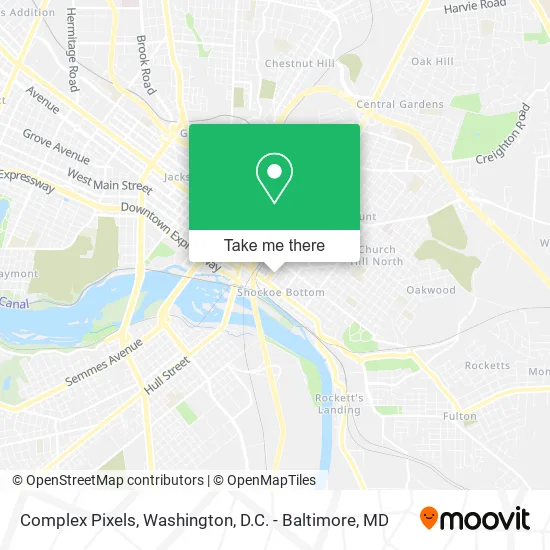
See Complex Pixels, Richmond, on the map
Public Transit to Complex Pixels in Richmond
Wondering how to get to Complex Pixels in Richmond? Moovit helps you find the best way to get to Complex Pixels with step-by-step directions from the nearest public transit station.
Moovit provides free maps and live directions to help you navigate through your city. View schedules, routes, timetables, and find out how long does it take to get to Complex Pixels in real time.
Looking for the nearest stop or station to Complex Pixels? Check out this list of stops closest to your destination: Main + 18th; Broad + 18th; Main Street Station Eastbound Station; Richmond (E Grace St & Crane St); Richmond (Main St Station Plaza); 17th + Marshall; Pathrichmond Main Street Amtrak Station.
Bus: BRT, FLIXBUS N2471, FLIXBUS N2601, GREYHOUND US0670, 14, 7A, 7B, 56, FLIXBUS 2605, FLIXBUS N2605, GREYHOUND US0700, FLIXBUS N2472.Train: NORTHEAST REGIONAL.
Want to see if there’s another route that gets you there at an earlier time? Moovit helps you find alternative routes or times. Get directions from and directions to Complex Pixels easily from the Moovit App or Website.
We make riding to Complex Pixels easy, which is why over 1.5 million users, including users in Richmond, trust Moovit as the best app for public transit. You don’t need to download an individual bus app or train app, Moovit is your all-in-one transit app that helps you find the best bus time or train time available.
For information on prices of bus and train, costs and ride fares to Complex Pixels, please check the Moovit app.
Use the app to navigate to popular places including to the airport, hospital, stadium, grocery store, mall, coffee shop, school, college, and university.
Complex Pixels Address: 1806 E Franklin St Richmond, VA 23223 street in Richmond
- Serenity Manor at Hollins Mill,
- Y & H Mercantile,
- Adiva Naturals,
- Phototech,
- Light Images,
- Saxman Jeff S Photography,
- Artware,
- Zuppa,
- Margarita's Cantina,
- Lofts at Franklin,
- Journeyman's Adventure,
- Fallout,
- Addiction [at Fallout],
- On the Rox,
- Stadium Sports Bar,
- Element Lounge,
- La Bodega,
- Fuel Creative,
- Jon Hood Photography,
- Rhumb Line
Places Near Complex Pixels (Richmond)
- Washington DC VA Medical Center, Washington,
- Westfield Montgomery Mall, Montgomery County,
- Capital One Arena, Washington,
- Amazon Hq2, Arlington County,
- Basilica of the National Shrine, Washington,
- Museum Of The Bible, Washington,
- PG Mall, Prince George's County,
- National Mall, Washington,
- Warner Theatre, Washington,
- The Anthem, Washington,
- National Zoo, Washington,
- M&T Bank Stadium, Baltimore,
- Washington National Cathedral, Washington,
- Marriott Marquis Washington, DC, Washington,
- National Museum of African American History and Culture, Washington,
- Sibley Memorial Hospital, Washington,
- Georgetown, Washington,
- Rock Creek Tennis Center, Washington,
- Camden Yards, Baltimore,
- Pennsylvania Ave NW (3rd st and pennsylvania), Washington
How to get to popular places in Washington, D.C. - Baltimore, MD with public transit
Get around Richmond by public transit!
Traveling around Richmond has never been so easy. See step by step directions as you travel to any attraction, street or major public transit station. View bus and train schedules, arrival times, service alerts and detailed routes on a map, so you know exactly how to get to anywhere in Richmond.
When traveling to any destination around Richmond use Moovit's Live Directions with Get Off Notifications to know exactly where and how far to walk, how long to wait for your line, and how many stops are left. Moovit will alert you when it's time to get off — no need to constantly re-check whether yours is the next stop.
Wondering how to use public transit in Richmond or how to pay for public transit in Richmond? Moovit public transit app can help you navigate your way with public transit easily, and at minimum cost. It includes public transit fees, ticket prices, and costs. Looking for a map of Richmond public transit lines? Moovit public transit app shows all public transit maps in Richmond with all Bus, Train, Metro, Light Rail and Ferry routes and stops on an interactive map.
Washington, D.C. - Baltimore, MD has 5 transit type(s), including: Bus, Train, Metro, Light Rail and Ferry, operated by several transit agencies, including WMATA, Montgomery County Ride On, Fairfax Connector, TheBus, PRTC, DASH - Alexandria, Arlington Transit (ART), RTA of Central Maryland, MDOT MTA, MDOT MTA Light RailLink, MDOT MTA Commuter Bus, MDOT MTA Local Bus, FXBGO!, Virginia Railway Express (VRE) and MARC