How to get to Compras + by bus?
Click on the bus route to see step by step directions with maps, line arrival times and updated time schedules.
From Morro Solar, Chorrillos
66 minFrom Urb Mateo Pumacahua Santiago de Surco, Santiago D
51 minFrom Av. Javier Prado, San Borja
29 minFrom AV MEXICO LA VICTORIA, La Victori
25 minFrom Megaplaza Lima Norte, Independen
43 minFrom MegaPlaza, Independen
43 minFrom Avenida República de panama, Miraflores
35 minFrom Velatorio Carmelitas, Miraflores
35 minFrom Av El Polo Surco, Santiago D
51 minFrom Parque De La Felicidad, San Borja
53 min
Bus stops near Compras + in Lima
Bus lines to Compras + in Lima
- 404, Brasil (Magdalena Del Mar) - Wiesse (San Juan De Lurigancho),VIEW
- 1024, Los Sauces - Cerro Candela,VIEW
- 1030, Canta Callao (San Martin De Porres) - San Diego (San Martin De Porres),VIEW
- 1065, Valdiviezo (Ate) - Ceres (Ate),VIEW
- 1084, Ceres (Ate) - La Campiña (Chorrillos),VIEW
- 1097, Av. Santa Rosa (San Juan De Lurigancho) - Las Palmas (Pachacamac) ,VIEW
- 1180, Pamplona Alta (San Juan De Miraflores) - Torre Blanca (Carabayllo),VIEW
- 1183, Carabayllo - Surco - Carabayllo,VIEW
- 1219, San Miguel - Ate,VIEW
- 1252, V.M.T. - San Miguel,VIEW
- 1269, Santa Rosa (Callao) - Las Gaviotas (Ate),VIEW
- IM47, Km. 22 - Faucett - La Marina - Brasil - Caquetá - Km. 22,VIEW
- 1462, Carabayllo - Universitaria - Brasil - Carabayllo,VIEW
- 201, Ovalo La Perla (Callao) - Ceres (Ate),VIEW
- 206, Alameda Del Corregidor (La Molina) - San Marcos (San Miguel),VIEW
- 209, San Marcos (San Miguel) - Tagore (Ate),VIEW
- 1203, Portón (San Juan De Lurigancho) - Plaza Norte (San Martin De Porres) - Portón (San Juan De Lurigancho),VIEW
- 1231, Carabayllo - Chorrillos,VIEW
- 1279, Ceres,VIEW
- 1304, Callao - Pachacamac,VIEW
What are the closest stations to Compras +?
The closest stations to Compras + are:
- Hospital De La Policia is 239 meters away, 4 min walk.
- Hospital Militar is 302 meters away, 5 min walk.
- Avenida Manuel Cipriano Dulanto, 543-723 is 387 meters away, 6 min walk.
- Sucre is 572 meters away, 8 min walk.
- La Marina is 594 meters away, 8 min walk.
- Cabo Gutarra is 602 meters away, 8 min walk.
- Amazonas is 749 meters away, 10 min walk.
Which bus lines stop near Compras +?
These bus lines stop near Compras +: 1065, 1183, 1269, 201.
What’s the nearest bus station to Compras + in Lima?
The nearest bus station to Compras + in Lima is Hospital De La Policia. It’s a 4 min walk away.
What time is the first bus to Compras + in Lima?
The 1180 is the first bus that goes to Compras + in Lima. It stops nearby at 4:06 AM.
What time is the last bus to Compras + in Lima?
The IM47 is the last bus that goes to Compras + in Lima. It stops nearby at 12:50 AM.
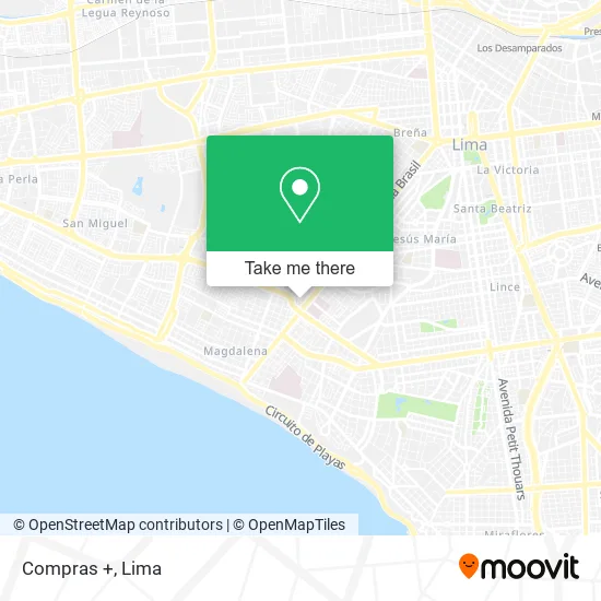
See Compras +, Lima, on the map
Public Transit to Compras + in Lima
Wondering how to get to Compras + in Lima? Moovit helps you find the best way to get to Compras + with step-by-step directions from the nearest public transit station.
Moovit provides free maps and live directions to help you navigate through your city. View schedules, routes, timetables, and find out how long does it take to get to Compras + in real time.
Looking for the nearest stop or station to Compras +? Check out this list of stops closest to your destination: Hospital De La Policia; Hospital Militar; Avenida Manuel Cipriano Dulanto; Sucre; La Marina; Cabo Gutarra; Amazonas.
Bus: 1065, 1183, 1269, 201, 404, 1024, 1030, 1084, 1462, 206, 209, 1203, 1231, 1279, 1304, 1317, 204, 1010, 1012, 1111, 1173, 1205.
Want to see if there’s another route that gets you there at an earlier time? Moovit helps you find alternative routes or times. Get directions from and directions to Compras + easily from the Moovit App or Website.
We make riding to Compras + easy, which is why over 1.5 million users, including users in Lima, trust Moovit as the best app for public transit. You don’t need to download an individual bus app or train app, Moovit is your all-in-one transit app that helps you find the best bus time or train time available.
For information on prices of bus, costs and ride fares to Compras +, please check the Moovit app.
Use the app to navigate to popular places including to the airport, hospital, stadium, grocery store, mall, coffee shop, school, college, and university.
Compras + Address: Calle San José Cercado, 15084 Pueblo Libre street in Lima
- Noel Landia,
- García Lazo Delavega Liliana,
- Lali Oliva Asesora de Imágen Profesional,
- Pueblo Libre Calle Gregorio Paredes Calle Gregorio Paredes,
- JIRON GREGORIO PAREDES 283 DPTO 312,
- Condominio "Santa Ana" Gregorio Paredes 283,
- Restaurant Mavi,
- Restaurant Las Terrazas De Mi Pueblo,
- Jirón Olavegoya Pueblo Libre,
- Clínica San Bernardo-Emergencia,
- Puente Av. La Marina / Brasil,
- Capsucor,
- Verylicious,
- Recuerdos Cecile,
- Cebicheria El Mesón de Luz,
- Calle Gregorio Paredes 273 Pueblo Libre,
- Playa Brasil,
- PUEBLO LIBRE MORALES ALPACA MORALES ALPACA,
- Iparraguirre & Caballero Abogados Consultores,
- Iparraguirre & Horseman Consulting Attorneys
Places Near Compras + (Lima)
- Barranco, Barranco,
- Av. La Marina, San Miguel,
- Gamarra,
- Av. Salaverry, Jesus Mari,
- Circuito Mágico Del Agua, Lima,
- Jockey Plaza, Santiago D,
- Real Plaza Puruchuco, Ate,
- Parque Kennedy, Miraflores,
- Plaza San Miguel, San Miguel,
- Parque de las Leyendas, San Miguel,
- Paradero Av.Brasil,
- Miraflores, Miraflores,
- Larcomar, Miraflores,
- Mall Del Sur,
- Pontificia Universidad Católica del Perú - PUCP, San Miguel,
- av arequipa, Lima,
- Centro Comercial Plaza Norte, Independen,
- Av. Abancay, Lima,
- Hospital Edgardo Rebagliati Martins, Jesus Mari,
- Aeropuerto Internacional Jorge Chávez, Ventanilla
How to get to popular places in Lima with public transit
Get around Lima by public transit!
Traveling around Lima has never been so easy. See step by step directions as you travel to any attraction, street or major public transit station. View bus and train schedules, arrival times, service alerts and detailed routes on a map, so you know exactly how to get to anywhere in Lima.
When traveling to any destination around Lima use Moovit's Live Directions with Get Off Notifications to know exactly where and how far to walk, how long to wait for your line, and how many stops are left. Moovit will alert you when it's time to get off — no need to constantly re-check whether yours is the next stop.
Wondering how to use public transit in Lima or how to pay for public transit in Lima? Moovit public transit app can help you navigate your way with public transit easily, and at minimum cost. It includes public transit fees, ticket prices, and costs. Looking for a map of Lima public transit lines? Moovit public transit app shows all public transit maps in Lima with all Bus, Metro and Ferry routes and stops on an interactive map.
Lima has 3 transit type(s), including: Bus, Metro and Ferry, operated by several transit agencies, including Metro de Lima Línea 2 , Metro de Lima, Corredor Rojo, Metropolitano, Metropolitano - Alimentadores, Corredor Morado, Corredor Azul, Rutas Tradicionales, Transportes y Servicios La Esperanza S.A., Las Flores S.A., Virgen de la Asunción S.A., Consorcio HAM, Transportes y Service Canadá S.A., ETUL4SA and ETUCHISA