Directions to Comprehensive Travel Solutions (Baltimore) with public transportation
The following transit lines have routes that pass near Comprehensive Travel Solutions
 Bus: 51, 95, CITYLINK GOLD, CITYLINK RED, CITYLINK SILVER.
- Train: MARC, ACELA, CARDINAL, CAROLINIAN, CRESCENT.
How to get to Comprehensive Travel Solutions by bus?
Click on the bus route to see step by step directions with maps, line arrival times and updated time schedules.
From I-695 Exit 29 (Loch Raven Blvd (MD 542)/Cromwell Bridge Rd), Baltimore County
52 minFrom Bwi2 Employee Shuttles, Baltimore
38 minFrom Maryland, Baltimore
43 minFrom Dundalk, Maryland, Baltimore County
58 minFrom Towson Town Center, Baltimore County
40 minFrom Johns Hopkins Bayview Medical Center, Baltimore
46 minFrom I-695 @ Exit 26 (York Rd/MD 45), Baltimore County
40 minFrom Saint Agnes Hospital, Baltimore
55 minFrom Towson, MD, Baltimore County
34 minFrom University Of Maryland Baltimore (Umbc), Baltimore County
65 min
Bus stops near Comprehensive Travel Solutions in Baltimore
Train stations near Comprehensive Travel Solutions in Baltimore
Light Rail stations near Comprehensive Travel Solutions in Baltimore
- Penn Station, 17 min walk,VIEW
Bus lines to Comprehensive Travel Solutions in Baltimore
What are the closest stations to Comprehensive Travel Solutions?
The closest stations to Comprehensive Travel Solutions are:
- Saint Paul St & 22nd St Sb is 67 yards away, 2 min walk.
- Charles St & 22nd St Nb is 327 yards away, 5 min walk.
- 25th St & St Paul St Eb Ns is 353 yards away, 5 min walk.
- Howard St & 23rd St Nb is 444 yards away, 6 min walk.
- Penn Station Marc Sb is 1298 yards away, 16 min walk.
- Penn Station is 1305 yards away, 17 min walk.
- Baltimore Penn Station is 1305 yards away, 16 min walk.
Which bus lines stop near Comprehensive Travel Solutions?
These bus lines stop near Comprehensive Travel Solutions: 51, 95, CITYLINK GOLD, CITYLINK RED, CITYLINK SILVER, PURPLE ROUTE.
What’s the nearest light rail station to Comprehensive Travel Solutions in Baltimore?
The nearest light rail station to Comprehensive Travel Solutions in Baltimore is Penn Station. It’s a 17 min walk away.
What’s the nearest train station to Comprehensive Travel Solutions in Baltimore?
The nearest train stations to Comprehensive Travel Solutions in Baltimore are Penn Station Marc Sb and Baltimore Penn Station. The closest one is a 16 min walk away.
What’s the nearest bus station to Comprehensive Travel Solutions in Baltimore?
The nearest bus station to Comprehensive Travel Solutions in Baltimore is Saint Paul St & 22nd St Sb. It’s a 2 min walk away.
What time is the first light rail to Comprehensive Travel Solutions in Baltimore?
The LIGHT RAILLINK is the first light rail that goes to Comprehensive Travel Solutions in Baltimore. It stops nearby at 3:42 AM.
What time is the last light rail to Comprehensive Travel Solutions in Baltimore?
The LIGHT RAILLINK is the last light rail that goes to Comprehensive Travel Solutions in Baltimore. It stops nearby at 1:30 AM.
What time is the first train to Comprehensive Travel Solutions in Baltimore?
The MARC is the first train that goes to Comprehensive Travel Solutions in Baltimore. It stops nearby at 4:30 AM.
What time is the last train to Comprehensive Travel Solutions in Baltimore?
The SILVER METEOR is the last train that goes to Comprehensive Travel Solutions in Baltimore. It stops nearby at 7:57 AM.
What time is the first bus to Comprehensive Travel Solutions in Baltimore?
The CITYLINK SILVER is the first bus that goes to Comprehensive Travel Solutions in Baltimore. It stops nearby at 3:52 AM.
What time is the last bus to Comprehensive Travel Solutions in Baltimore?
The CITYLINK SILVER is the last bus that goes to Comprehensive Travel Solutions in Baltimore. It stops nearby at 3:11 AM.
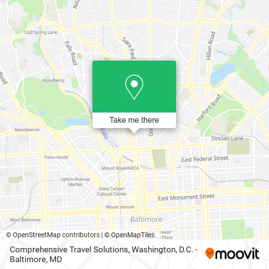
See Comprehensive Travel Solutions, Baltimore, on the map
Public Transit to Comprehensive Travel Solutions in Baltimore
Wondering how to get to Comprehensive Travel Solutions in Baltimore? Moovit helps you find the best way to get to Comprehensive Travel Solutions with step-by-step directions from the nearest public transit station.
Moovit provides free maps and live directions to help you navigate through your city. View schedules, routes, timetables, and find out how long does it take to get to Comprehensive Travel Solutions in real time.
Looking for the nearest stop or station to Comprehensive Travel Solutions? Check out this list of stops closest to your destination: Saint Paul St & 22nd St Sb; Charles St & 22nd St Nb; 25th St & St Paul St Eb Ns; Howard St & 23rd St Nb; Penn Station Marc Sb; Penn Station; Baltimore Penn Station.
Bus: 51, 95, CITYLINK GOLD, CITYLINK RED, CITYLINK SILVER, PURPLE ROUTE, 21.Train: MARC, ACELA, CARDINAL, CAROLINIAN, CRESCENT, NORTHEAST REGIONAL.
Want to see if there’s another route that gets you there at an earlier time? Moovit helps you find alternative routes or times. Get directions from and directions to Comprehensive Travel Solutions easily from the Moovit App or Website.
We make riding to Comprehensive Travel Solutions easy, which is why over 1.5 million users, including users in Baltimore, trust Moovit as the best app for public transit. You don’t need to download an individual bus app or train app, Moovit is your all-in-one transit app that helps you find the best bus time or train time available.
For information on prices of bus, costs and ride fares to Comprehensive Travel Solutions, please check the Moovit app.
Use the app to navigate to popular places including to the airport, hospital, stadium, grocery store, mall, coffee shop, school, college, and university.
Comprehensive Travel Solutions Address: 2225 Saint Paul St Baltimore, MD 21218 street in Baltimore
- Law Offices of James Sweeting III LLC,
- James E. Hooper House,
- United Methodist Historical,
- Baltimore Folk Music Society - BFMS,
- Chesapeake Connections,
- Labcorp,
- Sheppard Pratt,
- Central Casting,
- Edgemont Builders,
- Bethany Communitie,
- Meoc on Line,
- The Essig Team,
- Parole and Probation,
- Yalcin Development,
- Tyg Handyman,
- Dapper Luq,
- Sisters Beauty Salon,
- Pride Center of Maryland,
- Molen Associates,
- Lucky Lock
Places Near Comprehensive Travel Solutions (Baltimore)
- Westfield Montgomery Mall, Montgomery County,
- Camden Yards, Baltimore,
- Sibley Memorial Hospital, Washington,
- Washington National Cathedral, Washington,
- Washington DC VA Medical Center, Washington,
- Marriott Marquis Washington, DC, Washington,
- Basilica of the National Shrine, Washington,
- Amazon Hq2, Arlington County,
- Capital One Arena, Washington,
- PG Mall, Prince George's County,
- National Theatre, Washington,
- M&T Bank Stadium, Baltimore,
- The Anthem, Washington,
- Museum Of The Bible, Washington,
- Pennsylvania Ave NW (3rd st and pennsylvania), Washington,
- Rock Creek Tennis Center, Washington,
- Warner Theatre, Washington,
- National Zoo, Washington,
- Georgetown, Washington,
- National Museum of African American History and Culture, Washington
How to get to popular places in Washington, D.C. - Baltimore, MD with public transit
Get around Baltimore by public transit!
Traveling around Baltimore has never been so easy. See step by step directions as you travel to any attraction, street or major public transit station. View bus and train schedules, arrival times, service alerts and detailed routes on a map, so you know exactly how to get to anywhere in Baltimore.
When traveling to any destination around Baltimore use Moovit's Live Directions with Get Off Notifications to know exactly where and how far to walk, how long to wait for your line, and how many stops are left. Moovit will alert you when it's time to get off — no need to constantly re-check whether yours is the next stop.
Wondering how to use public transit in Baltimore or how to pay for public transit in Baltimore? Moovit public transit app can help you navigate your way with public transit easily, and at minimum cost. It includes public transit fees, ticket prices, and costs. Looking for a map of Baltimore public transit lines? Moovit public transit app shows all public transit maps in Baltimore with all Bus, Train, Metro, Light Rail and Ferry routes and stops on an interactive map.
Washington, D.C. - Baltimore, MD has 5 transit type(s), including: Bus, Train, Metro, Light Rail and Ferry, operated by several transit agencies, including WMATA, Montgomery County Ride On, Fairfax Connector, TheBus, PRTC, DASH - Alexandria, Arlington Transit (ART), RTA of Central Maryland, MDOT MTA, MDOT MTA Light RailLink, MDOT MTA Commuter Bus, MDOT MTA Local Bus, FXBGO!, Virginia Railway Express (VRE) and MARC