How to get to Computer Lab 3rd Floor by bus?
Click on the bus route to see step by step directions with maps, line arrival times and updated time schedules.
From Guinness Open Gate Brewery & Barrel House, Baltimore County
83 minFrom Randallstown, MD, Baltimore County
75 minFrom NSA Friendship Annex (FANX), Anne Arundel County
71 minFrom Good Samaritan Hospital, Baltimore
68 minFrom Hyatt Regency Baltimore Inner Harbor, Baltimore
40 minFrom Johns Hopkins Bayview Medical Center, Baltimore
59 minFrom Morgan State University, Baltimore
65 minFrom Reisterstown Road Plaza, Baltimore
48 minFrom National Aquarium-Baltimore, Baltimore
37 minFrom Western High School, Baltimore
67 min
Bus stops near Computer Lab 3rd Floor in Baltimore
Train station near Computer Lab 3rd Floor in Baltimore
- West Baltimore Marc Nb, 39 min walk,VIEW
Bus lines to Computer Lab 3rd Floor in Baltimore
What are the closest stations to Computer Lab 3rd Floor?
The closest stations to Computer Lab 3rd Floor are:
- Athol Ave & Edmondson Ave FS Sb is 166 yards away, 3 min walk.
- Edmondson Ave & Woodridge Rd FS Wb is 303 yards away, 5 min walk.
- Edmondson Ave & Westside Skill Center MB Eb is 535 yards away, 8 min walk.
- Edmondson Ave & Augusta Ave Eb is 552 yards away, 8 min walk.
- Edmondson Ave & Swann Ave Wb is 571 yards away, 8 min walk.
- West Baltimore Marc Nb is 3229 yards away, 39 min walk.
Which bus lines stop near Computer Lab 3rd Floor?
These bus lines stop near Computer Lab 3rd Floor: 77, 78, CITYLINK BLUE.
What’s the nearest bus station to Computer Lab 3rd Floor in Baltimore?
The nearest bus station to Computer Lab 3rd Floor in Baltimore is Athol Ave & Edmondson Ave FS Sb. It’s a 3 min walk away.
What time is the first train to Computer Lab 3rd Floor in Baltimore?
The MARC is the first train that goes to Computer Lab 3rd Floor in Baltimore. It stops nearby at 4:39 AM.
What time is the last train to Computer Lab 3rd Floor in Baltimore?
The MARC is the last train that goes to Computer Lab 3rd Floor in Baltimore. It stops nearby at 10:53 PM.
What time is the first bus to Computer Lab 3rd Floor in Baltimore?
The CITYLINK BLUE is the first bus that goes to Computer Lab 3rd Floor in Baltimore. It stops nearby at 3:37 AM.
What time is the last bus to Computer Lab 3rd Floor in Baltimore?
The CITYLINK BLUE is the last bus that goes to Computer Lab 3rd Floor in Baltimore. It stops nearby at 3:28 AM.
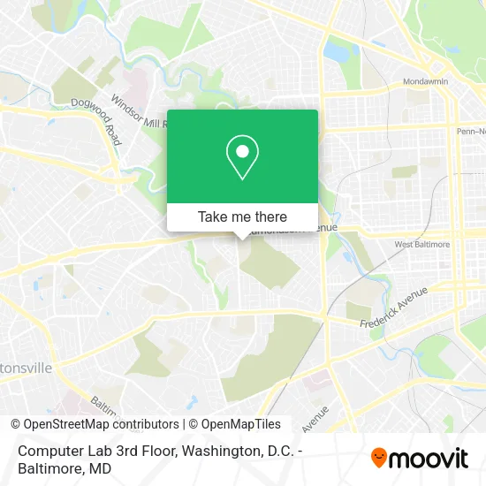
See Computer Lab 3rd Floor, Baltimore, on the map
Public Transit to Computer Lab 3rd Floor in Baltimore
Wondering how to get to Computer Lab 3rd Floor in Baltimore? Moovit helps you find the best way to get to Computer Lab 3rd Floor with step-by-step directions from the nearest public transit station.
Moovit provides free maps and live directions to help you navigate through your city. View schedules, routes, timetables, and find out how long does it take to get to Computer Lab 3rd Floor in real time.
Looking for the nearest stop or station to Computer Lab 3rd Floor? Check out this list of stops closest to your destination: Athol Ave & Edmondson Ave FS Sb; Edmondson Ave & Woodridge Rd FS Wb; Edmondson Ave & Westside Skill Center MB Eb; Edmondson Ave & Augusta Ave Eb; Edmondson Ave & Swann Ave Wb; West Baltimore Marc Nb.
Bus: 77, 78, CITYLINK BLUE, 34, 38, 40, CITYLINK ORANGE, 150.Train: MARC.
Want to see if there’s another route that gets you there at an earlier time? Moovit helps you find alternative routes or times. Get directions from and directions to Computer Lab 3rd Floor easily from the Moovit App or Website.
We make riding to Computer Lab 3rd Floor easy, which is why over 1.5 million users, including users in Baltimore, trust Moovit as the best app for public transit. You don’t need to download an individual bus app or train app, Moovit is your all-in-one transit app that helps you find the best bus time or train time available.
For information on prices of bus, metro and train, costs and ride fares to Computer Lab 3rd Floor, please check the Moovit app.
Use the app to navigate to popular places including to the airport, hospital, stadium, grocery store, mall, coffee shop, school, college, and university.
Location: Baltimore, Washington, D.C. - Baltimore, MD
- Edmondson High School,
- Raise,
- Isreal Life,
- Edmondson-Westside High School,
- Baltimore City School District,
- N Athol Ave (athol ave birchwood),
- Edmondson Red-Light / Speed Camera Trap,
- Enoch Pratt Free Library-Edmondson,
- Edmondson Track And Field,
- Athol and Edmondson,
- Edmondson and N Athol,
- Edmondson & Athol,
- Village Liquors,
- S & H Liquors Inc,
- 653 Walnut Ave,
- Edmondson Avenue Branch Enoch Pratt Free Library,
- Dr. Office,
- Central Church Of Christ,
- Clean Best Cleaners,
- Murry's Edmondson Ave Eight Zero Five Four
Places Near Computer Lab 3rd Floor (Baltimore)
- Marriott Marquis Washington, DC, Washington,
- Sibley Memorial Hospital, Washington,
- Capital One Arena, Washington,
- Georgetown, Washington,
- Washington DC VA Medical Center, Washington,
- Pennsylvania Ave NW (3rd st and pennsylvania), Washington,
- National Theatre, Washington,
- Basilica of the National Shrine, Washington,
- Rock Creek Tennis Center, Washington,
- Amazon Hq2, Arlington County,
- Washington National Cathedral, Washington,
- National Zoo, Washington,
- The Anthem, Washington,
- National Museum of African American History and Culture, Washington,
- Westfield Montgomery Mall, Montgomery County,
- Museum Of The Bible, Washington,
- M&T Bank Stadium, Baltimore,
- Camden Yards, Baltimore,
- PG Mall, Prince George's County,
- Warner Theatre, Washington
How to get to popular places in Washington, D.C. - Baltimore, MD with public transit
Get around Baltimore by public transit!
Traveling around Baltimore has never been so easy. See step by step directions as you travel to any attraction, street or major public transit station. View bus and train schedules, arrival times, service alerts and detailed routes on a map, so you know exactly how to get to anywhere in Baltimore.
When traveling to any destination around Baltimore use Moovit's Live Directions with Get Off Notifications to know exactly where and how far to walk, how long to wait for your line, and how many stops are left. Moovit will alert you when it's time to get off — no need to constantly re-check whether yours is the next stop.
Wondering how to use public transit in Baltimore or how to pay for public transit in Baltimore? Moovit public transit app can help you navigate your way with public transit easily, and at minimum cost. It includes public transit fees, ticket prices, and costs. Looking for a map of Baltimore public transit lines? Moovit public transit app shows all public transit maps in Baltimore with all Bus, Train, Metro, Light Rail and Ferry routes and stops on an interactive map.
Washington, D.C. - Baltimore, MD has 5 transit type(s), including: Bus, Train, Metro, Light Rail and Ferry, operated by several transit agencies, including WMATA, Montgomery County Ride On, Fairfax Connector, TheBus, PRTC, DASH - Alexandria, Arlington Transit (ART), RTA of Central Maryland, MDOT MTA, MDOT MTA Light RailLink, MDOT MTA Commuter Bus, MDOT MTA Local Bus, FXBGO!, Virginia Railway Express (VRE) and MARC