How to get to Con Edison by bus?
Click on the bus route to see step by step directions with maps, line arrival times and updated time schedules.
From 225 Broadway, Manhattan
59 minFrom Middle Village, NY, Queens
70 minFrom Parkchester, Bronx
61 minFrom SoHo Grand Hotel, Manhattan
58 minFrom Flushing, Queens
90 minFrom Bubby's, Manhattan
79 minFrom 100 Church Street, Manhattan
62 minFrom Jersey City Medical Center, Jersey City
94 minFrom Journal Square, Jersey City
86 min
How to get to Con Edison by train?
Click on the train route to see step by step directions with maps, line arrival times and updated time schedules.
How to get to Con Edison by subway?
Click on the subway route to see step by step directions with maps, line arrival times and updated time schedules.
Bus stops near Con Edison in Manhattan
Bus lines to Con Edison in Manhattan
What are the closest stations to Con Edison?
The closest stations to Con Edison are:
- York Av/E 74 St is 97 yards away, 2 min walk.
- 1 Av/E 75 St is 344 yards away, 5 min walk.
- E 72 St/York Av is 379 yards away, 5 min walk.
- York Av/E 79 St is 445 yards away, 6 min walk.
- 86 St is 467 yards away, 6 min walk.
- 77 St is 716 yards away, 9 min walk.
Which bus lines stop near Con Edison?
These bus lines stop near Con Edison: M15, M15-SBS, M31, M72.
Which train lines stop near Con Edison?
These train lines stop near Con Edison: 3, HEMPSTEAD BRANCH, PORT WASHINGTON BRANCH.
Which subway lines stop near Con Edison?
These subway lines stop near Con Edison: 6X, Q.
What’s the nearest subway station to Con Edison in Manhattan?
The nearest subway station to Con Edison in Manhattan is 86 St. It’s a 6 min walk away.
What’s the nearest bus station to Con Edison in Manhattan?
The nearest bus station to Con Edison in Manhattan is York Av/E 74 St. It’s a 2 min walk away.
What time is the first subway to Con Edison in Manhattan?
The Q is the first subway that goes to Con Edison in Manhattan. It stops nearby at 3:01 AM.
What time is the last subway to Con Edison in Manhattan?
The Q is the last subway that goes to Con Edison in Manhattan. It stops nearby at 3:45 AM.
What time is the first bus to Con Edison in Manhattan?
The M15 is the first bus that goes to Con Edison in Manhattan. It stops nearby at 3:00 AM.
What time is the last bus to Con Edison in Manhattan?
The M15 is the last bus that goes to Con Edison in Manhattan. It stops nearby at 3:01 AM.
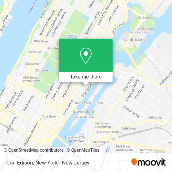
See Con Edison, Manhattan, on the map
Public Transit to Con Edison in Manhattan
Wondering how to get to Con Edison in Manhattan? Moovit helps you find the best way to get to Con Edison with step-by-step directions from the nearest public transit station.
Moovit provides free maps and live directions to help you navigate through your city. View schedules, routes, timetables, and find out how long does it take to get to Con Edison in real time.
Looking for the nearest stop or station to Con Edison? Check out this list of stops closest to your destination: York Av/E 74 St; 1 Av/E 75 St; E 72 St/York Av; York Av/E 79 St; 86 St; 77 St.
Bus: M15, M15-SBS, M31, M72, M79-SBS.Train: 3, HEMPSTEAD BRANCH, PORT WASHINGTON BRANCH.Subway: 6X, Q, N, R, W, 4, 5, 6.
Want to see if there’s another route that gets you there at an earlier time? Moovit helps you find alternative routes or times. Get directions from and directions to Con Edison easily from the Moovit App or Website.
We make riding to Con Edison easy, which is why over 1.5 million users, including users in Manhattan, trust Moovit as the best app for public transit. You don’t need to download an individual bus app or train app, Moovit is your all-in-one transit app that helps you find the best bus time or train time available.
For information on prices of bus, subway and train, costs and ride fares to Con Edison, please check the Moovit app.
Use the app to navigate to popular places including to the airport, hospital, stadium, grocery store, mall, coffee shop, school, college, and university.
Con Edison Address: 506 E 75th St street in Manhattan
- New York-Presbyterian Hospital / Weill Cornell 501 E 75th Street,
- Custom Frameless Shower Doors Enclosure & Mirrors,
- Hss Pediatric Rehabilitation & Young Athlete Center,
- Anthony Rossi, Md - Msk Dermatologist & Mohs Surgeon,
- Haug Realty Corp.,
- Tracy Stern Salontea,
- David H. Koch Center for Cancer Care at Memorial Sloan Kettering Cancer Center,
- Lycée Français de New York,
- Newlight Eyewear,
- 74th and York Ave,
- 74th St and York York Ave,
- Yvettes Small Pet Care,
- Kossar's Bagels & Bialys,
- La Salle Dumpling Room,
- Miss Wonton,
- Himalayan Vegan Organic Restaurant,
- Con Edison East 75th Street Substation,
- Michael A. Marchetti, Md,
- Claire's Kitchen,
- Prime Factor Group, Inc
Places Near Con Edison (Manhattan)
- San Gennaro Feast, Manhattan,
- SoHo, Manhattan,
- Chinatown, Manhattan,
- 26 Federal Plaza, Manhattan,
- Rockefeller Center, Manhattan,
- 376 Hudson Street, Manhattan,
- Bellevue Hospital, Manhattan,
- 1 Police Plaza, Manhattan,
- Mountainside Hospital, Glen Ridge,
- Hudson Yards, Manhattan,
- Wall Street, Manhattan,
- Pier 83, Manhattan,
- Queens Center Mall, Queens,
- Times Square, Manhattan,
- 66 John Street, Manhattan,
- qqqq, Manhattan,
- 911 Memorial, Manhattan,
- 111 Centre New York City Supreme Court, Manhattan,
- Katz's Deli, Manhattan,
- 3 Stone St, Manhattan
How to get to popular places in New York - New Jersey with public transit
Get around Manhattan by public transit!
Traveling around Manhattan has never been so easy. See step by step directions as you travel to any attraction, street or major public transit station. View bus and train schedules, arrival times, service alerts and detailed routes on a map, so you know exactly how to get to anywhere in Manhattan.
When traveling to any destination around Manhattan use Moovit's Live Directions with Get Off Notifications to know exactly where and how far to walk, how long to wait for your line, and how many stops are left. Moovit will alert you when it's time to get off — no need to constantly re-check whether yours is the next stop.
Wondering how to use public transit in Manhattan or how to pay for public transit in Manhattan? Moovit public transit app can help you navigate your way with public transit easily, and at minimum cost. It includes public transit fees, ticket prices, and costs. Looking for a map of Manhattan public transit lines? Moovit public transit app shows all public transit maps in Manhattan with all Bus, Train, Subway, Light Rail, Ferry and Cable Car routes and stops on an interactive map.
New York - New Jersey has 6 transit type(s), including: Bus, Train, Subway, Light Rail, Ferry and Cable Car, operated by several transit agencies, including MTA Subway, Metro-North Railroad, LIRR, PATH, MTA New York City Transit - Express routes, MTA Bus, NJ Transit, NYC Ferry, NICE bus, Bee-Line Bus, NJ Transit Rail, Norwalk Transit District, Hartford Line, River Valley Transit and HART