How to get to Concasa by bus?
Click on the bus route to see step by step directions with maps, line arrival times and updated time schedules.
From Conjunto Paraíso dos Pássaros, Sacramenta
35 minFrom Supermercado Preço Baixo (Una), Ananindeua
39 minFrom Estação BRT - Marambaia, Entroncamento
21 minFrom Distribuidora de Cremosinho, Entroncamento
28 minFrom Av. Dalva, Entroncamento
29 minFrom Bairro de Sao Bras, Ananindeua
37 minFrom Shopping Metrópole Ananindeua, Ananindeua
37 minFrom Conjunto Valparaiso, Ananindeua
39 minFrom Rua Ajax de Oliveira, Bengui
41 minFrom Bairro do Coqueiro, Ananindeua
34 min
Bus stops near Concasa in Belém
- D. Marreiros Com 3 De Maio, 2 min walk,VIEW
- 14 De Abril Com José Malcher | Mais Barato Plaza, 4 min walk,VIEW
- 14 De Abril Com D. Marreiros, 5 min walk,VIEW
- José Malcher Com Castelo, 6 min walk,VIEW
- Castelo Com José Malcher | Subestação Celpa, 6 min walk,VIEW
- Magalhães Com 3 De Maio | Escola Vilhena Alves, 6 min walk,VIEW
- Alcindo Com José Malcher, 7 min walk,VIEW
- Castelo Com Magalhães, 9 min walk,VIEW
Ferry stations near Concasa in Belém
Bus lines to Concasa in Belém
- 422, Alcindo Cacela - Domingos Marreiros,VIEW
- 114, Cremação II - Alcindo Cacela,VIEW
- 308, UFPA - Alcindo Cacela,VIEW
- 441, Ceasa - Felipe Patroni,VIEW
- M101, Terminal Marituba ⇄ Ver-o-Peso,VIEW
- M103, Terminal Marituba ⇄ Presidente Vargas,VIEW
- 227, Sacramenta - Humaitá,VIEW
- 230, Felipe Patroni,VIEW
- 309, UFPA - Ver-O-Peso,VIEW
- 314, Guamá - Ver-O-Peso,VIEW
- 316, Guamá - Pres. Vargas,VIEW
- 318, Arsenal,VIEW
- 320, UFPA - Tamoios,VIEW
- 323, Canudos - Praça Amazonas,VIEW
- 326, Canudos - Praça Amazonas (Tucunduba),VIEW
- 328, Cipriano Santos - Pres. Vargas,VIEW
- 417, Ufpa/ Alcindo Cacela - José Malcher,VIEW
- 548, Marambaia - Ver-O-Peso,VIEW
- 631, Marex - Ver-O-Peso,VIEW
- 638, Pratinha - Pres. Vargas,VIEW
What are the closest stations to Concasa?
The closest stations to Concasa are:
- D. Marreiros Com 3 De Maio is 87 meters away, 2 min walk.
- 14 De Abril Com José Malcher | Mais Barato Plaza is 229 meters away, 4 min walk.
- 14 De Abril Com D. Marreiros is 316 meters away, 5 min walk.
- José Malcher Com Castelo is 374 meters away, 6 min walk.
- Castelo Com José Malcher | Subestação Celpa is 390 meters away, 6 min walk.
- Magalhães Com 3 De Maio | Escola Vilhena Alves is 392 meters away, 6 min walk.
- Alcindo Com José Malcher is 467 meters away, 7 min walk.
- Castelo Com Magalhães is 662 meters away, 9 min walk.
- Arapari Navegação is 2135 meters away, 28 min walk.
- Praça Princesa Isabel is 2604 meters away, 34 min walk.
- Praça Do Pescador is 2684 meters away, 35 min walk.
Which bus lines stop near Concasa?
These bus lines stop near Concasa: 665, 667, 783 A, 872, 930, 985, M101.
What’s the nearest bus station to Concasa in Belém?
The nearest bus station to Concasa in Belém is D. Marreiros Com 3 De Maio. It’s a 2 min walk away.
What’s the nearest ferry station to Concasa in Belém?
The nearest ferry station to Concasa in Belém is Arapari Navegação. It’s a 28 min walk away.
What time is the first bus to Concasa in Belém?
The 866 is the first bus that goes to Concasa in Belém. It stops nearby at 4:30 AM.
What time is the last bus to Concasa in Belém?
The 758 is the last bus that goes to Concasa in Belém. It stops nearby at 1:38 AM.
What time is the first ferry to Concasa in Belém?
The T004 is the first ferry that goes to Concasa in Belém. It stops nearby at 4:30 AM.
What time is the last ferry to Concasa in Belém?
The T004 is the last ferry that goes to Concasa in Belém. It stops nearby at 11:36 PM.
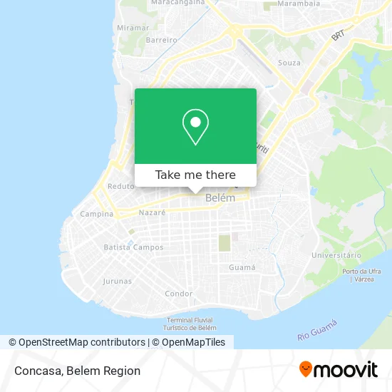
See Concasa, Belém, on the map
Public Transit to Concasa in Belém
Wondering how to get to Concasa in Belém? Moovit helps you find the best way to get to Concasa with step-by-step directions from the nearest public transit station.
Moovit provides free maps and live directions to help you navigate through your city. View schedules, routes, timetables, and find out how long does it take to get to Concasa in real time.
Looking for the nearest stop or station to Concasa? Check out this list of stops closest to your destination: D. Marreiros Com 3 De Maio; 14 De Abril Com José Malcher | Mais Barato Plaza; 14 De Abril Com D. Marreiros; José Malcher Com Castelo; Castelo Com José Malcher | Subestação Celpa; Magalhães Com 3 De Maio | Escola Vilhena Alves; Alcindo Com José Malcher; Castelo Com Magalhães; Arapari Navegação; Praça Princesa Isabel; Praça Do Pescador.
Bus: 665, 667, 783 A, 872, 930, 985, M101, 422, 114, 308, 441, M103, 227, 230, 309, 446, 635.Ferry: T004.
Want to see if there’s another route that gets you there at an earlier time? Moovit helps you find alternative routes or times. Get directions from and directions to Concasa easily from the Moovit App or Website.
We make riding to Concasa easy, which is why over 1.5 million users, including users in Belém, trust Moovit as the best app for public transit. You don’t need to download an individual bus app or train app, Moovit is your all-in-one transit app that helps you find the best bus time or train time available.
For information on prices of bus, costs and ride fares to Concasa, please check the Moovit app.
Use the app to navigate to popular places including to the airport, hospital, stadium, grocery store, mall, coffee shop, school, college, and university.
Concasa Address: Travessa Três de Maio, 1019 São Brás Belém-PA 66063-388 street in Belém
- Centro De Imagem E Saúde Medtech,
- Travessa 3 de Maio & Avenida Governador José Malcher,
- Travessa 3 de Maio 971,
- Laboratório Biociência,
- VER A MIDIA COMUNICACAO VISUAL,
- RCF ADMINISTRADORA DE IMOVEIS,
- Restaurante Parada Obrigatoria,
- Condominio do Edificio Torre de Bolonha,
- Uniodonto - Plantão 24h,
- Condominio do Edificio Rio Tibre,
- ASH CORRETORA E ADMINISTRADORA DE SEGUROS,
- Camalta Camaroes Terra Alta sa,
- Condominio do Edificio Saint Laurent,
- Linha Benfica-São Brás,
- Condomínio do Edifício Blumenau,
- Linha Cipriano Santos - Presidente Vargas,
- J.R. Lanches e Refeições,
- Esquina 9 de janeiro com Domingos Marreiros,
- Avenida Júlio Cesar,
- Hospital Amazônia Apart. 217
Places Near Concasa (Belém)
- hospital Barros Barreto, Belém,
- Shopping Metrópole Ananindeua, Ananindeua,
- Grão Pará, Belém,
- Centro Integrado de Inclusão e Reabilitação - CIIR, Entroncamento,
- Doca, Belém,
- Mangal Das Garças, Belém,
- Praça Brasil, Belém,
- Parque Shopping Belém, Bengui,
- Bancrevea, Bengui,
- Aeroporto Internacional de Belém (BEL), Entroncamento,
- Avenida Augusto Montenegro, Belém,
- Boulevard Shopping, Belém,
- Avenida Júlio Cesar, Belém,
- Shopping Pátio Belém, Belém,
- Santa Casa De Misericórdia, Belém,
- Shopping Bosque Grão Pará, Entroncamento,
- Hangar PA, Belém,
- Av.Senador Lemos, Belém,
- Linha 872: Icoaraci - Almirante Barroso (Presidente Vargas), Icoaraci,
- Shopping Center Bosque Grão Pará, Entroncamento
How to get to popular places in Belem Region with public transit
Get around Belém by public transit!
Traveling around Belém has never been so easy. See step by step directions as you travel to any attraction, street or major public transit station. View bus and train schedules, arrival times, service alerts and detailed routes on a map, so you know exactly how to get to anywhere in Belém.
When traveling to any destination around Belém use Moovit's Live Directions with Get Off Notifications to know exactly where and how far to walk, how long to wait for your line, and how many stops are left. Moovit will alert you when it's time to get off — no need to constantly re-check whether yours is the next stop.
Wondering how to use public transit in Belém or how to pay for public transit in Belém? Moovit public transit app can help you navigate your way with public transit easily, and at minimum cost. It includes public transit fees, ticket prices, and costs. Looking for a map of Belém public transit lines? Moovit public transit app shows all public transit maps in Belém with all Bus and Ferry routes and stops on an interactive map.
Belem Region has 2 transit type(s), including: Bus and Ferry, operated by several transit agencies, including BRT Metropolitano, BRT Belém, SETRANSBEL, Coopcaban, Expresso Modelo, Voyage Transportes, Amazonat, Coopersati, Luane Transportes, Cooptarvc, Ruth Transportes, Mayara Transportes, Cooptauá, Expresso São José and Castanhal (Clara, Rosa's, Salve Maria)