Directions to Conceito (Colombo) with public transportation
The following transit lines have routes that pass near Conceito
How to get to Conceito by bus?
Click on the bus route to see step by step directions with maps, line arrival times and updated time schedules.
From Terminal Pinhais, Pinhais
30 minFrom Rua Conselheiro Laurindo, Centro
45 minFrom Estação Tubo Museu Oscar Niemeyer, Centro Cívico
54 minFrom 20° Batalhão de Infantaria Blindado, Bacacheri
42 minFrom Decathlon, Jardim Botânico
38 minFrom Rua Treze de Maio, Centro
50 minFrom Praça Nossa Senhora de Salette, Centro Cívico
51 minFrom Bosque Zaninelli, Pilarzinho
76 minFrom Terminal Guadalupe, Centro
36 minFrom Rodovia Joao Leopoldo Jacomel, Pinhais
19 min
Bus stops near Conceito in Colombo
Bus lines to Conceito in Colombo
- I20 MARACANÃ / AFONSO PENA, Terminal Maracanã → Terminal Afonso Pena,VIEW
- B41 MARACANÃ / CAPÃO DA IMBUIA, Terminal Maracanã → Terminal Capão da Imbuia,VIEW
- B58 MARACANÃ / SANTA CÂNDIDA (CIRCULAR), Terminal Santa Cândida ↺ Terminal Maracanã (Circular),VIEW
- B69 MAD. CURITIBA / SÃO DIMAS, Terminal Guadalupe → São Dimas,VIEW
- B39 CAMPO ALTO / SANTA CÂNDIDA, Terminal Santa Cândida ↺ Campo Alto / Capela do Atuba (Circular),VIEW
- B57 CAMPO ALTO / SANTA CÂNDIDA, Terminal Santa Cândida ↺ Terminal Maracanã (Circular),VIEW
- B25 MARACANÃ / BAIRRO ALTO, Terminal Bairro Alto → Terminal Maracanã,VIEW
- B14 PLANALTO, Terminal Maracanã → Planalto,VIEW
- B59 PLANALTO / GUARAITUBA, Terminal Maracanã → Terminal Guaraituba,VIEW
- B29 ROÇA GRANDE / APDEC (VIA MARACANÃ), Terminal Roça Grande → APDEC,VIEW
What are the closest stations to Conceito?
The closest stations to Conceito are:
- Rua Abel Scuissiato, 1671 is 51 meters away, 2 min walk.
- Rua Abel Scuissiato, 1686 is 306 meters away, 5 min walk.
- R. Araribóia, 293 is 473 meters away, 7 min walk.
- Travessa Zumbí, 10 is 513 meters away, 7 min walk.
- Avenida Confúcio, 332 is 903 meters away, 12 min walk.
Which bus lines stop near Conceito?
These bus lines stop near Conceito: 222 VILA ESPERANÇA, B41 MARACANÃ / CAPÃO DA IMBUIA, I20 MARACANÃ / AFONSO PENA.
What’s the nearest bus station to Conceito in Colombo?
The nearest bus station to Conceito in Colombo is Rua Abel Scuissiato, 1671. It’s a 2 min walk away.
What time is the first bus to Conceito in Colombo?
The B39 CAMPO ALTO / SANTA CÂNDIDA is the first bus that goes to Conceito in Colombo. It stops nearby at 4:55 AM.
What time is the last bus to Conceito in Colombo?
The B69 MAD. CURITIBA / SÃO DIMAS is the last bus that goes to Conceito in Colombo. It stops nearby at 1:48 AM.
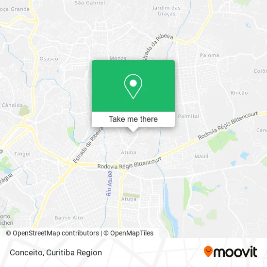
See Conceito, Colombo, on the map
Public Transit to Conceito in Colombo
Wondering how to get to Conceito in Colombo? Moovit helps you find the best way to get to Conceito with step-by-step directions from the nearest public transit station.
Moovit provides free maps and live directions to help you navigate through your city. View schedules, routes, timetables, and find out how long does it take to get to Conceito in real time.
Looking for the nearest stop or station to Conceito? Check out this list of stops closest to your destination: Rua Abel Scuissiato; Rua Abel Scuissiato; R. Araribóia; Travessa Zumbí; Avenida Confúcio.
Bus: 222 VILA ESPERANÇA, B41 MARACANÃ / CAPÃO DA IMBUIA, I20 MARACANÃ / AFONSO PENA, B58 MARACANÃ / SANTA CÂNDIDA (CIRCULAR), B69 MAD. CURITIBA / SÃO DIMAS, B39 CAMPO ALTO / SANTA CÂNDIDA, B57 CAMPO ALTO / SANTA CÂNDIDA, B25 MARACANÃ / BAIRRO ALTO, B14 PLANALTO, B59 PLANALTO / GUARAITUBA, B29 ROÇA GRANDE / APDEC (VIA MARACANÃ).
Want to see if there’s another route that gets you there at an earlier time? Moovit helps you find alternative routes or times. Get directions from and directions to Conceito easily from the Moovit App or Website.
We make riding to Conceito easy, which is why over 1.5 million users, including users in Colombo, trust Moovit as the best app for public transit. You don’t need to download an individual bus app or train app, Moovit is your all-in-one transit app that helps you find the best bus time or train time available.
For information on prices of bus, costs and ride fares to Conceito, please check the Moovit app.
Use the app to navigate to popular places including to the airport, hospital, stadium, grocery store, mall, coffee shop, school, college, and university.
Conceito Address: Rua Faraday, 968 Atuba Colombo-PR 83408-220 street in Colombo
- Pedacinho do Lar,
- Studio Mari Designer de Unhas,
- Circuito Atacado E Varejo,
- Certcon Contabilidade,
- Cais,
- MB Leva e Traz,
- Condomínio Residencial Ibiza,
- Telles Transportes,
- Aroma do Sítio Restaurante Eireli,
- Brexo dos Avos,
- Acv - Representacoes Comerciais,
- Pollinox,
- Jam Service Contabilidade,
- Banco 24horas,
- Admg & Endler Contabilidade,
- Previdencia social COLOMBO,
- Bertavel Veiculos,
- Od Servicos Medicos,
- Uni Car Multimarcas,
- Family Cake
Places Near Conceito (Colombo)
- Campo Largo, Campo,
- Jockey Plaza Shopping Center, Tarumã,
- Hospital Angelina Caron, Campina Grande Do Sul,
- Park Shopping Barigüi, Mossunguê,
- Hospital Da Cruz Vermelha, Batel,
- Rua General Mário Tourinho, Campina Do Siqueira,
- Hospital Universitário Evangélico de Curitiba, Bigorrilho,
- Hhhhh, Fazendinha,
- Hospital Madalena Sofia, Bairro Alto,
- Jardim Botânico de Curitiba PR, Centro,
- Shopping Estação, Rebouças,
- Rua Martim Afonso 558, Mercês,
- Hospital Nossa Senhora Das Graças, Mercês,
- Shopping Palladium, Portão,
- Hospital de Clínicas (HC - UFPR), Centro,
- Parque Barigui, Mercês,
- Hospital do Rocio, Campo,
- Pontifícia Universidade Católica do Paraná (PUCPR), Prado Velho,
- Arena Da Baixada - Curitiba,
- Hospital Erasto Gaertner, Jardim Das Américas
How to get to popular places in Curitiba Region with public transit
Get around Colombo by public transit!
Traveling around Colombo has never been so easy. See step by step directions as you travel to any attraction, street or major public transit station. View bus and train schedules, arrival times, service alerts and detailed routes on a map, so you know exactly how to get to anywhere in Colombo.
When traveling to any destination around Colombo use Moovit's Live Directions with Get Off Notifications to know exactly where and how far to walk, how long to wait for your line, and how many stops are left. Moovit will alert you when it's time to get off — no need to constantly re-check whether yours is the next stop.
Wondering how to use public transit in Colombo or how to pay for public transit in Colombo? Moovit public transit app can help you navigate your way with public transit easily, and at minimum cost. It includes public transit fees, ticket prices, and costs. Looking for a map of Colombo public transit lines? Moovit public transit app shows all public transit maps in Colombo with all Bus and Cable Car routes and stops on an interactive map.
Curitiba Region has 2 transit type(s), including: Bus and Cable Car, operated by several transit agencies, including Sistema Integrado de Mobilidade (URBS), Sistema Integrado de Mobilidade (AMEP), URBS (Cartões bancários e Dinheiro), URBS (Cartões bancários / Cartão URBS), AMEP (Cartões bancários / Cartão MetroCard), AMEP (Cartões bancários / Cartão MetroCard / Dinheiro), Viação Colombo (Dinheiro), TRIAR (Cartão TRIAR / Dinheiro), Empresa Curitiba Cerro Azul (Dinheiro), Expresso Nossa Senhora da Penha (Dinheiro), Empresa Campo Alto Tijucas (Dinheiro), Auto Viação São José (Cartão VEM / Dinheiro), BRT S/A (Cartão VEM / Dinheiro), TransPiedade (Cartão Cidadão / Dinheiro) and Oceânica Sul (Cartão Transporte / Dinheiro)